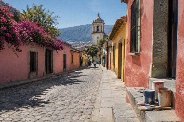
Jalatlaco: The Cobblestone Barrio Of Painted Walls
Jalatlaco is one of the barrios of Oaxaca City, an inland highland capital in the Valles Centrales of Mexico, known for its cobblestone lanes and dense concentration of murals.
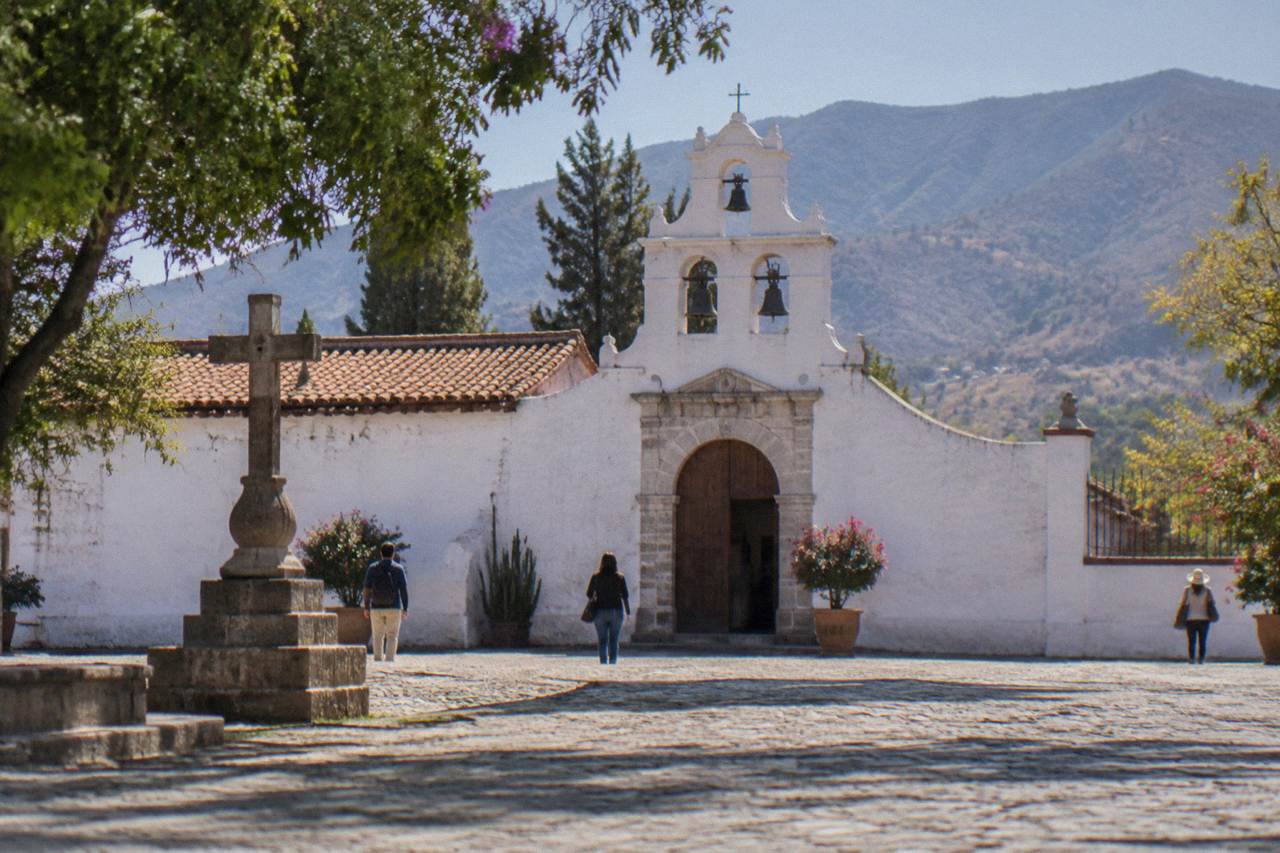
Jalatlaco is a barrio of Oaxaca City, the state capital, sitting within walking reach of the Centro Histórico. Its painted walls and cobblestone streets make it the city's street art heart, covered by several guided walking products including one led by a working artist.
Jalatlaco is a barrio of Oaxaca City, the inland highland capital of the state of Oaxaca in Mexico, and it is the part of town where the painted wall is the main attraction. The city sits in the Valles Centrales at about 1,550 m, far from any sea, and its historic core is listed by UNESCO as part of the "Historic Centre of Oaxaca and Archaeological Site of Monte Albán", property 415. Jalatlaco sits beside that core, close enough that visitors fold it into a day on foot, and distinct enough that the tour list gives it its own street art products, including a walk led by a working artist and a free tip-based walk devoted entirely to its murals.
This page covers what the barrio is, how to reach it, what the walls hold, when the weather helps, and how it compares with the other barrios of the city. The practical facts, INAH site hours, climate normals and event dates below come from INAH, SMN and state tourism sources.
What Is Jalatlaco In Oaxaca?
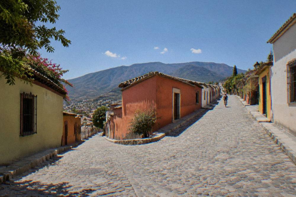
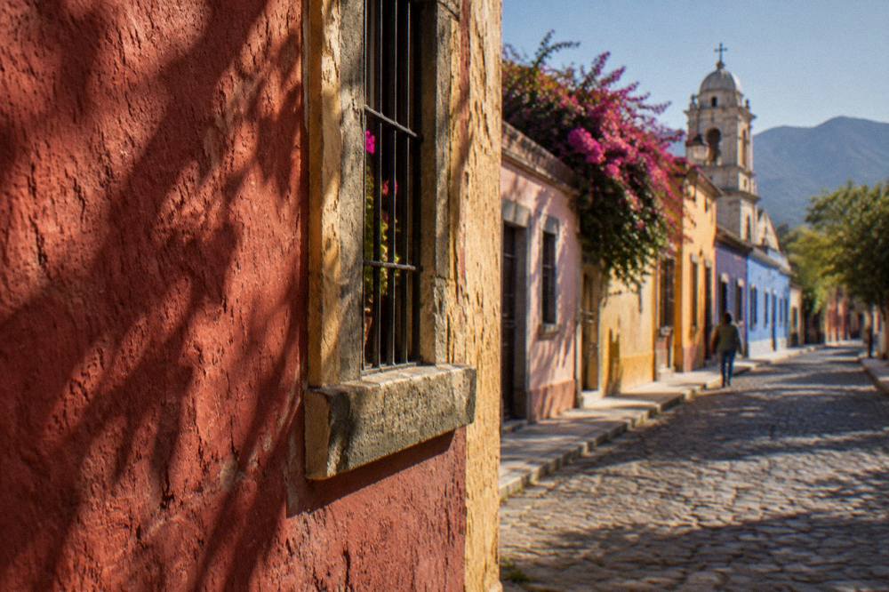
Jalatlaco is one of the traditional barrios of Oaxaca City, an inland city in the Valles Centrales of Mexico, and it is known for cobblestone streets and a dense concentration of murals on house walls. The barrio is covered by dedicated street art tours on this site's tour list, including one walk led by a working artist, which is the clearest sign of what the area offers: painted walls, quiet lanes and working art workshops.
The evidence for what Jalatlaco holds is in what the tour market sells there. The tour list carries a paid street art walk led by an artist, and separately a free, tip-based tour built around Jalatlaco's murals and art workshops. The neighbourhood also appears on general city walking tours as a stop, and the street food walking tour of the city carries Jalatlaco in its own name, which places the barrio firmly on the eating map as well as the art map.
What the barrio does not offer is equally clear. There is no sea, no beach and no river promenade in Oaxaca City; Jalatlaco is a dry, highland neighbourhood of streets and walls. It also holds no INAH archaeological zone. The archaeological sites of the valley, Monte Albán, Mitla and Yagul, are separate destinations reached by road, and their hours and fees sit in their own pages on this site, linked below.
For orientation, start from the Oaxaca neighbourhoods overview, which places Jalatlaco among the city's other barrios, or from the master things to do in Oaxaca page if the whole city is on the table.
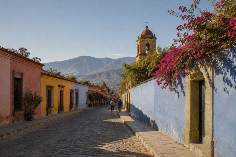
Where Is Jalatlaco And How Do You Get There?
Jalatlaco is a barrio of Oaxaca City located within walking reach of the Centro Histórico, so the standard way in is on foot from the center, and the barrio also appears as a stop on city walking tours. No bus fare, taxi fare or colectivo route to Jalatlaco carries a verifiable official figure, so this page prints none, and visitors should agree any taxi fare before setting off, as city taxis do not run on meters.
The barrio sits within the fabric of the city rather than at its edge, and the walking products that cover it run for short city distances. The paid historic center walking tour on the tour list covers the center itself, while the street art products head for Jalatlaco's walls specifically. Visitors staying in the Centro Histórico can treat Jalatlaco as part of a walking day; the is Oaxaca walkable question on this site is answered in depth elsewhere, and the short version is that the historic core and its adjacent barrios are walkable territory.
Two practical cautions apply anywhere in Oaxaca City. First, the city sits at about 1,550 m, and the sun at that altitude is strong even when the air feels mild; the SMN station normals show January nights averaging 10.3 C and January days 28.9 C, a wide daily swing. Second, road blockades by teachers' unions are a standing, sporadic risk in Oaxaca that can disrupt roads and airport access for hours at a time; treat them as a possibility when planning tight connections, and check conditions on the day.
For orientation inside the center before walking out to the barrio, the Centro Histórico guide and the Zócalo guide cover the ground between the main square and the barrios around it. The Andador Macedonio Alcalá, the pedestrian spine of the center, runs between the Zócalo and the Santo Domingo complex, and the barrio walk can be slotted onto either end of it.
What Will You See On Jalatlaco's Painted Walls?
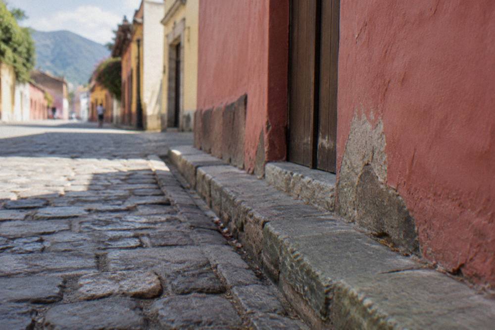
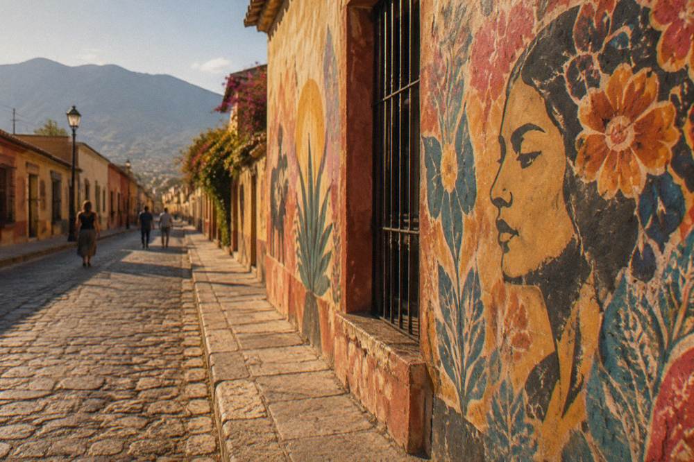
The walls of Jalatlaco hold murals and street art, and the tour products built around them describe murals, art workshops and neighbourhood traditions; the tour list carries an artist-led street art walk and a free tour of Jalatlaco's murals and art workshops. Beyond the walls, the barrio is a place of cobblestone lanes and everyday houses rather than monuments, with no INAH site and no entry fee at stake.
The cleanest way to read the walls is with someone who paints them. The related tour on this page, the Street Art Tour With An Artist in Oaxaca, is led by a working artist and covers the city's street art, Jalatlaco included. The full tour detail, including price and rating, prints on its own page: street art tour with an artist, and the live listing can be checked at any time at Check availability.
What can be said plainly is structural: two walking products are built around its walls, and the street art theme connects Jalatlaco to the wider Oaxaca street art scene covered on the site's Oaxaca street art page. The murals are outdoor and public, so walking them costs nothing on your own; the paid products add interpretation, and the free tip-based walks cost only what you choose to give at the end.
When Is The Best Time To Walk Jalatlaco In Oaxaca?
The dry season in Oaxaca City runs November to April and the rainy season May to October, with June averaging 188.3 mm of rain and January 2.4 mm, per the SMN station normals for 1991 to 2020, so the dry months are when a walking day in Jalatlaco faces the least rain. Within any season, mornings carry an advantage: April averages a 34.9 C daily high against a 15.8 C overnight low, so wall-walking early avoids the strongest afternoon heat.
The full monthly picture from the SMN station normals:
| Month | Mean daily high C | Mean nightly low C | Rain mm |
|---|---|---|---|
| Jan | 28.9 | 10.3 | 2.4 |
| Feb | 31.1 | 11.6 | 4.6 |
| Mar | 33.3 | 13.6 | 17.6 |
| Apr | 34.9 | 15.8 | 47.3 |
| May | 33.8 | 16.7 | 97.9 |
| Jun | 30.9 | 16.7 | 188.3 |
| Jul | 30.1 | 15.9 | 118.6 |
| Aug | 30.0 | 15.9 | 131.8 |
| Sep | 29.1 | 16.1 | 163.6 |
| Oct | 29.3 | 14.5 | 63.1 |
| Nov | 29.0 | 12.3 | 9.1 |
| Dec | 28.9 | 11.0 | 9.0 |
Rain in the wet months falls on roughly 20 days per month at the peak, but the totals still leave daylight for walking, and the site's Oaxaca in the rain guide covers the wet-season case in full. December and January bring the coolest nights on the table, 11.0 C and 10.3 C, so a morning walk in those months can start cold and end warm. Layered clothing answers the daily swing better than any single month choice.
Two calendar periods reshape the whole city, Jalatlaco included. Día de Muertos centres on the traditional dates of 31 October to 2 November, and the barrio's streets form part of the citywide celebrations; the 2026 programme has not been announced, so this site prints no dates beyond the traditional ones. Guelaguetza takes over July: the 2026 edition ran 20 and 27 July at the Auditorio Guelaguetza on the Cerro del Fortín, with Palco A at 1,632 MXN and Palco B at 1,321 MXN, and Palcos C and D free, sold through the official ticketing channel. The 2027 dates are not announced.
How Does Jalatlaco Compare With Other Oaxaca Neighbourhoods?
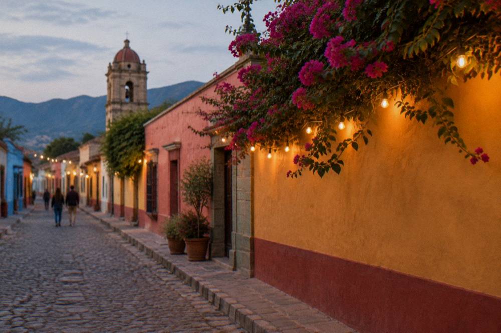
Jalatlaco competes with Xochimilco and Reforma as the barrios visitors walk out to from the Centro Histórico: Jalatlaco holds the street art concentration, Xochimilco carries its own walking products, and Reforma sits among the central options; the Centro Histórico itself holds the monuments, the Zócalo and the markets, and the south-of-centro zone holds the market district. None of the barrios carries an entry fee, and all are reached on foot from the center.
The comparison in brief:
| Area | What defines it on this site's tour list | Walking products covering it |
|---|---|---|
| Jalatlaco | Murals, street art, art workshops | Artist-led street art walk, free murals and workshops tour, street food walk |
| Xochimilco | Free aqueduct and chocolate themed walk | Free Xochimilco walking tour |
| Centro Histórico | Historic buildings, Zócalo, museums | Historic center walking tour, culture and traditions walk, free introduction walks |
| South of centro | Market district | Food and market tours, market immersion tour |
The Xochimilco guide and the Reforma guide cover the neighboring barrios in the same depth, and the south of centro and mercados guide handles the market quarter. Visitors deciding where to sleep can start from the where to stay in Oaxaca guide; the state lodging tax of 3 percent on hotel-type stays, 5 percent for platform intermediaries, applies regardless of neighbourhood. Santa Lucía del Camino and Xoxocotlán, on the city's outer edge toward the airport, form a further zone covered in their own guide for anyone weighing a stay beyond the central barrios.
Can You Pair Jalatlaco With A Day Trip From Oaxaca?
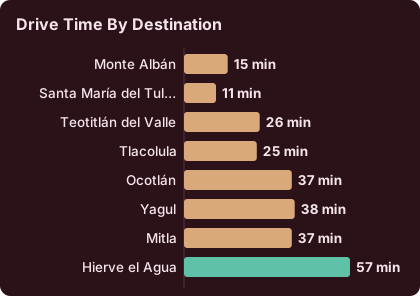
Yes: Jalatlaco takes an hour or two on foot, which leaves the rest of the day for the valley, and the drive times from the Zócalo run about 15 minutes to Monte Albán, about 37 minutes to Mitla and about 57 minutes to Hierve el Agua, per derived road routing, so a morning among the walls and an afternoon at an archaeological site is a workable shape. Real traffic and mountain roads make these times floors, not promises.
The derived drive times from the Zócalo, computed on road-network routing and rounded up:
| Destination | Distance km | Drive time, about |
|---|---|---|
| Monte Albán | 8.7 | 15 minutes |
| Santa María del Tule | 10.2 | 11 minutes |
| Teotitlán del Valle | 29.2 | 26 minutes |
| Tlacolula | 31.2 | 25 minutes |
| Ocotlán | 32.5 | 37 minutes |
| Yagul | 41.9 | 38 minutes |
| Mitla | 44.6 | 37 minutes |
| Hierve el Agua | 67.1 | 57 minutes |
The INAH sites at the end of those roads charge by category. Category I covers Monte Albán, Mitla and Yagul at 105 MXN for Mexican nationals and 210 MXN for foreign visitors; Category III covers Dainzú, Lambityeco and Zaachila at 80 and 145 MXN. Monte Albán, Mitla and Yagul open Monday to Sunday 08:00 to 17:00, with last access at 16:00 for Monte Albán and Yagul and 16:30 for Mitla. Zaachila opens Thursday to Sunday only, 10:00 to 16:00. Atzompa opens Monday to Sunday 08:00 to 16:00 with last access at 15:00. The Monte Albán guide, the Mitla guide and the Hierve el Agua guide carry the full detail, and the site's Monte Albán tour and Hierve el Agua tour pages list the guided options. Visitors booking an outside-hours visit at several of the smaller INAH zones will find the figure listed on those zones' own pages, a service priced far above the standard ticket and aimed at researchers and special groups rather than casual walks.
What About Food And Workshops Near Jalatlaco?
Food and making things are the two strongest complements to a Jalatlaco walk: the tour list carries a street food walking tour with Jalatlaco in its name, a food and markets tour with traditional tastings, a vegetarian cooking class with a market visit, and craft workshops from alebrije painting to printmaking with a local artist.
The eating side of the city is covered in depth on the site's Oaxaca food tour page and the markets pages for Mercado 20 de Noviembre and Mercado Benito Juárez, both within the central market district. The vegetarian cooking class pairs a market visit with kitchen time, and the quesillo and papermaking tour to San Agustín Etla pairs two craft traditions in one valley outing. For mezcal, the site's mezcal tour page lists the tasting products, from distillery visits with behind-the-scenes access to mezcal and mole pairings led by a certified sommelier.
Is Jalatlaco Safe To Walk In Oaxaca?
The advisory picture for Oaxaca is standard-precaution rather than avoid-travel: the UK FCDO advises against all but essential travel to parts of Mexico but does not name Oaxaca on its main page, Canada advises a high degree of caution in Mexico overall without singling out Oaxaca, and the US State Department lists Oaxaca state at Level 2, exercise increased caution. Walking Jalatlaco's streets in daylight is a normal activity for visitors.
The standing caveat for the whole region is the sporadic road blockade. Protest actions have closed highway exits and airport access roads for hours at a time in recent months, and while these resolve within a day, they can break a tight itinerary. Confirm road conditions before a departure day that involves the airport or a long drive. The site's Oaxaca safety guide carries the full advisory detail.
Within the barrio, the ordinary rules of any city apply: agree taxi fares in advance since taxis run without meters, keep to lit streets after dark, and note that no bike-share exists anywhere in Oaxaca, so walking, taxis and the tour vehicles are the options. The evening street food tour on the tour list runs into the night hours and covers city streets with a guide, which is one structured way to see the after-dark city.
Common Questions About Jalatlaco In Oaxaca
What Is Jalatlaco Known For?
Jalatlaco is known as the painted barrio of Oaxaca City: cobblestone streets, murals on house walls and working art workshops. Two walking products on this site are built around its walls and art.
How Far Is Jalatlaco From The Centro Histórico?
Jalatlaco sits within walking reach of Oaxaca City's Centro Histórico, and city walking tours cover both in one outing. No verifiable official figure exists for the exact walking distance or a taxi fare to the barrio, so this site prints none.
Can You Visit Jalatlaco On A Tour?
Yes. The tour list carries an artist-led street art walk, a free tip-based walk of the barrio's murals, a historic center walking tour and a street food tour with Jalatlaco in its name.
Is Jalatlaco Free To Visit?
Yes. The barrio is a public neighbourhood with no gate or entry fee, and its murals are outdoors. The free tip-based walking tours cost only what you choose to give the guide at the end.
When Is The Best Month To Walk Jalatlaco?
The dry season, November to April, brings the least rain, with January averaging 2.4 mm against June's 188.3 mm per the SMN station normals. April's 34.9 C average daily high makes mornings the better walking window that month.
Does Jalatlaco Have Museums Or Ruins?
No. Jalatlaco holds no INAH site and its attractions are outdoor and free. The region's archaeological zones, Monte Albán, Mitla, Yagul and the others, are reached by road from the city and charge INAH admission by category.
Jalatlaco rewards a slow morning: a loop of the painted lanes, a stop for street food, and then the rest of the day given to the valley's ruins, the markets of the center or a workshop where something gets made. The walls are always there, the walks run most days, and the barrio sits close enough to the Zócalo that it costs almost nothing to reach.