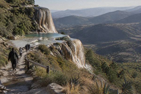
Hierve El Agua: The Petrified Waterfalls And Rock Pools
Hierve el Agua sits about 67 km from Oaxaca City in the Tlacolula Valley: springs heavy with minerals have built stone waterfall formations and a set of rock pools on a cliff edge. Here is what the sources say about getting there, what a day trip really involves, and how to plan it.
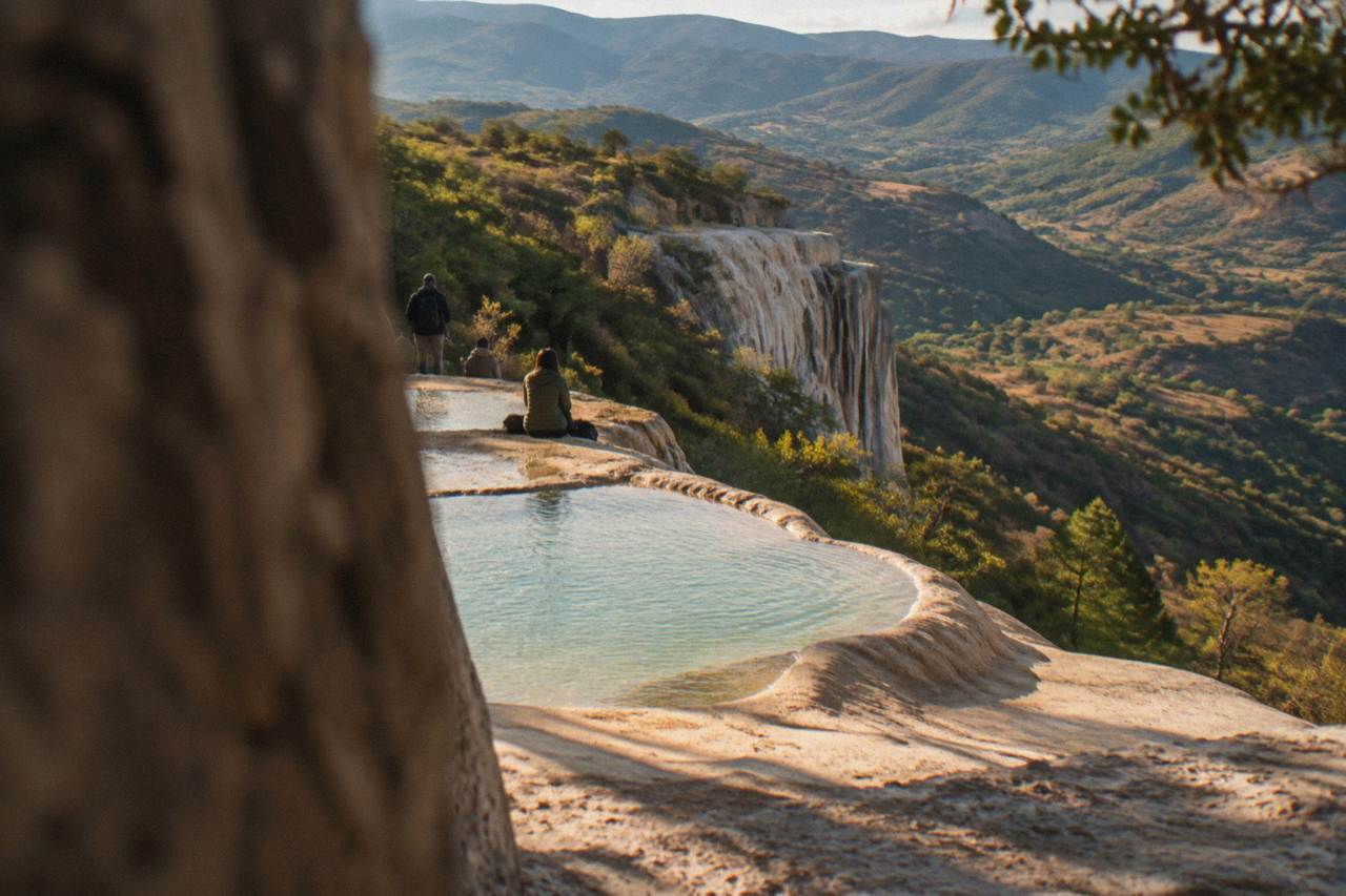
Hierve el Agua is a set of mineral springs and petrified waterfall formations about 67 km, roughly a 57 minute drive, east of Oaxaca City in the Tlacolula Valley. Visitors go for the cliffside rock pools and the stone cascades, usually on a day trip that also stops at Mitla, the Tule tree or a mezcal distillery.
Hierve el Agua is one of the strangest landscapes within reach of Oaxaca City, the inland highland capital of the state of Oaxaca at about 1,550 m in the Valles Centrales. Springs saturated with minerals have, over a very long time, deposited rock in the shape of cascades: white stone "waterfalls" frozen down a cliff face, with a shelf of pools along the rim. The site sits in the Tlacolula Valley, about 67 km east of the Zócalo, and it is a day trip, never a city stroll.
What Is Hierve El Agua Near Oaxaca?
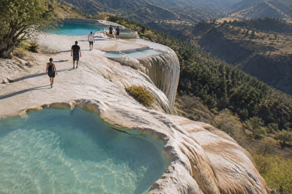
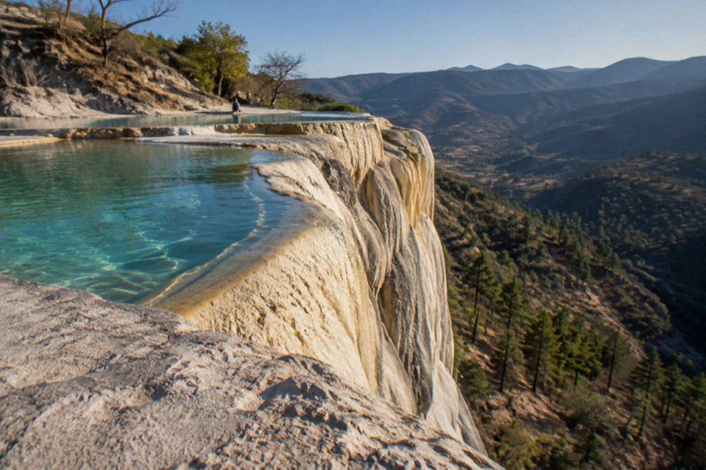
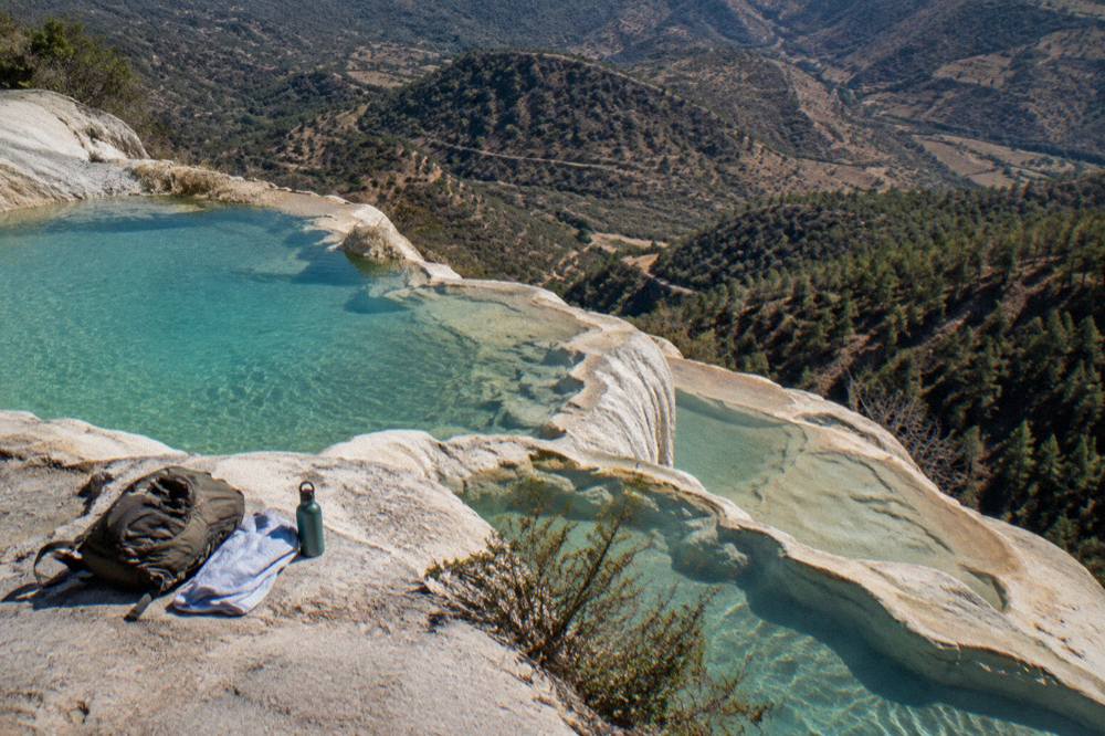
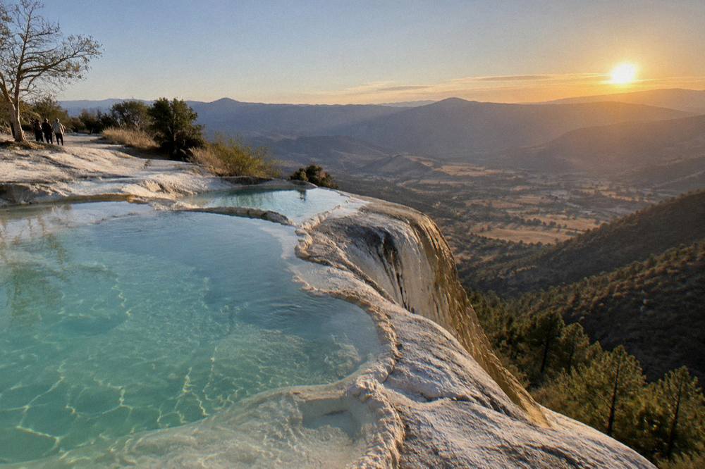
Hierve el Agua is a mineral spring site in the Tlacolula Valley, about 67 km east of Oaxaca City, where water saturated with dissolved minerals has deposited rock in the shape of waterfalls and a terraced shelf of pools on a cliff edge. It is not a conventional waterfall and there is no moving cascade: the "falls" are stone formations built up by the springs, and the pools at the top are the part visitors swim in.
The name translates from Spanish as "the water boils", a reference to the way the springs well up. The site sits high on a mountain slope, and the views run out over the valley below. It is one of the Tlacolula Valley's two headline destinations alongside the Mitla archaeological zone, and the two are about 20 km apart, which is why nearly every tour and independent itinerary pairs them. What the file does verify is the distance and drive time, and those are firm.
For context on how the valley fits together, the Hierve el Agua day trip guide breaks the full route down stop by stop, and the wider things to do in Oaxaca page places it against every other option in and around the city.
How Far Is Hierve El Agua From Oaxaca City?
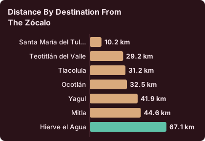
Hierve el Agua is about 67 km from the Zócalo in Oaxaca City, a drive of about 57 minutes in free-flow conditions, computed on the road network from the square's coordinates. Real traffic, mountain switchbacks and the final climb to the site make the journey slower in practice, so plan on more than an hour each way and do not schedule anything tight behind it.
Those figures are derived from routing on the actual roads, from the Zócalo at 17.0605953, -96.7253435 to the site, and they are stated as "about" because free-flow time is not a promise. The road climbs out of the valley, passes through Tlacolula and Mitla, and then rises into the mountains on a winding final stretch. Drivers coming from Oaxaca City pass the turn-offs for several other stops on the way, which is why the drive doubles as a valley itinerary.
| Destination from the Zócalo | Distance | Free-flow drive time |
|---|---|---|
| Santa María del Tule | 10.2 km | about 11 minutes |
| Teotitlán del Valle | 29.2 km | about 26 minutes |
| Tlacolula | 31.2 km | about 25 minutes |
| Ocotlán | 32.5 km | about 37 minutes |
| Yagul | 41.9 km | about 38 minutes |
| Mitla | 44.6 km | about 37 minutes |
| Hierve el Agua | 67.1 km | about 57 minutes |
The pattern in the table is the pattern of every valley day trip: the Tule tree sits on the way out, Mitla is the last town before the climb, and Hierve el Agua is the far end of the line. A common shape is Tule first, then Mitla or a weaving village, then the long climb to the springs, with a mezcal distillery near Santiago Matatlán on the return. The dedicated how long is the drive from Oaxaca to Hierve el Agua answer covers the road itself in more detail.
How Do You Get To Hierve El Agua Without A Car?
Without a car, the practical route from Oaxaca City is a guided day tour, and the tour list carries several: dedicated Hierve el Agua tours and longer loops that add Mitla, the Tule tree, rug workshops in Teotitlán del Valle and a mezcal distillery. Public transport to the site itself involves local connections through Mitla and the mountain community road, and the file carries no fares for it, so the site's own pages steer almost everyone toward a tour for this one.
The distinction matters more here than at the city sights. Monte Albán is 15 minutes out and easy to reach several ways; Hierve el Agua is the farthest headline attraction from the centre, at the end of a mountain road, and the return leg lands late in the day. Tours also absorb the stops: the value of the loop is that Mitla, Tule and Matatlán sit directly on the outward road, so a tour that strings them together costs little extra time.
The site's Hierve el Agua tour page compares the dedicated options side by side, and you can also Check availability on the featured petrified waterfalls and pools tour directly.
What Can You Actually See And Do At Hierve El Agua?
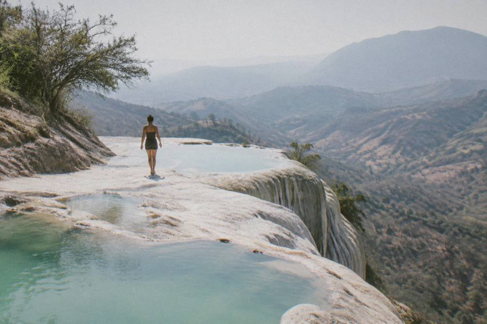
The site delivers three things: the petrified waterfall formations, the white mineral terraces that build them, and a shelf of rock pools along the cliff edge where visitors swim. Around that core, a visit involves walking the paths along the rim, viewing the stone cascades from the lookout points, and, on tours, stopping at the neighbouring valley attractions on the road in.
The pools are the swimming draw. They sit on the lip of the cliff, so a swim comes with a long view over the valley. The stone cascades themselves are the visual signature: mineral deposits built up in the shape of falling water, running down the rock face below the rim. Walking the rim path connects the pool area with the viewpoints over the formations.
The 2026 closure check found no reported access problems on the Mitla to Hierve el Agua road, no announced works at the site and no current community blockade affecting the route. That check is a snapshot: road blockades by teachers' unions are a standing risk in Oaxaca that can disrupt road and airport access at any time of year, and independent drivers should keep an ear on local news the day before.
Is Hierve El Agua Worth The Trip From Oaxaca?
For almost every visitor spending three or more days in Oaxaca City, yes: the site is the most distinctive natural formation reachable from the city, and the answer page on this site weighs it as a clear yes for anyone who can give it a full day. The honest counterweights are the distance, about 67 km each way on a mountain road, and the fact that a visit costs a whole day that could otherwise go to Monte Albán, the craft villages or the city's markets and food.
The trade-off is really about pace. A traveller with two days in the city faces a straight choice between Hierve el Agua and Monte Albán, and the ruins are 15 minutes away while the springs are an hour. From three days upward, the springs stop competing: the drive passes Tule, Tlacolula and Mitla anyway, so the day becomes a valley circuit rather than a single-site expedition. The full argument, including what the tour reviews say, sits in is Hierve el Agua worth it.
| Factor | Hierve el Agua | Monte Albán |
|---|---|---|
| Distance from the Zócalo | about 67 km | about 8.7 km |
| Free-flow drive time | about 57 minutes | about 15 minutes |
| Run by | local communities | INAH |
| Typical pairing on a tour | Mitla, Tule, Teotitlán, mezcal | craft villages, Cuilapan |
Can You Swim At Hierve El Agua?
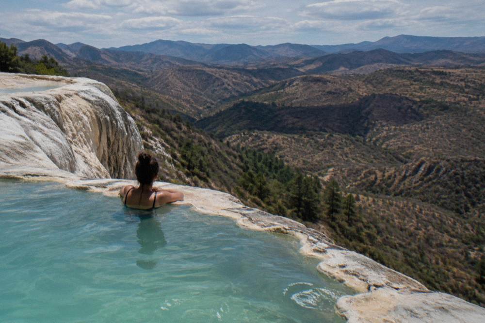
Yes, swimming is the main activity at the top of the site: the rock pools along the cliff edge are open to bathers, and the tour listings on this site's tour list describe the pools as a central part of the experience. The springs feed the pools year-round, so treat specifics as things to confirm with your tour operator or at the entrance on the day.
What can be said with figures is the climate context, because a swim in the mountains behaves differently from a swim on the coast. The SMN station normals for Oaxaca, 1991 to 2020, put afternoon highs at about 30 C in the June to September rainy months and near 35 C in April, with nights that drop to between 10 and 17 C depending on the month. Swimmers in the dry season should expect a cool walk back to the vehicle after dark, and in the rainy season should expect afternoon cloud and the possibility of a storm on the mountain road. Dry season runs November to April and rainy season May to October, with rain peaking June to September.
What Does A Hierve El Agua Day Trip Cost?
Dedicated Hierve el Agua tours and combined valley loops span a range of price points on the tour list, from budget-fare full-day loops to a private option and a long hiking version.
The budget question is really a structure question. A traveller who only wants the springs books the dedicated tour; a traveller who wants the whole valley books a loop and gets four stops for one outbound road. The Oaxaca travel costs and budget guide places the day against everything else a trip spends money on.
When Is The Best Time Of Year To Visit Hierve El Agua?
The climate record points to the November to April dry season for the clearest views: monthly rainfall at the Oaxaca station runs from 2.4 mm in January to 9.1 mm in November, against 188.3 mm in June and 163.6 mm in September. April has the highest normal daily high at 34.9 C, while December and January nights fall to about 11.0 and 10.3 C, so the swim season and the view season pull in slightly different directions.
No official source ranks the months for visitors. The table is the SMN station normals for Oaxaca, 1991 to 2020, and each reader can weigh it: dry months mean reliable roads and views, wet months mean green hills, afternoon rain around one day in three at the peak, and warm nights for swimming.
| Month | Average high C | Average low C | Average rain mm |
|---|---|---|---|
| January | 28.9 | 10.3 | 2.4 |
| February | 31.1 | 11.6 | 4.6 |
| March | 33.3 | 13.6 | 17.6 |
| April | 34.9 | 15.8 | 47.3 |
| May | 33.8 | 16.7 | 97.9 |
| June | 30.9 | 16.7 | 188.3 |
| July | 30.1 | 15.9 | 118.6 |
| August | 30.0 | 15.9 | 131.8 |
| September | 29.1 | 16.1 | 163.6 |
| October | 29.3 | 14.5 | 63.1 |
| November | 29.0 | 12.3 | 9.1 |
| December | 28.9 | 11.0 | 9.0 |
Two festival windows reshape the whole region's calendar and are worth knowing before locking dates. The Guelaguetza takes over Oaxaca City on two Mondays in July, with the 2026 edition held on 20 and 27 July at the Auditorio Guelaguetza on the Cerro del Fortín, and July hotel demand in the city spikes around it. Día de Muertos centres on the traditional dates of 31 October to 2 November, and the 2026 programme has not been announced. Both windows fill city accommodation, which pushes day-trip bookings up with it.
How Does Hierve El Agua Combine With Mitla And The Tule Tree?
The three stops sit in a near-straight line east of Oaxaca City, about 10 km to the Tule tree, about 45 km to Mitla and about 67 km to Hierve el Agua, so the combination is not just possible but natural: every combined tour on the tour list runs Tule, Mitla and the springs in one day, most adding a rug workshop in Teotitlán del Valle and a mezcal tasting near Santiago Matatlán on the return leg.
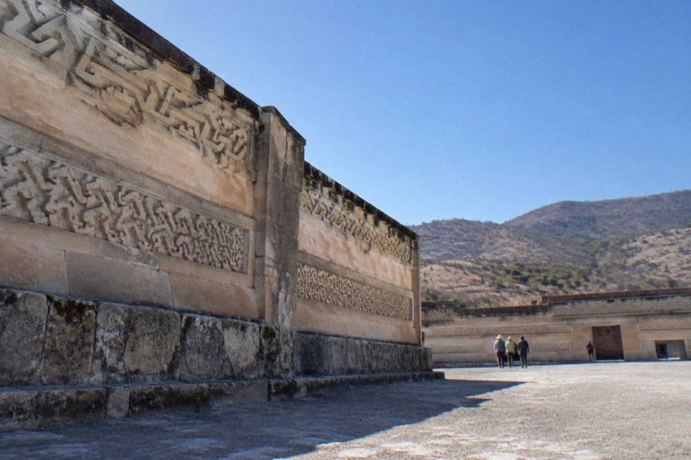
Each stop contributes something different, and each is documented on its own page here. The Tule tree stands beside its church in Santa María del Tule, about 11 minutes from the city. Mitla is an INAH archaeological zone, open Monday to Sunday 08:00 to 17:00 with last access at 16:30, charging 105 MXN for nationals and 210 MXN for foreigners, per the INAH listing. Yagul, a smaller Category I zone with the same fees, sits off the same road about 38 minutes out and appears on some longer itineraries. Hierve el Agua caps the day at the end of the climb.
| Stop | Distance from the Zócalo | Drive time | Fee note |
|---|---|---|---|
| Santa María del Tule | 10.2 km | about 11 minutes | church fee not published |
| Teotitlán del Valle | 29.2 km | about 26 minutes | workshops, no state fee |
| Tlacolula | 31.2 km | about 25 minutes | market, no state fee |
| Yagul | 41.9 km | about 38 minutes | 105 MXN nationals, 210 MXN foreigners |
| Mitla | 44.6 km | about 37 minutes | 105 MXN nationals, 210 MXN foreigners, last access 16:30 |
| Hierve el Agua | 67.1 km | about 57 minutes | not published |
Deeper pages on each stop: Mitla, the Santa María del Tule tree, and the Tlacolula Sunday market for anyone building an independent week. The five-day itinerary also slots the full loop into a longer visit: see Oaxaca in 5 days.
What Should You Bring For A Hierve El Agua Day Trip?
Bring swimwear and a towel for the pools, cash in pesos for local on-site costs, water and sun protection for the altitude, and layers for the return drive: station normals show January nights near 10.3 C against April afternoons near 34.9 C, so a single day can cross both. Sturdy shoes matter for the rim paths, which run along a cliff edge above a long drop.
Oaxaca City sits at about 1,550 m and the site sits higher still, so the sun is stronger than the temperature suggests and the evening cool arrives quickly. The what to pack for Oaxaca guide covers the city-wide version of the same logic. For food, the markets near the Zócalo, including Mercado 20 de Noviembre, are the standard provisioning stop before an early departure.
Is It Safe To Drive To Hierve El Agua?
The road itself carries no reported closure or works in the 2026 official checks, the Mitla to Tehuantepec highway section was completed and inaugurated in January 2025, and the US State Department lists Oaxaca state at Level 2, exercise increased caution, with no travel restrictions for its staff to Oaxaca City or Monte Albán. The standing caveat is road blockades by teachers' unions, which can close highways and airport access sporadically and without warning, and mountain driving after dark, which is the reason tours schedule the return in daylight.
The advisory picture: the UK FCDO advises against all but essential travel to parts of Mexico and does not name Oaxaca on its main page; Canada advises a high degree of caution in Mexico overall with regional advisories; the US Level 2 status for Oaxaca state is reported, and readers should confirm it before travel. None of this singles out the valley road. The practical risks on this drive are ordinary ones: a long climb, switchbacks, and animals or slow vehicles on the final stretch. The is Oaxaca safe guide carries the full advisory picture for the city and state.
Common Questions About Hierve El Agua
How Far Is Hierve El Agua From Oaxaca City?
About 67 km from the Zócalo, a drive of about 57 minutes in free-flow conditions. Mountain roads and traffic make the real journey longer, so plan for more than an hour each way.
Can You Swim At Hierve El Agua?
Yes. The rock pools along the cliff edge are the site's main activity, and the tour listings describe swimming as a central part of the visit.
What Is The Entry Fee For Hierve El Agua?
The site is run by local communities rather than INAH, so it has no place in the institute's fee tables, and this site does not print unsourced figures. Bring cash in pesos and expect to pay locally on arrival.
Can You Visit Hierve El Agua And Mitla In One Day?
Yes, and it is the standard shape of the trip. Mitla is about 37 minutes from the city and Hierve el Agua about 57, with the ruins on the road to the springs, so nearly every combined tour on the tour list runs both, usually with the Tule tree as well.
Is Hierve El Agua Worth It Without A Tour?
It is reachable independently with a rental car or local transport connections through Mitla, but it is the farthest headline attraction from the city at the end of a mountain road. For a short stay, a tour is the practical answer; the dedicated tours on this page all run round-trip transport from Oaxaca City.
When Should You Not Visit Hierve El Agua?
The rainy season peaks June to September, with 188.3 mm of rain in June at the Oaxaca station, and afternoon storms can affect the mountain road. The site remains open year-round in principle, but dry-season months from November to April carry the least weather risk.
A final planning note: Hierve el Agua rewards a full day and punishes a rushed one. Give it the whole loop, Tule and Mitlan included, and the hour each way turns from a cost into the itinerary. The Oaxaca Travel Guide carries matching pages on every stop on that road, from the Zócalo out to the springs.