Oaxaca To Hierve El Agua: Getting There And Making A Day Of It
Hierve el Agua sits about 67 km from Oaxaca City in the Tlacolula Valley. This guide covers drive times, guided day trips, combining the site with Mitla and the Tule tree, and what the year's weather means for the pools.
Hierve el Agua is about 67 km and about 57 minutes of free-flow driving from the Zócalo in Oaxaca City, in the Tlacolula Valley. Guided valley day trips cover it with Mitla, the Tule tree and mezcal stops; independent travellers route through Tlacolula or Mitla. The site is run by local communities, so confirm the entry fee and hours locally before setting out.
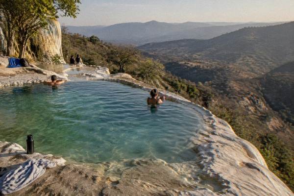
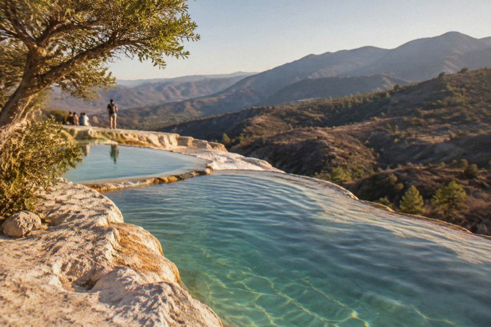
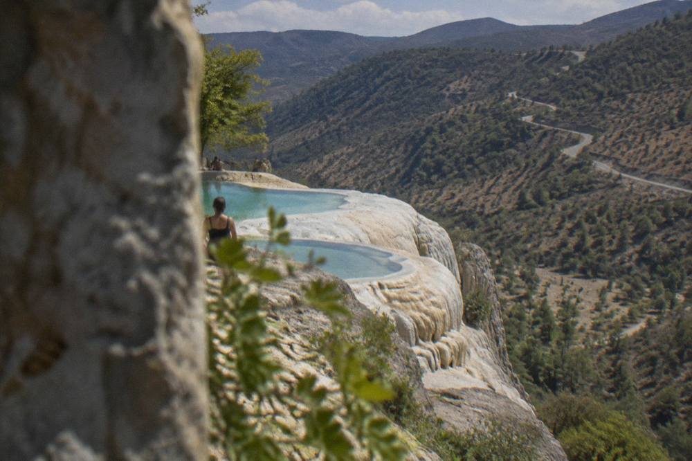
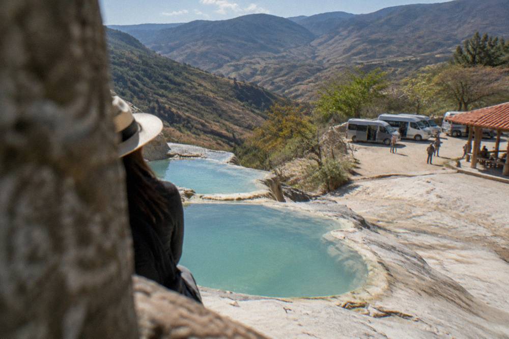
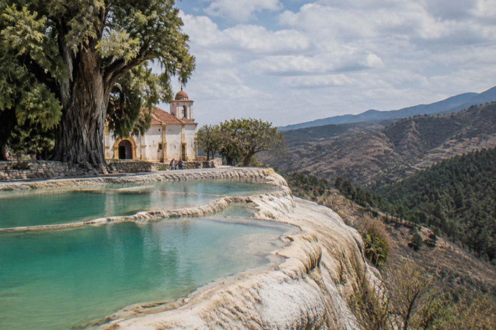
Hierve el Agua is a set of mineral springs and petrified rock formations in the Tlacolula Valley, about 67 km east of Oaxaca City by road. The name refers to water that seems to boil from the ground and has left stone cascades down the hillside, with a series of spring-fed pools at the top. The site is administered by local communities rather than a federal agency, which is why practical details such as the entry fee and opening hours are best confirmed on arrival or with your tour operator. This page from Oaxaca Travel Guide sets out the drive, the tour options and the stops that fill out a full day in the valley.
How Far Is Hierve El Agua From Oaxaca City?
Hierve el Agua lies about 67 km from the Zócalo in Oaxaca City, and the free-flow driving time is about 57 minutes on the valley route, computed from mapped road distances. Those are baseline figures: the final stretch is a winding mountain road, and real traffic, market days and weather make the trip slower. Allow well over an hour each way, more if you stop, and plan the day around a mid-morning arrival.
The route runs out through the Tlacolula Valley on the federal highway, past the towns of Tule, Teotitlán del Valle and Tlacolula, then turns off near Mitla and climbs into the hills on the road to San Lorenzo Albarradas. The turn-off is where the valley floor ends and the switchbacks begin, and that last section is the reason many travellers book a tour rather than drive. Parking arrangements at the site are handled by the local community, so settle the parking fee on the ground.
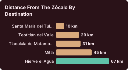
For context against the valley's other anchors, the same mapping gives these one-way distances and free-flow times from the Zócalo:
| Destination | Distance from the Zócalo | Free-flow drive time |
|---|---|---|
| Santa María del Tule | about 10 km | about 11 min |
| Teotitlán del Valle | about 29 km | about 26 min |
| Tlacolula de Matamoros | about 31 km | about 25 min |
| Mitla | about 45 km | about 37 min |
| Hierve el Agua | about 67 km | about 57 min |
The pattern is clear: Hierve el Agua is the far end of the valley's day-trip chain, and everything else on the list sits on the way. That geography is why the loop itinerary exists at all. More on the pairing options further down, and see How Long Is The Drive From Oaxaca To Hierve El Agua for the drive question alone.
How Do You Get From Oaxaca To Hierve El Agua Without A Car?
Independent travel from Oaxaca City to Hierve el Agua runs in two legs: local transport from the city out to Mitla or Tlacolula in the Tlacolula Valley, then a shared taxi or local transport up the mountain road for the final stretch to the springs. The valley leg departs from stands in the south of the city, and fares for both legs are best confirmed at the stand, since no official fare table is published.
Valley-bound colectivos leave from departure points in the south of the city, and the same network serves Tlacolula, Mitla and Teotitlán del Valle on frequent departures when full. The last leg from Mitla up to Hierve el Agua is short in distance but slow in time, and it is shared mototaxis and camionetas rather than a scheduled service. Times and fares for these legs come from local knowledge rather than any official source, so treat anything quoted in a forum as a snapshot and confirm at the stand.
The alternative is a guided day trip, which removes both legs of the transport puzzle and bundles the valley stops. The featured option on this site pairs the springs with a mezcal-making visit:
For travellers who want to compare the guided options before deciding, the current picks for this route are:
A smaller-group half-day version also exists if the full valley loop is more than the schedule allows:
Driving yourself is the third option. The road is paved to the site, and the getting around Oaxaca guide covers the wider transport picture. Whether a rental makes sense depends on how many valley stops you want to control yourself; a single-destination day to the springs is straightforward, a four-stop loop less so.
What Does A Guided Hierve El Agua Day Trip Include?
Most guided day trips from Oaxaca City include round-trip transport from the city, time at the Hierve el Agua pools and rock formations, and one or more valley stops such as Mitla, the Tule tree, a weaving town or a mezcal distillery. What varies between products is the size of the group, how long the day runs and which stops are bundled, so the decision is really about pace and depth rather than destination.
The tour list on this site shows the spread. Some products string together the full loop: springs, Mitla, the Tule tree, a rug workshop in Teotitlán del Valle and a mezcal tasting. Others compress the day or focus it, an option built around mezcal production itself, or a half-day that goes to the springs and comes back. The featured tour belongs to the focused group: transport, the springs and a behind-the-scenes mezcal-making stop. Its live listing carries the current price, rating and duration, and the operator's booking page is where availability shows.
That last pick is a city product rather than a valley one, a small-group cacao and chocolate session that pairs well as a shorter booking on a different day of the trip.
The practical case for a tour on this particular route is the mountain road. The switchbacks above Mitla are the one stretch of the valley network where a driver who knows the road changes the character of the day, and in the rainy season, when cloud sits on the hills, the difference is larger still. Whether that is worth a tour price against the colectivo legs is a judgement call; the tour pages on this site, starting with the Hierve el Agua tour overview, print prices and durations for the comparison.
Can You Combine Hierve El Agua With Mitla And The Tule Tree?
Yes, and it is the standard way to spend the day: the geography runs the stops in a line, with the Tule tree about 11 minutes out of the city, Teotitlán del Valle and Tlacolula along the valley floor, Mitla about 37 minutes out, and Hierve el Agua the final climb beyond Mitla. A loop that hits the tree, Mitla and the springs is a full day; adding Tlacolula or a weaving stop makes it a long one.
The INAH archaeological zone at Mitla anchors the valley end of the route. Per the INAH listing, Mitla is open Monday to Sunday 08:00 to 17:00 with last access at 16:30, and entry is 105 MXN for Mexican nationals and 210 MXN for foreign visitors as a Category I site. Mitla logged 104,428 visitors in 2025 according to the state tourism indicators, against 416,675 at Monte Albán, which gives a sense of the relative pressure on the two sites.
| Valley stop | Drive from the Zócalo | Entry situation |
|---|---|---|
| Santa María del Tule tree | about 11 min | tree on the church grounds; church fee not published |
| Teotitlán del Valle | about 26 min | weaving workshops; visits arranged directly |
| Tlacolula | about 25 min | market town; weekly market day only |
| Mitla (INAH) | about 37 min | 105 MXN nationals / 210 MXN foreigners, Mon to Sun 08:00 to 17:00, last access 16:30 |
| Hierve el Agua | about 57 min | community-run; fee and hours confirmed on site |
The Tule tree sits beside the church in Santa María del Tule, about 10 km from the city, and the church's own fee situation is not published in any primary source, so treat the tree as a quick photo-and-walk stop unless a longer visit is planned. The name itself has its own story, covered in What Does El Tule Mean In English. Tlacolula's weekly market is a separate animal entirely and has its own page on the Tlacolula Sunday market day trip; it only overlaps with a Hierve el Agua day if your travel dates line up with the market day.
For mezcal, the valley route passes through the heart of production country, and the mezcal route through Santiago Matatlán is the dedicated page. The featured tour on this page already builds a mezcal stop into the springs day: Check availability on the operator's booking page to see the current dates and price.
What Is The Weather Like At Hierve El Agua Through The Year?
The valley around Hierve el Agua follows the same pattern as Oaxaca City: a dry season from November to April and a rainy season from May to October, with June to September the peak rain months. The SMN station normals for Oaxaca give June 188.3 mm of rain and September 163.6 mm, against 2.4 mm in January. Rain typically falls in afternoon storms in the wet months, so a morning arrival at the springs is the standard advice.
The site sits high on a hillside above the valley, and the climb from the parking area plus the altitude mean the sun matters as much as the rain. Oaxaca City stands at about 1,550 m, and the springs are higher still. The normals table gives a picture of the year:
| Month | Mean daily high (C) | Mean daily low (C) | Mean rain (mm) |
|---|---|---|---|
| Jan | 28.9 | 10.3 | 2.4 |
| Feb | 31.1 | 11.6 | 4.6 |
| Mar | 33.3 | 13.6 | 17.6 |
| Apr | 34.9 | 15.8 | 47.3 |
| May | 33.8 | 16.7 | 97.9 |
| Jun | 30.9 | 16.7 | 188.3 |
| Jul | 30.1 | 15.9 | 118.6 |
| Aug | 30.0 | 15.9 | 131.8 |
| Sep | 29.1 | 16.1 | 163.6 |
| Oct | 29.3 | 14.5 | 63.1 |
| Nov | 29.0 | 12.3 | 9.1 |
| Dec | 28.9 | 11.0 | 9.0 |
Two readings of that table matter for the pools. First, April posts the highest mean daily high at 34.9 C, so spring days at an exposed hillside site call for serious sun protection; the monthly detail lives on the weather-by-month page, and the planning picture on when to visit Oaxaca. Second, from June through September the rain days run about 20 per month at the station, which is why tours on this route schedule the springs for the morning and keep the afternoons for covered stops such as the Mitla zone and mezcal tastings.
The dry months change the picture in the other direction. January averages just 2.4 mm of rain across about 1.4 rain days, and the air is clear, but nights drop to a mean minimum of 10.3 C. An early start for a sunrise-adjacent arrival means a jacket for the ride out and shorts by noon.
What Should You Bring For The Hierve El Agua Pools?
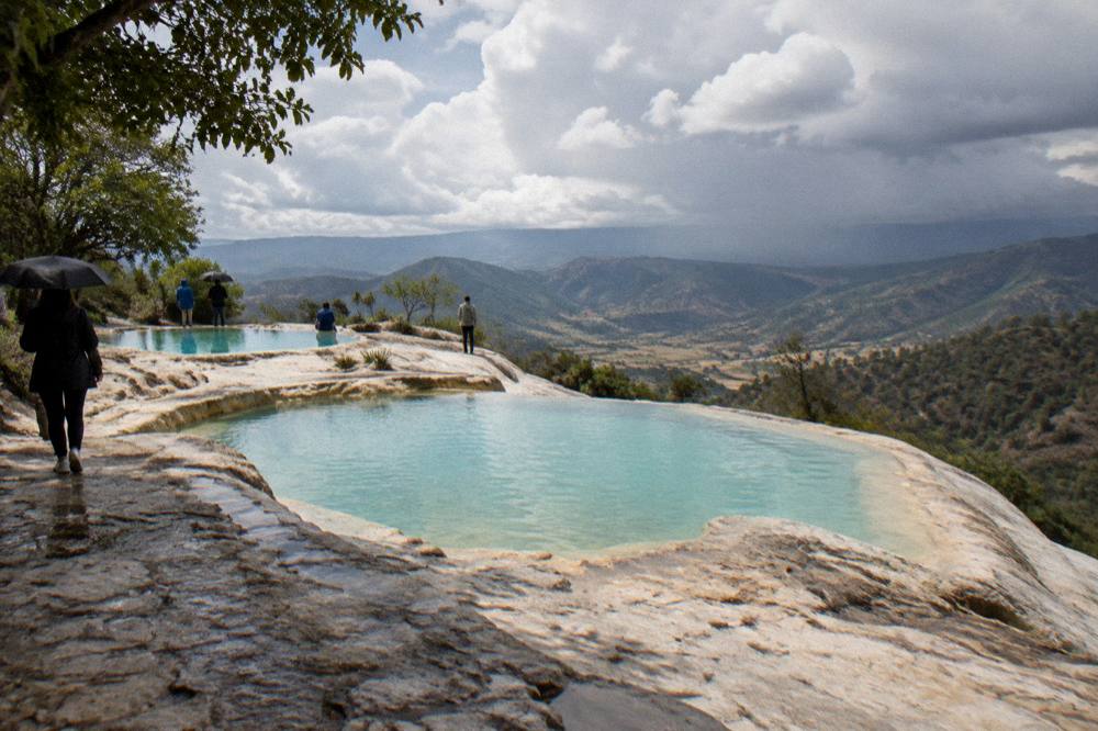
Bring swimwear under quick-drying clothes, water shoes for the rock surfaces, a towel, high-factor sun protection, more drinking water than feels necessary and cash in pesos for the community-run entry and any food or guides at the site. The pools are the point of the visit for many travellers, and there are no changing facilities of a standard a city pool would recognise, so arrive ready to swim.
The altitude and exposure do the work. At roughly 1,550 m and above, UV is strong even on the cool mornings of December and January, and the walk between the parking area, the pools and the viewpoints along the petrified cascades adds up. Sturdy shoes matter more than the distance suggests, because the path along the rock formations is uneven mineral terrace, not a paved promenade.
A short list, and what each item is for:
| Item | Why it matters at Hierve el Agua |
|---|---|
| Swimwear worn under clothes | limited changing facilities at a community-run site |
| Water shoes | slick mineral rock around the pools |
| Sun protection | high-altitude UV on an exposed hillside |
| Drinking water | no on-site supply listed; carry what you need |
| Cash in MXN | community entry and local vendors run on cash |
| Layer or jacket | mean lows of 10.3 to 11.0 C on winter mornings |
One caution the sources do support: the road up from Mitla is a mountain road, and in the June to September rain months, afternoon storms can make the descent slower than the ascent. A morning visit with an afternoon in Mitla or a mezcal distillery is the shape of a well-planned day, and the rainy-season page covers the wider adjustments.
Where To Stop Between Oaxaca And Hierve El Agua?
The stops that fill the day sit along the valley highway in order: the Tule tree at about 11 minutes out, Teotitlán del Valle at about 26 minutes, Tlacolula at about 25, and Mitla at about 37, with Hierve el Agua the final climb at about 57. Teotitlán del Valle is the weaving stop, Tlacolula the market town, Mitla the archaeological zone, and Santiago Matatlán the mezcal town just beyond.
Each has a dedicated day-trip page on this site, so the choice is really about how many stops a single day can hold. Two is comfortable, three is a full guided loop, four is a long day that only the packaged tours really deliver. The pairing logic:
| Combination | Shape of the day | Best for |
|---|---|---|
| Hierve el Agua only | out and back, half day | short trips, second visits |
| Hierve el Agua + Mitla | archaeology then springs, full day | first visits, history and swim |
| Tule + Mitla + Hierve el Agua + mezcal | the classic four-stop loop | the full packaged day |
| Teotitlán + Hierve el Agua | weaving stop then springs | craft-focused trips |
Beyond the valley, the region's other long days are separate undertakings: the Sierra Norte and Pueblos Mancomunados sit in the opposite direction with about 142 minutes of driving to Latuvi, and the Pacific coast at Puerto Escondido is about 165 minutes on the new highway. Neither belongs in a Hierve el Agua day; they compete with it for a slot in a longer itinerary, which the five-day Oaxaca itinerary sequences.
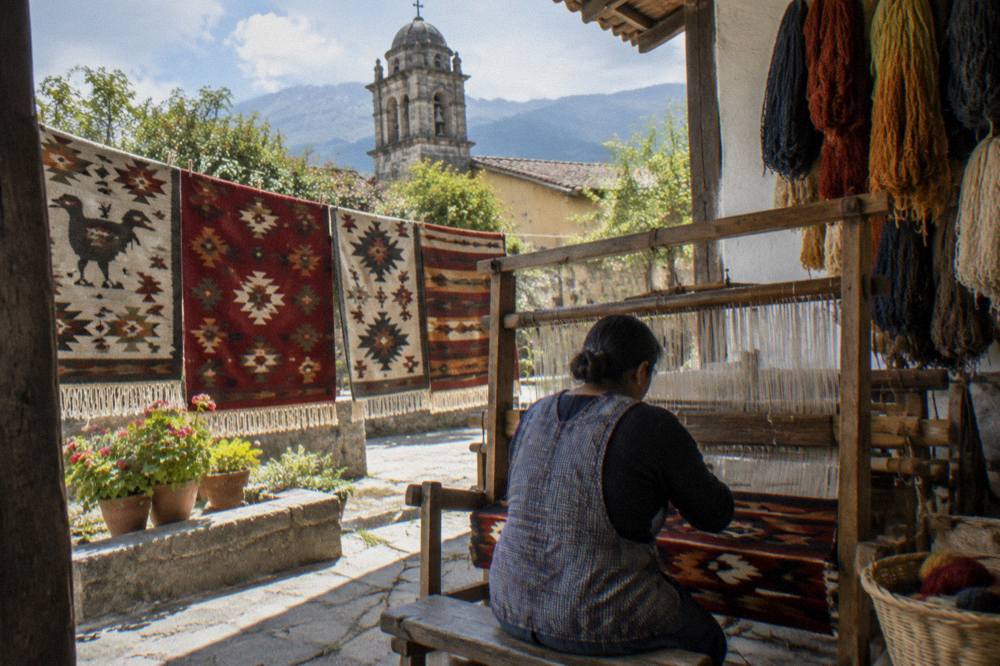
If the day is tight, the honest comparison is on the is Hierve el Agua worth it page: the springs against a Monte Albán morning, against a city cooking class, against the valley's other anchors. The short version is that the pools are the only swimming-and-scenery stop of their kind in the valley, and the drive is the price of that.
Is Hierve El Agua Worth The Drive From Oaxaca?
For a first visit of three days or more, yes: the petrified cascades and spring pools are the valley's most distinctive natural sight, and the 57-minute drive is shorter than the queues of a big-city attraction. For a one- or two-day trip centred on the city and Monte Albán, the springs are the first thing to cut, since the day costs a full valley loop to reach.
The trade-off is time against uniqueness. Monte Albán is closer and logged 416,675 visitors in 2025, Mitla is on the way out and drew 104,428, and the springs sit beyond both. A traveller with one day should follow the one day in Oaxaca plan; with three, the valley loop fits as day two or three per the three-day itinerary. The site's own page on Hierve el Agua covers the formations themselves, and the wider set of options lives on the things to do in Oaxaca page.
For the guided versions of the day, the current picks across the tour list:
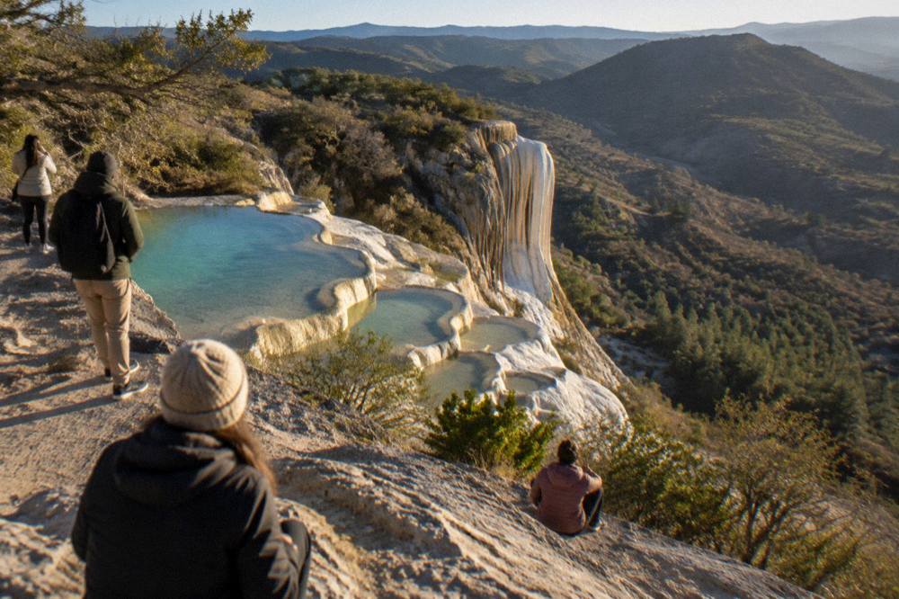
Common Questions About The Hierve El Agua Day Trip
How Long Is The Drive From Oaxaca City To Hierve El Agua?
About 67 km and about 57 minutes of free-flow driving from the Zócalo, computed from mapped road distances. The final stretch above Mitla is a winding mountain road, so real journeys run longer, especially with stops or in the rainy season.
Can You Swim At Hierve El Agua?
Yes, the spring-fed pools at the top of the site are the main draw alongside the petrified rock formations. Bring swimwear worn under clothes, water shoes for the mineral rock, a towel and sun protection, since the site sits at high altitude on an exposed hillside.
How Much Does It Cost To Enter Hierve El Agua?
The site is run by local communities rather than a federal agency, and no primary source publishes a current fee or opening hours. Confirm the entry situation on arrival or with your tour operator, and carry cash in pesos.
Can You Visit Hierve El Agua And Mitla In One Day?
Yes, it is the standard combination. Mitla lies about 37 minutes from the city on the way to the springs, is open Monday to Sunday 08:00 to 17:00 with last access at 16:30, and charges 105 MXN for nationals and 210 MXN for foreign visitors.
What Is The Best Time Of Year To Visit Hierve El Agua?
The dry season from November to April gives the clearest days, with January averaging 2.4 mm of rain. From June to September the station averages well over 100 mm of rain a month, mostly in afternoon storms, so a morning arrival is the safer plan in those months.
Do You Need A Tour For Hierve El Agua?
No, but the two-leg independent route, city transport to Mitla and then local transport up the mountain road, takes time and local knowledge. Guided day trips bundle the transport with valley stops such as Mitla, the Tule tree and a mezcal distillery, which suits a first visit on a short trip.
The valley east of Oaxaca City packs more into 67 km than most day-trip corridors anywhere: a tree the width of a church, weaving towns, a Category I archaeological zone, mezcal country and a set of cliffside mineral pools at the end of the road. Pick the stops that match the pace of the trip, keep the springs for the morning, and the day takes care of itself.