Oaxaca To Puerto Escondido: Road, Bus And Flight Compared
Oaxaca City sits inland at about 1,550 m in the Valles Centrales, and Puerto Escondido is roughly 190 km away on the Pacific. Here is how the road, the bus and the flight compare, using only figures the sources give.
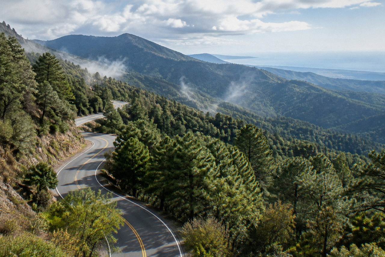
The drive from the Zócalo in Oaxaca City to Puerto Escondido is about 190.1 km and about 165 minutes on the new highway, a free-flow estimate; real traffic and mountain roads are slower. The bus is operated by ADO with fares and times set by the operator. The flight leaves from OAX, Xoxocotlán International Airport, operated by ASUR.
Puerto Escondido is on the Pacific coast, and Oaxaca City is not: the capital of the state of Oaxaca in Mexico is an inland highland city in the Valles Centrales at about 1,550 m, with no sea, no port and no beach of its own. The run between the two is one of the great descents in Mexican travel, from valley plateau down through the Sierra Sur mountains to the ocean, and it can be done by private car on the new highway, by bus, or by a short flight out of OAX, Xoxocotlán International Airport, operated by ASUR. This page compares the three options using only the figures the sources carry, flags where no figure is published, and helps you decide which option fits your trip, with the coast treated as the long extension it is rather than a local day trip.
How Far Is Oaxaca City From Puerto Escondido?
The road distance from the Zócalo in Oaxaca City to Puerto Escondido is about 190.1 km, and the free-flow drive time on the new highway is about 165 minutes, or roughly two and three quarter hours. These are derived estimates from route mapping on OpenStreetMap roads, not official figures, and real traffic and mountain roads make the trip slower in practice.
The 165-minute estimate assumes the Barranca Larga to Ventanilla section of the newer highway, the route that changed this journey. Before that section opened, prior guides described the drive as 2.5 to 3.5 hours or more on slower mountain roads, and older routing through the Sierra Sur was considerably longer. The derived figure is free-flow: it does not model freight traffic, weather, roadworks or the climbs and descents that slow real vehicles. Treat about 165 minutes as the floor, not the promise.
That context matters for planning. A traveler leaving the Zócalo in the morning can, in principle, be on a Pacific beach the same afternoon, which was not realistic a decade ago. But every minute of that estimate is mountain highway, and the file gives no official total from any government source, so any itinerary built on it should carry slack: a later bus, a missed turn or a checkpoint can absorb an hour without anything being wrong.
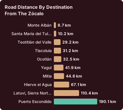
For comparison with other extensions from the city, the same derived dataset gives these free-flow times from the Zócalo.
| Destination from the Zócalo | Road distance | Free-flow time |
|---|---|---|
| Monte Albán | 8.7 km | about 15 min |
| Santa María del Tule | 10.2 km | about 11 min |
| Teotitlán del Valle | 29.2 km | 26 min |
| Tlacolula | 31.2 km | 25 min |
| Ocotlán | 32.5 km | 37 min |
| Yagul | 41.9 km | 38 min |
| Mitla | 44.6 km | 37 min |
| Hierve el Agua | 67.1 km | 57 min |
| Latuvi, Sierra Norte | 110.4 km | 142 min |
| Puerto Escondido | 190.1 km | 165 min |
Puerto Escondido is by a wide margin the farthest entry on that list, more than five times the road distance of Mitla and nearly three times the drive time of Hierve el Agua. That is exactly why the coast is a long extension and never a local outing: the valley craft villages are drives, but the Pacific is a project. If your days in Oaxaca are short, the Hierve el Agua day trip or the Mitla and Tlacolula day trip sit in the same direction and a fraction of the distance.
Straight-line figures tell the same story from another angle. Mitla is about 42 km from the city as the crow flies, Hierve el Agua about 52 km, and Zaachila about 12 km, against a Puerto Escondido run of roughly 190 km by road through mountains. The road is long because the terrain is long: there is no flat corridor from the Valles Centrales to the coast.
Is The Drive From Oaxaca To Puerto Escondido Safe?
The US State Department lists Oaxaca state at Level 2, exercise increased caution, a reported rating, with no travel restrictions for US government staff to Oaxaca City, Monte Albán, Puerto Escondido or Huatulco, though restrictions apply in the Isthmus region. The UK FCDO advises against all but essential travel to parts of Mexico and does not name Oaxaca on its main page, and Canada advises a high degree of caution for Mexico overall.
Those are the advisory wordings the sources carry, and none of them singles out the Oaxaca City to Puerto Escondido highway. What the file does flag for this state is a standing, undated risk: road blockades by teachers' unions can disrupt road and airport access, sporadically and for hours or days at a time. No specific blockade should be dated or predicted, but a coast trip is the kind of long road journey where a blockade matters, so checking conditions on the day of travel is simply part of the plan.
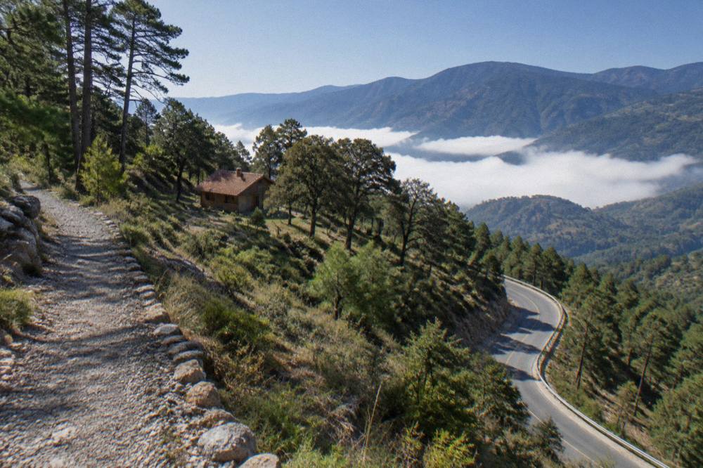
The road itself is a mountain highway. The derived 165-minute figure is free-flow, and mountain roads in the Sierra Sur carry grades, curves and weather that a flat-road driver would not expect. The file gives no figure for road accidents, road quality ratings or recommended departure times, and none is invented here. What can be said from the numbers: the route is about 190 km of it, which is a long single spell of mountain driving by any standard.
Combining the advisory picture with the terrain picture, the honest summary is: the state's advisory tier is the second-lowest of the four US levels and the coast destinations are outside the restricted Isthmus zone, while the drive demands mountain-road patience. Travelers who want the coast without the wheel can read the bus and flight sections below, and the question is it better to fly or take the bus to Oaxaca covers the same trade-off from the Mexico City direction.
Can You Take A Bus From Oaxaca To Puerto Escondido?
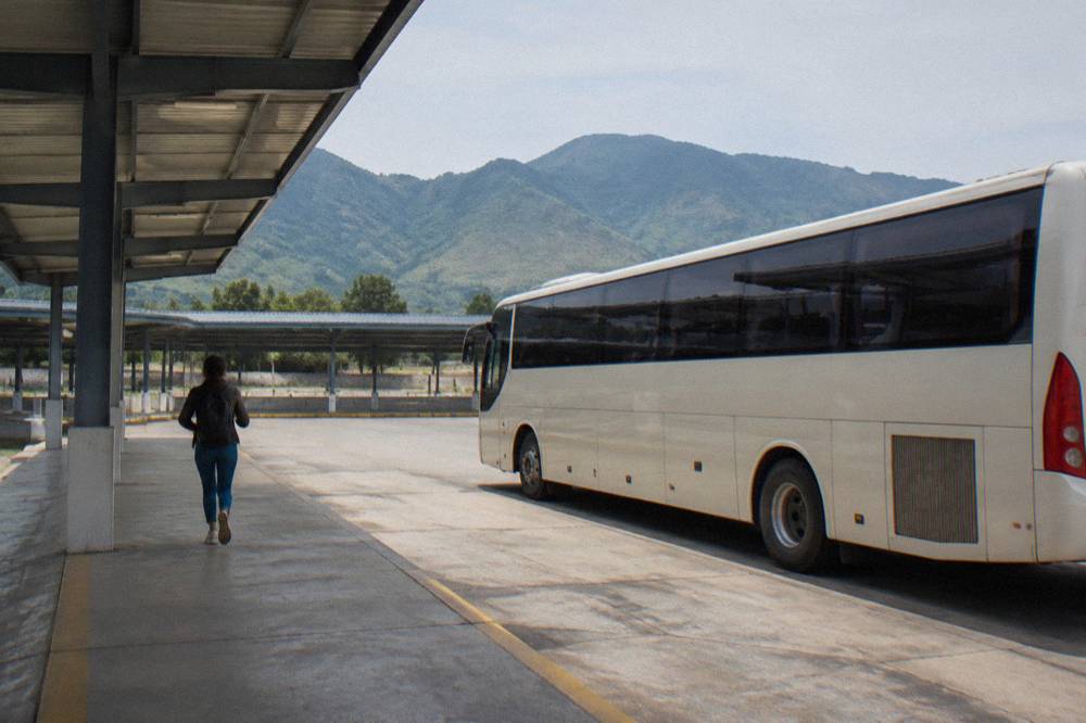
Yes, ADO runs buses from Oaxaca City toward Puerto Escondido with multiple daily departures, and its official site is ado.com.mx. Fares and journey times are set by the operator and are not stated on this page. Check the operator's own site for the timetable and current fare before booking.
What can be said about the bus is structural. ADO is the operator, its site is the official channel, and the service pattern from the city includes the coast among its long-distance destinations alongside Mexico City, Huatulco and Puebla. The ADO bus guide for Oaxaca covers the operator in depth, and the dedicated answer on how long the bus takes from Puerto Escondido to Oaxaca City addresses the return leg's duration question directly.
The bus's real advantage over the drive is the mountain road itself. A 190 km descent through the Sierra Sur puts the grades, the curves and the blockade risk in a professional driver's hands rather than yours, and it removes the question of where to park or refuel on a route the file gives no fuel or stop figures for. Its cost is time and rigidity: departure times are the operator's, and the sea-level arrival comes when the schedule says so, not when you do.
For the wider picture, the same operator connects the city to the capital, and the pages on Mexico City to Oaxaca and Oaxaca to Mexico City cover that corridor, including the answer to how long the bus from Mexico City to Oaxaca takes. The principle is identical on the coast run: the operator sets times and fares, and the booking site is where both are read.
Should You Fly From Oaxaca To Puerto Escondido?
The honest answer is that the flight question hinges on OAX, the city's airport at Xoxocotlán, operated by ASUR, with normal operating hours of 06:00 to 20:00 and no announced runway disruption for 2026. Whether a nonstop to Puerto Escondido exists on your date is a schedule question the operator's booking pages answer, not this page.
What the file verifies about the airport is solid and useful. Normal operating hours are 06:00 to 20:00, which frames any departure: whatever the flight, it leaves inside that window.
The flight's arithmetic is the drive's arithmetic inverted. The road is about 165 free-flow minutes, so any flight plus airport time that beats three hours door to door wins on speed, and a 190 km hop is short in the air. Against that: the airport sits outside the centre, the file gives no authorised taxi fare to the Zócalo and no word on whether ride-hailing apps serve the airport, so the transfer legs are unknowns to price on the day rather than figures to print. The Oaxaca airport guide is the sibling page that goes deepest on the terminal itself.
One more framing from the numbers: Puerto Escondido airport serves the same stretch of coast as Huatulco, and the Oaxaca to Huatulco page covers that alternative, which pairs with different flights and different onward transfers. Which airport serves your beach depends on where on the coast you are sleeping, and both are long extensions of a highland trip.
Road, Bus Or Flight: Which Should You Choose?
Choose the road drive of about 165 free-flow minutes if you want the fastest listed point-to-point time and can handle 190 km of mountain highway; choose the bus if you would rather not drive it, accepting the operator's timetable and fare; choose the flight out of OAX if schedule beats scenery and a nonstop exists on your date. All three figures that exist are printed in this article, and the rest is set by operators.
The comparison table below stays strictly inside what the sources give. Where no figure is published, the cell says so rather than guessing, because a plausible-sounding fare or duration is worse than an honest blank. The full index of guides sits on Oaxaca Travel Guide.
| Option | Distance or route | Time figure the sources give | Fare figure the sources give | Who sets the details |
|---|---|---|---|---|
| Private car, new highway | about 190.1 km | about 165 min free-flow (derived) | none published | driver and road conditions |
| ADO bus | Oaxaca City to Puerto Escondido | set by operator | set by operator | ado.com.mx |
| Flight from OAX | OAX to Puerto Escondido | schedule-dependent | set by carrier | the operator's booking page |
Two secondary considerations shape the choice in practice. First, blockade risk applies to both road and air: the standing pattern of teachers' union road blockades can hit highway access and airport access alike, and no date can be put on one. Second, the mountain descent is the trip: travelers who value the Sierra Sur crossing for its own sake lose it at altitude in a cabin, and gain it behind a windshield or a bus window. The file carries no scenery ranking and none is invented; the point is only that the three modes traverse the same terrain differently.
A pattern that works for many coast-bound trips, using only timings in this file: spend the first days in the city and valleys, where Monte Albán is about 15 minutes away and a guided option such as the Check availability link shows covers the site with Cuilapan de Guerrero in one loop, then move to the coast by whichever of the three modes fits. The Oaxaca in 5 days and Oaxaca in a week itineraries are built for exactly that split, and the root things to do in Oaxaca page carries the full inventory.
Can You Stop On The Way, Or Split The Route?
San José del Pacífico is the natural midpoint split on the Oaxaca City to Pacific coast road route, lying high in the Sierra Sur on the descent, and the site carries a dedicated guide to it, though the file gives no derived drive time from the Zócalo to San José del Pacífico itself.
Splitting the drive changes its character. Instead of one about 190 km mountain haul, the run becomes two shorter legs with a night at altitude between them, which matters for fatigue on exactly the kind of road where fatigue costs most. The Oaxaca to San José del Pacífico guide covers the stop and its surrounds, and it is the only named intermediate waypoint on this route for which this site carries a full page, alongside the coast terminals of Oaxaca to Mazunte and Zipolite as onward options from Puerto Escondido.
What the file does not give, and what therefore stays unsaid: fuel prices, toll figures, recommended stops beyond that midpoint, and any drive time between intermediate points on the route. The bus equivalent of the split is simply an overnight in the city before a morning departure, and the flight equivalent does not exist: you cannot split a 190 km hop.
The split also interacts with the seasons. The SMN station normals for Oaxaca City put June at 188.3 mm of rain against January's 2.4 mm, and rainy-season months mean mountain roads taken wet. A split drive with a mid-morning start on each leg leaves more daylight margin than a single evening descent, and that is a planning judgement, not a published safety figure.
| Month | Mean high C | Mean low C | Rain mm |
|---|---|---|---|
| Jan | 28.9 | 10.3 | 2.4 |
| Feb | 31.1 | 11.6 | 4.6 |
| Mar | 33.3 | 13.6 | 17.6 |
| Apr | 34.9 | 15.8 | 47.3 |
| May | 33.8 | 16.7 | 97.9 |
| Jun | 30.9 | 16.7 | 188.3 |
| Jul | 30.1 | 15.9 | 118.6 |
| Aug | 30.0 | 15.9 | 131.8 |
| Sep | 29.1 | 16.1 | 163.6 |
| Oct | 29.3 | 14.5 | 63.1 |
| Nov | 29.0 | 12.3 | 9.1 |
| Dec | 28.9 | 11.0 | 9.0 |
Those normals belong to the SMN station in Oaxaca City at 1,594 m, not to the coast, and the two climates differ: the city is dry from November to April with the rainy season from May to October, while a sea-level finish means a warmer arrival than any figure here. The table frames the highland half of the journey, which is the half you drive through first.
Is Puerto Escondido Worth The Detour From Oaxaca City?
Puerto Escondido received no separate visitor figure in the city's 2025 tourism indicators, which counted 1,324,332 arrivals in Oaxaca City itself, of which 1,111,799 were national and 212,533 foreign visitors, so the honest case for the detour rests on geography and your trip length rather than a published coastal demand statistic: it is 190.1 km and a climate change from 1,550 m of altitude to sea level.
The numbers that do exist describe the highland side. Oaxaca City's 2025 arrivals averaged a 2.00-night stay and 51.73 percent hotel occupancy, which says the typical visit is short: adding a Pacific leg to a two-night base is a big structural change to the trip, not an afternoon add-on. The same indicators counted 416,675 visitors at Monte Albán in 2025, against 104,428 at Mitla, which measures where the pull of the highlands actually sits.
The decision logic the figures support: with two nights, the valleys alone fill the time, and the craft villages of Teotitlán del Valle or the Tlacolula Sunday market are the scale of outing that fits. With five or more nights, the coast stops being a detour and becomes a second base, and the road, bus and flight comparison above decides how you make the switch. The Oaxaca city or the coast guide frames that whole question, and the Oaxaca itinerary planning page turns it into days.
| Indicator, Oaxaca City, 2025 | Figure |
|---|---|
| Total tourist arrivals | 1,324,332 |
| National arrivals | 1,111,799 |
| Foreign arrivals | 212,533 |
| Hotel occupancy | 51.73 percent |
| Average stay | 2.00 nights |
| Monte Albán visitors | 416,675 |
| Mitla visitors | 104,428 |
What Does The Coast Trip Cost Compared With Staying In The Valleys?
No bus fare, flight price or fuel cost for the Oaxaca City to Puerto Escondido run is available to this site; the costs that can be given are the INAH archaeology tickets, 105 MXN for nationals and 210 MXN for foreign visitors at Category I sites such as Monte Albán and Mitla, which is what a valleys day actually spends at the gate.
That asymmetry is the honest cost picture. The transfer costs exist, but they are set by the operator's booking pages and the fuel market, and they belong on the day of booking, not in an article. The gate costs are fixed and published: Category I covers Monte Albán, Mitla and Yagul at 105 and 210 MXN, while Category III sites such as Dainzú, Lambityeco and Zaachila charge 80 and 145 MXN, and a visit outside normal INAH hours costs 730 MXN where the option is listed.
| INAH site | Category | Nationals MXN | Foreigners MXN | Hours |
|---|---|---|---|---|
| Monte Albán | I | 105 | 210 | Mon to Sun 08:00 to 17:00, last access 16:00 |
| Mitla | I | 105 | 210 | Mon to Sun 08:00 to 17:00, last access 16:30 |
| Yagul | I | 105 | 210 | Mon to Sun 08:00 to 17:00, last access 16:00 |
| Dainzú | III | 80 | 145 | Mon to Sun 08:00 to 17:00, last access 16:30 |
| Lambityeco | III | 80 | 145 | Mon to Sun 08:00 to 17:00, last access 16:30 |
| Zaachila | III | 80 | 145 | Thu to Sun 10:00 to 16:00 |
One state-level cost does attach to any overnight anywhere in Oaxaca: the lodging tax, 3 percent on hotel-type stays, or 5 percent where an intermediary platform collects it, under the state fiscal law as reformed by decree 884 published 10 December 2025. That applies as much on the coast as in the capital, so it does not tip the comparison, but it belongs in any accommodation budget. The Oaxaca travel costs and budget guide assembles the full picture for the highland side.
Common Questions About The Oaxaca To Puerto Escondido Trip
How Long Is The Drive From Oaxaca City To Puerto Escondido?
About 165 minutes free-flow over about 190.1 km on the new highway, a derived estimate from route mapping rather than an official figure, and real traffic and mountain roads make it slower.
How Long Is The Bus From Puerto Escondido To Oaxaca City?
Is The Oaxaca To Puerto Escondido Road Safe?
The US State Department lists Oaxaca state at Level 2, exercise increased caution, a reported rating, with no restrictions for staff to Oaxaca City, Monte Albán, Puerto Escondido or Huatulco; road blockades by teachers' unions are a standing, undated risk that can disrupt highway and airport access.
Should I Fly Or Drive From Oaxaca To The Coast?
The flight leaves from OAX, ASUR-operated with hours 06:00 to 20:00, and beats the about 165-minute drive only if a nonstop fits your schedule and transfers line up; the drive and bus trade speed for the mountain crossing itself.
Can You Visit Puerto Escondido As A Day Trip From Oaxaca City?
No: at about 190.1 km each way through the Sierra Sur it is a long extension, not a local day trip, and the typical Oaxaca City stay of 2.00 nights makes a coastal overnight the only realistic shape.
Where Should You Stop Between Oaxaca City And The Pacific?
San José del Pacífico, high in the Sierra Sur on the descent, is the midpoint split this site carries a full guide to, though no derived drive time from the Zócalo to it is published, so no minute figure is given here.