How Long Is The Bus From Puerto Escondido To Oaxaca City?
The bus ride from Puerto Escondido on the Pacific coast up to Oaxaca City crosses about 190 km of mountain highway. Here is what the route involves, how the drive time compares, and how to plan the trip.
Puerto Escondido sits on the Pacific coast; Oaxaca City (Oaxaca de Juárez) sits inland in the Valles Centrales at about 1,550 m of altitude, and the road between them is a mountain route of about 190.1 km from the Zócalo, computed as about 165 minutes of free-flow driving. The bus is the slow version of that climb. Journey times and fares for the route are set by the operator and are not published as fixed official figures, so this page reports what can actually be measured: the distance, the road, the seasons that change it, and how to plan around both ends of the trip.
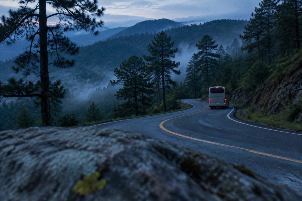
No official journey time is published for the bus from Puerto Escondido to Oaxaca City, and this site does not print a schedule figure the operator has not set. The road distance is about 190.1 km, computed at about 165 minutes of free-flow driving on the new highway. A bus takes longer than a car on that same road, because it climbs, descends and stops, so treat the drive time as the floor and buy tickets with the schedule shown at ado.com.mx.
That distinction matters more here than on most routes in Mexico. The Barranca Larga to Ventanilla section gave the route a newer, improved alignment, and secondary references describe the drive as roughly two and a half to three and a half hours depending on conditions and vehicle. Those are not official figures either. What is verifiable is the geometry: the route leaves sea level and finishes at about 1,550 m, and mountain roads with that profile run slower than their free-flow computation.
Practical takeaway: when the operator's booking page shows a departure and an arrival, the difference between those two clocks is the real answer to this question, and it is the only one that reflects the service you would actually ride. The ADO bus guide for Oaxaca covers the operator's site, classes of service and how tickets work, without inventing a minute count.
What Route Does The Bus Take From Puerto Escondido To Oaxaca City?
The bus follows the Oaxaca coast road inland and then climbs through the mountains on the highway built around the Barranca Larga to Ventanilla section, finishing about 190.1 km from the Zócalo of Oaxaca City. The free-flow computation for that distance is about 165 minutes, which secondary references on the route describe as roughly two and a half to three and a half hours in real conditions.
The climb is the story of the trip. Puerto Escondido is a Pacific beach town; Oaxaca City is a highland valley capital with no sea anywhere near it. Between the two, the road gains and loses elevation repeatedly, and curves set the pace more than distance does. The table below puts the coastal run in context with other measured distances from the Zócalo, all computed on OpenStreetMap roads in free-flow conditions, which real traffic and mountain driving exceed.
| Destination from the Zócalo | Distance | Free-flow drive time |
|---|---|---|
| Monte Albán | 8.7 km | about 15 min |
| Mitla | 44.6 km | about 37 min |
| Hierve el Agua | 67.1 km | about 57 min |
| Latuvi, Sierra Norte | 110.4 km | about 142 min |
| Puerto Escondido | 190.1 km | about 165 min |
Two things follow from that table. First, the coast is by any measure a long extension of an Oaxaca trip, not a local outing from the city; the site treats Puerto Escondido, Mazunte and Huatulco as separate destinations you travel to, and the Puerto Escondido day trip page covers that corridor in its own right. Second, every one of those drive times is a derived figure, computed from mapped roads without traffic, weather or stops, and each should be read with "about" attached.
Season changes the road too. The SMN station normals for Oaxaca put the rainy season from May to October, with June averaging 188.3 mm of rain and September 163.6 mm, against 2.4 mm in January and 9.0 mm in December. Rain in the mountains means slower going, whatever vehicle you are in.
| Month | Average rain in Oaxaca City |
|---|---|
| January | 2.4 mm |
| June | 188.3 mm |
| July | 118.6 mm |
| August | 131.8 mm |
| September | 163.6 mm |
| December | 9.0 mm |
Is The Bus Or The Flight Better From Puerto Escondido To Oaxaca City?
The flight is the short option: Oaxaca City is served by Xoxocotlán International Airport (OAX), operated by ASUR, and the same journey by road is a mountain crossing of about 190.1 km. The bus trades speed for the scenery of the climb and, usually, a lower fare, though fares on either mode are set by the operator.
Both modes end in the same valley. The airport sits in the Xoxocotlán area south of the centre, and the bus arrives at the operator's terminal in the city; from either, the Centro Histórico is a short taxi or colectivo ride, with fares agreed locally rather than metered. If the decision is really about time budget, the fly or bus comparison for Oaxaca works through the trade-offs for the Mexico City route, and the same logic applies from the coast.
One planning note that is easy to miss: Mexico abolished daylight saving time, and Oaxaca stays at UTC-6 all year, so clock arithmetic between a coastal departure board and a city arrival board is at least straightforward. The getting to Oaxaca from Mexico City by bus page covers the other long bus corridor into the city.
Where Does The Bus Arrive In Oaxaca City?
The bus arrives at the operator's terminal in Oaxaca City, from which the Centro Histórico and the Zócalo are a short local taxi or colectivo ride away. Terminal addresses and arrival procedures are set by the operator, and this site does not print an address or a fare figure for that final leg; the operator's own site carries the terminal details at the point of purchase.
What can be said with confidence is the shape of the arrival. The historic centre is compact and walkable once you are in it, and the centre coordinates of the Zócalo sit at the heart of a UNESCO inscribed property, the Historic Centre of Oaxaca and Archaeological Site of Monte Albán. From the terminal, everything a first visitor wants, the Andador Macedonio Alcalá, Santo Domingo de Guzmán and the markets of the centre, lies within an easy walk of the Zócalo once you have crossed the last few kilometres by taxi.
If the arrival lands late in the day, the centre still functions: the city's evenings are part of its rhythm, and food tours and walking routes run into the night. The one caution this guide reports from the advisories is general rather than route specific: the UK FCDO advises against all but essential travel to parts of Mexico and does not name Oaxaca on its main page, Canada advises a high degree of caution for Mexico overall, and the US State Department lists Oaxaca state at Level 2, exercise increased caution. Road blockades by teachers' unions are a standing, sporadic risk in the state that can affect highway and airport access for hours at a time, so a buffer around any same-day connection is simply good planning.
What Should You Do In Oaxaca City After The Bus Arrives?
The practical move after a mountain bus ride is to spend the first full day inside the city and save the valley for the day after. Oaxaca City's centre rewards walking, and the big excursions, Monte Albán about 15 minutes away by road and the Tlacolula Valley sites about 25 to 40 minutes out, are easier with fresh legs and an early start than straight off a bus.
A common pattern is one day in the centre, one day of archaeology, one day of valley crafts and mezcal. The related pick on this page fits the third of those days: a private day trip covering Mitla, a weavers town, a mezcal stop and Hierve el Agua, which you can check on Check availability once dates are firm. Because it is private, the pacing adapts to a group that has just spent a morning on a mountain highway.
For sizing the city stop itself, the how many days in Oaxaca question has a fuller answer, and this guide's overall take on the destination sits on the is Oaxaca worth visiting page.
How Should You Plan The Coastal Leg Of An Oaxaca Trip?
Treat the coast and the city as two destinations joined by one long road. The bus from Puerto Escondido is the link, not a day trip in either direction: about 190.1 km each way means a same-day return would consume the whole day in transit, so the workable plans are either a flight between the two, or a bus ride with at least a night, and better two or three, on each side.
Sequencing helps. Many travellers fly into one and out of the other, or break the overland journey with a stop in the Sierra Norte, whose trailheads begin around Latuvi at about 142 minutes of free-flow driving from the city. Others base in the city for the valleys and finish on the coast, using the bus as the closing transfer. The Oaxaca Travel Guide homepage lays out the full destination, city, valleys, Sierra and coast, if the trip is still taking shape.
Whichever direction the bus runs, buy from the operator's own site, keep the booking reference offline, and check the departure board on the day, since mountain weather and occasional highway blockades are the two things that most often move a schedule. That is the honest answer to the length question: the road is about 190 km and about three hours of driving in ideal conditions, the bus is longer by however long its stops and the climb make it, and the operator's schedule is the number that counts.
Common Questions About The Bus From Puerto Escondido To Oaxaca City
How Long Is The Bus From Puerto Escondido To Oaxaca City?
No official journey time is published for the route. The road distance is about 190.1 km, with a free-flow drive computation of about 165 minutes on the new highway, and a bus takes longer than that. The schedule shown at the operator's site at the time of purchase is the figure to plan around.
How Far Is Puerto Escondido From Oaxaca City?
About 190.1 km by road from the Zócalo, computed on mapped roads. The straight-line distance is shorter, but no road runs it directly; the route climbs through the mountains on the highway built around the Barranca Larga to Ventanilla section.
Is The Drive From Puerto Escondido To Oaxaca City Dangerous?
It is a mountain highway with curves and elevation change, and the rainy season from May to October brings heavy rain in the mountains, with June averaging 188.3 mm in Oaxaca City. Official advisories do not name Oaxaca as an area to avoid; sporadic road blockades by teachers' unions are a standing risk in the state that can close routes for hours.
Is It Better To Fly Or Take The Bus From Puerto Escondido To Oaxaca City?
The flight is far quicker: Oaxaca City is served by Xoxocotlán International Airport, operated by ASUR. The bus trades time for scenery and usually price, though fares on either mode are set by the operators.
Can You Do Puerto Escondido As A Day Trip From Oaxaca City?
No. At about 190.1 km and about 165 minutes of free-flow driving each way, the coast is an extension of an Oaxaca trip, not a local day trip. Plan at least one night on the coast, or use a flight to compress the transfer.