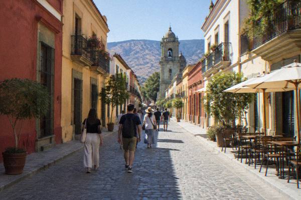
Andador Macedonio Alcalá: The Pedestrian Street From Zócalo To Santo Domingo
The Andador Macedonio Alcalá is the pedestrian spine of Oaxaca City, running from the Zócalo to Santo Domingo de Guzmán past museums, galleries, cafés and the city's green cantera architecture.
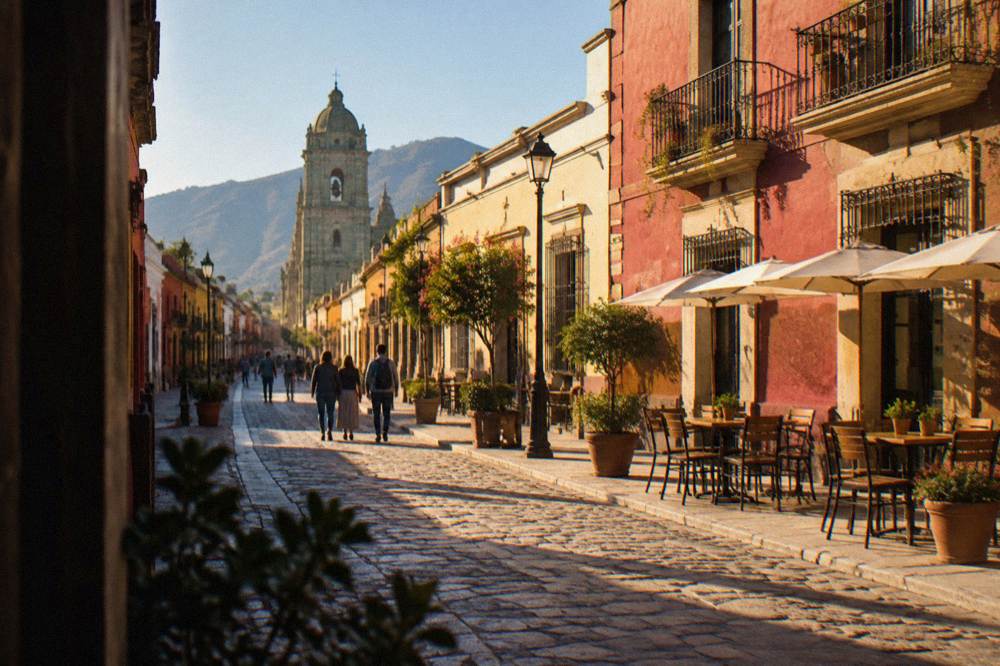
The Andador Macedonio Alcalá is a pedestrian-only street in Oaxaca City's Centro Histórico, connecting the Zócalo to Santo Domingo de Guzmán in a walk of roughly ten minutes, past the Museo de las Culturas de Oaxaca and the Jardín Etnobotánico.
The Andador Macedonio Alcalá is the main pedestrian street of Oaxaca City, the inland highland capital of the state of Oaxaca in Mexico, and it links the two anchors of the historic centre: the Zócalo at one end and the church and former convent of Santo Domingo de Guzmán at the other. Oaxaca de Juárez sits in the Valles Centrales at about 1,550 m, and its historic centre is inscribed by UNESCO as part of the property "Historic Centre of Oaxaca and Archaeological Site of Monte Albán", listing 415. The city was founded in 1529 as Antequera. The Andador is the single most useful street a first-time visitor can learn, because almost every major sight in the centre either sits on it or sits a short block away, and the whole route is closed to through traffic year round. This guide covers what the street connects, the hours and prices at each end, where to eat along it, and how it fits into a wider Oaxaca itinerary.
What Is The Andador Macedonio Alcalá In Oaxaca?
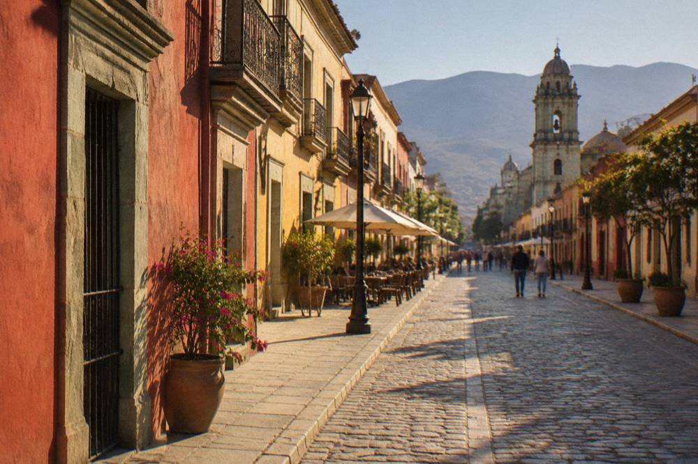
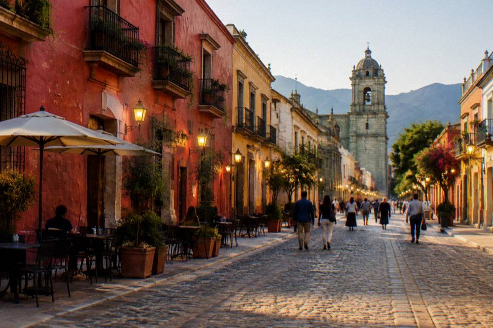
The Andador Macedonio Alcalá is a pedestrian-only street in the Centro Histórico of Oaxaca City, running from the Zócalo, the city's main square, north to the church of Santo Domingo de Guzmán, with the Teatro Macedonio Alcalá partway along it. It is closed to through traffic and carries visitors between the two ends of the historic centre on foot, past galleries, jewellers, cafés and museums.
Partway along its length, the street passes the Teatro Macedonio Alcalá, the theatre that gives the route its theatre landmark. At the Zócalo end it begins at the southwest corner of the Plaza de la Constitución, next to the Oaxaca Cathedral. From there it runs north through the heart of the Centro Histórico, passing the side entrance to the Museo de las Culturas de Oaxaca and finishing at the Plaza of Santo Domingo, one of the city's principal church fronts. The whole route is flat, and the city's compact centre means the walk between the two ends takes only minutes at an easy pace.
The Andador also works as an orientation line for the rest of the centre. East of the street lies the Barrio de Xochimilco, covered in the Xochimilco neighbourhood guide, and south is the market district around the Mercado Benito Juárez and the Mercado 20 de Noviembre. Because the Andador connects all of these within a few blocks, many visitors use it as the backbone of a first day, as set out in the one day in Oaxaca itinerary.
How Long Does The Andador Take To Walk, And What Sits Along It?
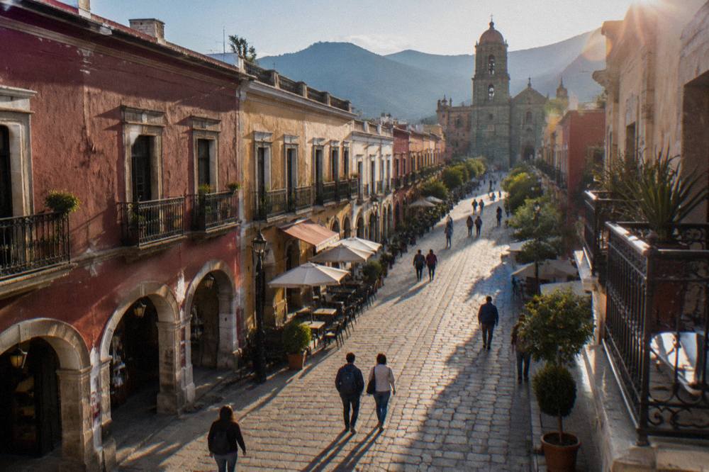
The Andador Macedonio Alcalá takes about ten minutes to walk end to end at a steady pace, covering the stretch from the Zócalo to the Plaza of Santo Domingo, though a visit with stops for the museums, the Jardín Etnobotánico and the shops along the way easily fills half a day. The street itself is short; the sights on it are not.
Four anchors sit on or immediately off the street, and each one rewards a stop. The following table sets out what sits where, working from the Zócalo end north.
| Order | Sight | Position on the Andador |
|---|---|---|
| 1 | Zócalo (Plaza de la Constitución) and the Cathedral | South end |
| 2 | Teatro Macedonio Alcalá | Middle stretch, east side |
| 3 | Museo de las Culturas de Oaxaca, in the former convent of Santo Domingo | North end, entered from the Andador |
| 4 | Santo Domingo de Guzmán and the Jardín Etnobotánico | North end |
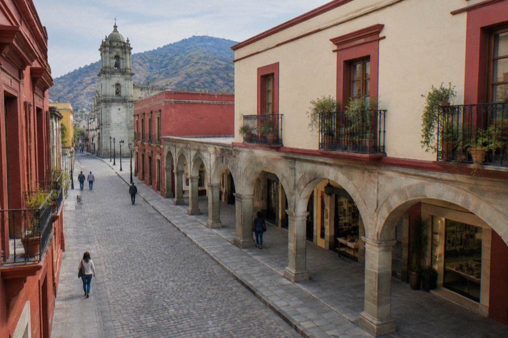
The north end is the densest. The church of Santo Domingo de Guzmán closes the view along the street, and beside it the Museo de las Culturas de Oaxaca occupies the former convent building, entered directly from the Andador. Next to the museum complex lies the Jardín Etnobotánico, a garden visited on guided tours only. That concentration means the last hundred metres of the street hold more sightseeing weight than the rest of the route combined.
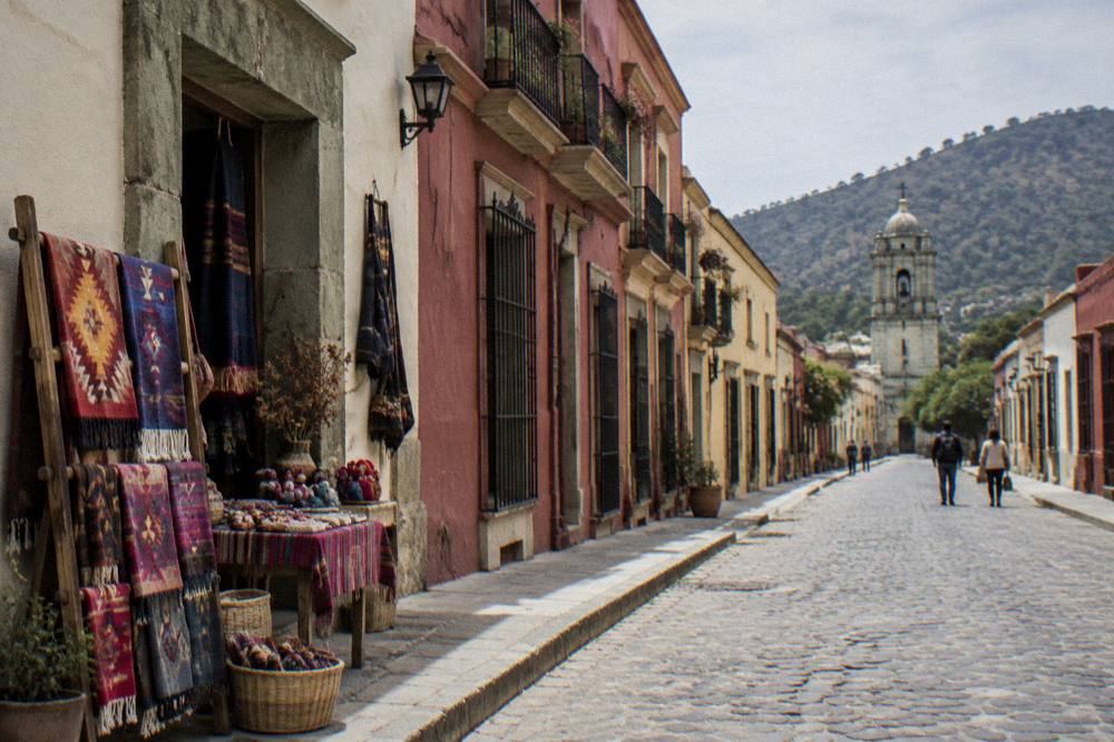
Between the two ends, the street carries galleries, craft jewellers, mezcal shops, cafés and restaurants. It is also the natural route for reaching the Teatro Macedonio Alcalá, which stands on the middle stretch. Nothing along the route requires a ticket except the museum and, for those arriving by tour, the guided garden visits, so the street works equally well as a destination and as a corridor between the Zócalo and Santo Domingo.
What Are The Hours And Prices At Each End Of The Andador?
The Zócalo end of the Andador is a public square open at all times with no entry fee, while the north end carries the two ticketed stops: the Museo de las Culturas de Oaxaca, open Tuesday to Saturday 10:00 to 16:00 and closed Sunday and Monday, charging 105 MXN for Mexican nationals and 210 MXN for foreign visitors, and the Jardín Etnobotánico, visited on free guided tours.
The museum's closing days matter more than any other detail on this street, because a visit planned for a Sunday or Monday finds the museum shut. The Jardín Etnobotánico runs its free guided visits Monday to Friday at 10:30, 11:00, 11:30, 12:00 and 17:00, and on Saturday between 10:30 and 12:00, with large groups and school groups asked to book two weeks ahead, per the state release of 18 August 2025. The garden is otherwise not visited unaccompanied.
| Sight at either end | Days open | Hours | Entry fee (MXN) |
|---|---|---|---|
| Zócalo and Cathedral square | Daily | Public space | Free |
| Museo de las Culturas de Oaxaca | Tuesday to Saturday | 10:00 to 16:00 | 105 nationals / 210 foreigners |
| Jardín Etnobotánico guided tours | Monday to Saturday | Mon-Fri 10:30, 11:00, 11:30, 12:00, 17:00; Sat 10:30 to 12:00 | Free |
| Santo Domingo de Guzmán church | Check on site before visiting | Not stated in the sources used here | Not stated |
The INAH fee category that applies to the museum is the same one used at Monte Albán, Mitla and Yagul, which helps anyone planning a wider itinerary that combines the centre with the archaeological zones. INAH also lists a rate of 730 MXN for visits outside normal hours at its Oaxaca sites, a figure aimed at special access rather than ordinary tickets. Anyone combining the Andador with an archaeology day can read the full site details in the Monte Albán guide, with the ruins about 15 minutes by road from the centre.
When Is The Best Time Of Day To Walk The Andador?
No official source ranks times of day for the Andador, so this page gives the fixed facts instead: Oaxaca City keeps UTC-6 all year with no daylight saving, the dry season runs November to April with under 20 mm of rain per month from November to March, and the rainy season runs May to October with its peak from June to September, so timing a walk is a matter of shade, rain and museum hours rather than published schedules.
What the climate record does support is planning around the fixed opening hours. The museum's 10:00 opening and the garden's morning tour slots put the ticketed sights in the middle of the day, and the street itself is open whenever the visitor chooses to walk it. The monthly normals from the SMN station for Oaxaca, which sits at 1,594 m, give the following picture.
| Month | Mean daily high (C) | Mean nightly low (C) | Rain (mm) |
|---|---|---|---|
| January | 28.9 | 10.3 | 2.4 |
| February | 31.1 | 11.6 | 4.6 |
| March | 33.3 | 13.6 | 17.6 |
| April | 34.9 | 15.8 | 47.3 |
| May | 33.8 | 16.7 | 97.9 |
| June | 30.9 | 16.7 | 188.3 |
| July | 30.1 | 15.9 | 118.6 |
| August | 30.0 | 15.9 | 131.8 |
| September | 29.1 | 16.1 | 163.6 |
| October | 29.3 | 14.5 | 63.1 |
| November | 29.0 | 12.3 | 9.1 |
| December | 28.9 | 11.0 | 9.0 |
The station normals put the annual rainfall total at 853.3 mm, with June recording 188.3 mm on average and January 2.4 mm. April carries an average daily high of 34.9 C and the December to January nights average lows of 11.0 C and 10.3 C. None of this is a recommendation of one month over another; it is the measured baseline the street's visitors walk through.
What Food And Markets Sit Near The Andador?
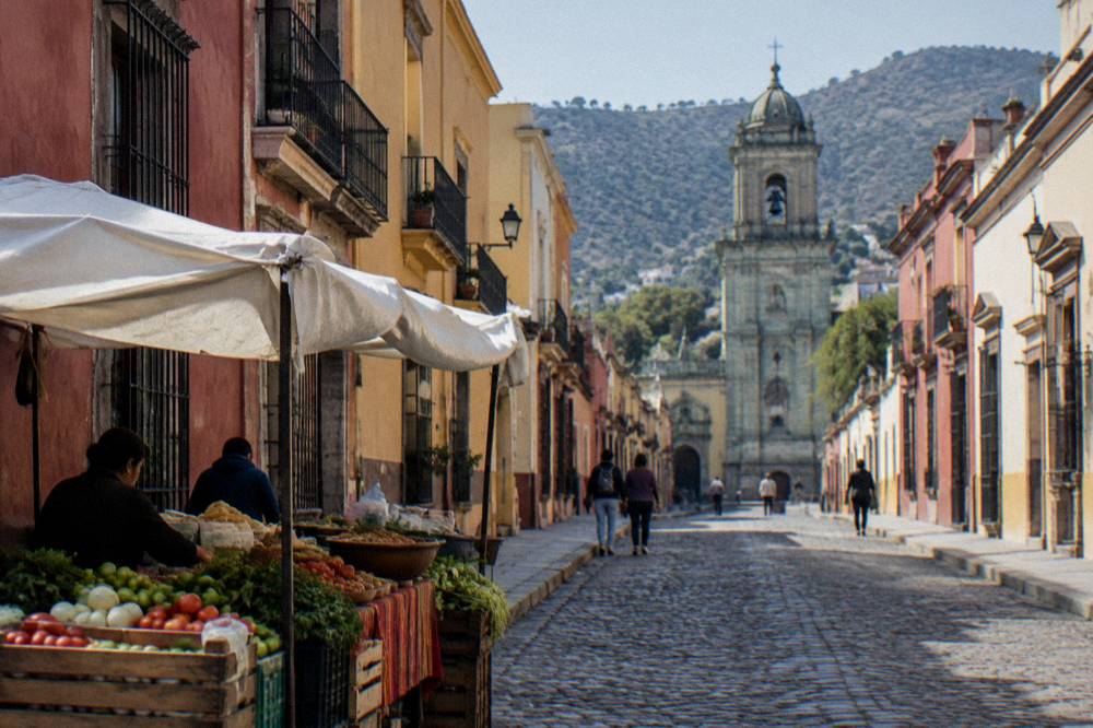
The Andador runs two blocks west of the Mercado Benito Juárez and the Mercado 20 de Noviembre, the two central markets most used by visitors for food, and the street itself carries restaurants and cafés the full length of its route, so a food stop is never more than a couple of blocks off the pedestrian way.
The market pair is the practical answer for anyone eating near the Andador. The Mercado Benito Juárez sits immediately south of the Zócalo end, and the Mercado 20 de Noviembre lies just beyond it; both are covered in their own pages on this site, and neither's opening hours are published in the official sources used here, so check on the day. For what to order once inside, the what to eat in Oaxaca guide and the street food guide cover tlayudas, mole, quesillo and the rest of the city's food vocabulary.
The street's own food offering runs from cafés to full restaurants, with mezcal shops in between. A guided option that pairs the two worlds is the evening street food walk below, which moves through the centre's food stops after dark. The wider set of guides lives on Oaxaca Travel Guide.
How Does The Andador Connect To The Rest Of Oaxaca City?
The Andador's two ends work as the city's orientation points: the Zócalo end links south to the markets and the Basílica de la Soledad, and the Santo Domingo end links north and west to the Barrio de Xochimilco and the Cerro del Fortín, with every major Centro Histórico sight within a short walk of one end or the other.
Working outward from the street, the Basílica de la Soledad stands west of the Zócalo, and the Cerro del Fortín, the hill that hosts the Auditorio Guelaguetza each July, rises northwest of Santo Domingo. The textile collections of the Museo Textil de Oaxaca sit a few blocks east of the Andador, and the IFAB street art legacy spreads through the centre's walls, covered in the street art guide. All of it is walkable from the Andador, which is why the street anchors the hidden gems itinerary as well as the first-day plans.
| Direction from the Andador | Sights within a short walk | Covered on this site by |
|---|---|---|
| South | Zócalo, Cathedral, Mercado Benito Juárez, Mercado 20 de Noviembre | Zócalo and market guides |
| West | Basílica de la Soledad | Basílica guide |
| North | Santo Domingo, Museo de las Culturas, Jardín Etnobotánico | Their own attraction pages |
| Northwest | Cerro del Fortín | Cerro del Fortín guide |
| East | Barrio de Xochimilco, Museo Textil de Oaxaca | Xochimilco area guide |
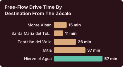
Beyond the centre, the Andador is the standard meeting and departure point for valley day trips, which leave the city for Mitla, Hierve el Agua, the Tule tree and the craft villages. Drive times from the Zócalo are derived figures and real traffic is slower, but they give a fair sense of scale.
| Destination from the Zócalo | Distance (km) | Free-flow drive time |
|---|---|---|
| Monte Albán | 8.7 | About 15 minutes |
| Santa María del Tule | 10.2 | About 11 minutes |
| Teotitlán del Valle | 29.2 | About 26 minutes |
| Mitla | 44.6 | About 37 minutes |
| Hierve el Agua | 67.1 | About 57 minutes |
The crafts villages of the southern valley, including San Martín Tilcajete and Ocotlán, sit on a different axis again, and a guided route covering three towns in one loop is listed below for anyone who wants the workshop visits arranged rather than self-driven.
Is The Andador Macedonio Alcalá Good For Street Art And Murals?
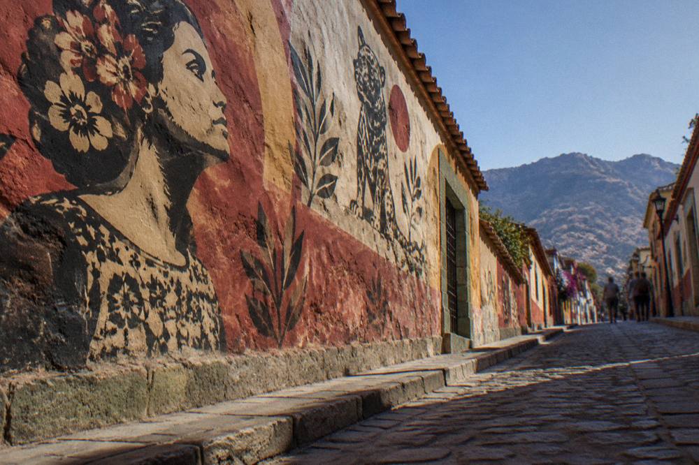
The Andador and the blocks immediately around it, especially Jalatlaco and the streets east of the centre, carry a dense concentration of murals and street art connected to the city's IFAB mural festival legacy, and a guided walk with a working artist covers both the walls and the techniques behind them, with the current price, rating and duration shown on the operator's card.
The IFAB and Oaxaca street art guide on this site maps the mural landscape in detail. What the Andador adds is proximity: the walls of Xochimilco and Jalatlaco sit within walking distance of either end of the street, so an art walk and the pedestrian street combine naturally into one morning or afternoon. Check availability on the operator's booking page for current dates.
What Should A First-Time Visitor Know Before Walking The Andador?
A first walk on the Andador needs three pieces of planning: the museum at the north end is closed Sunday and Monday, the garden is only seen on its free guided tour slots, and the whole route sits at about 1,550 m of altitude in a city with a dry season from November to April and a rainy season from May to October, so shoes for stone streets and a layer for cool nights cover most needs.
The street is flat and pedestrianised, which makes it manageable for visitors of any walking speed, and the Zócalo, the markets and the Basílica all sit level with it. The altitude figure comes from the primary records for the city, and the SMN climate station sits at 1,594 m. Currency on the street is Mexican pesos for local purchases, including the 105 MXN or 210 MXN museum ticket, and the exchange rate floats.
For anyone stretching the day beyond the centre, the valley options in the table above all leave from points within a short walk of the Andador, and the archaeological zones charge the same Category I or Category III rates described on this site's Monte Albán, Mitla and Yagul pages. The Guelaguetza each July puts its main performances on the Cerro del Fortín, within sight of the street's north end, and the 2026 edition charged 1,632 MXN for Palco A, 1,321 MXN for Palco B and nothing for Palcos C and D, figures to hold only as a reference for that past edition.
Common Questions About The Andador Macedonio Alcalá
Is The Andador Macedonio Alcalá Free To Walk?
Yes. The street is a public pedestrian way open at no charge. The only paid stops along it are the Museo de las Culturas de Oaxaca, at 105 MXN for nationals and 210 MXN for foreign visitors, and any paid tours that use the street as a route.
How Long Is The Andador Macedonio Alcalá?
The street runs from the Zócalo to the Plaza of Santo Domingo and takes about ten minutes to walk end to end without stops. With the museum, the garden tour and the shops, visitors commonly spend half a day on and around it.
When Is The Museo De Las Culturas De Oaxaca Open?
The museum is open Tuesday to Saturday, 10:00 to 16:00, and closed Sunday and Monday, per the INAH listing. It sits at the north end of the Andador, entered from the street.
Can You Visit The Jardín Etnobotánico On Your Own?
No. The garden is visited on guided tours only. The free guided visits run Monday to Friday at 10:30, 11:00, 11:30, 12:00 and 17:00, and Saturday between 10:30 and 12:00, with large and school groups booking two weeks ahead.
What Is At Each End Of The Andador?
The Zócalo, the Plaza de la Constitución, with the Cathedral beside it, stands at the south end. The church of Santo Domingo de Guzmán, with the Museo de las Culturas and the Jardín Etnobotánico alongside, stands at the north end.
Is The Andador Close To The Markets In Oaxaca City?
Yes. The Mercado Benito Juárez and the Mercado 20 de Noviembre sit about two blocks south of the Zócalo end of the street, so a market lunch fits easily into a walk between the two ends.