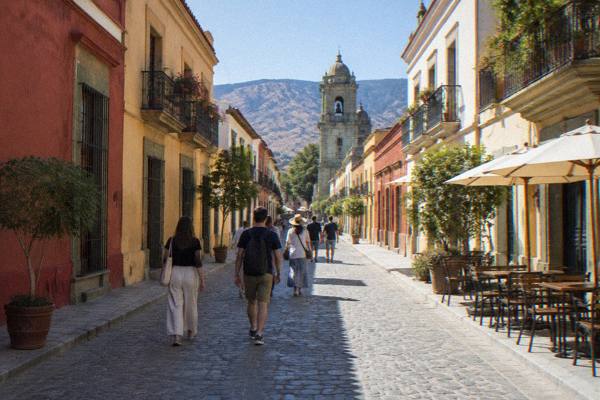
Centro Histórico: The Grid Around The Zócalo
The Centro Histórico of Oaxaca City is a compact colonial grid radiating from the Zócalo, and almost everything in it is reachable on foot. This guide covers what sits where, which hours and entry fees the official pages list, and how the centre connects to the barrios around it.
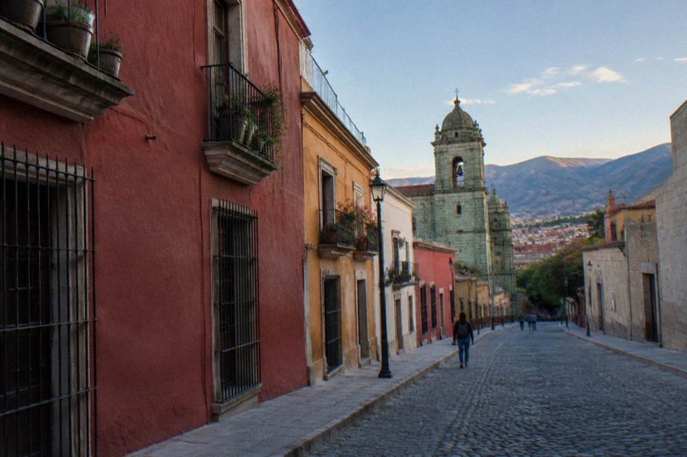
Oaxaca City's Centro Histórico is the UNESCO-listed colonial grid around the Zócalo, covering the Zócalo itself, the Cathedral, the Andador Macedonio Alcalá, Santo Domingo de Guzmán and the streets between. It sits at about 1,550 m in the Valles Centrales, inland and far from any coast. Everything in it is walkable, and the official entry fees and hours that matter most are the Museo de las Culturas and the Jardín Etnobotánico.
The Centro Histórico of Oaxaca City (Oaxaca de Juárez) is the inland highland capital of the state of Oaxaca, sitting at about 1,550 m in the Valles Centrales, and its core is a compact grid of streets laid around the Zócalo, the Plaza de la Constitución. UNESCO inscribed the "Historic Centre of Oaxaca and Archaeological Site of Monte Albán" as property 415, and the city was founded in 1529 as Antequera. Those two facts frame everything below: this is one of Mexico's listed colonial centres, and it is small enough that the whole grid, from the Zócalo to Santo Domingo de Guzmán and the edges of Jalatlaco and Xochimilco, is a walking district rather than a transit one. For the full overview of the city, the Oaxaca Travel Guide homepage collects every guide, itinerary and tour page in one place.
What Is The Centro Histórico Of Oaxaca City?
The Centro Histórico of Oaxaca City is the UNESCO-listed colonial core of the state capital, a street grid centred on the Zócalo and running roughly to Santo Domingo de Guzmán in one direction and the market streets in the other. The city was founded in 1529 as Antequera, and UNESCO property 415 pairs the historic centre with the archaeological site of Monte Albán. It lies at about 1,550 m, inland in the Valles Centrales.
The grid is the practical fact. Streets in the centre run in a regular pattern around the Zócalo, which means orientation is simple: the Zócalo is the reference point, the Andador Macedonio Alcalá runs north from it toward Santo Domingo de Guzmán, and the two big market buildings, Mercado Benito Juárez and Mercado 20 de Noviembre, sit a few blocks south and west. There is no sea, no beach and no river anywhere near this city; the Pacific coast around Puerto Escondido is a far extension, about 165 minutes by the new highway, and belongs to a different set of pages.
The 2025 Sectur indicators recorded 1,324,332 tourist arrivals in the city of Oaxaca across the year, with hotel occupancy at 51.73 percent and an average stay of 2.00 nights. The same source counted 416,675 visitors to Monte Albán in 2025. Those numbers describe a busy but not saturated centre: the grid absorbs its visitors across many small streets rather than one promenade. The population base is modest too, 270,955 in the municipality per the 2020 census, 4,132,148 statewide, so the historic core serves a small resident city plus its visitors rather than a metropolis.
What Can You See Inside The Grid Around The Zócalo?
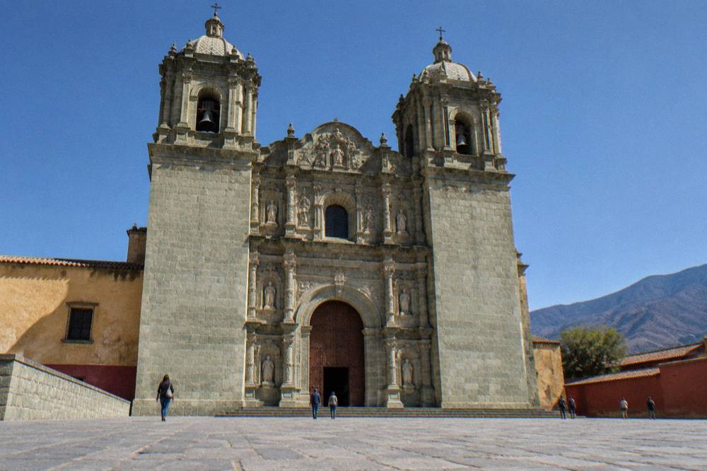
The grid around the Zócalo holds the Zócalo itself, the Cathedral, the Andador Macedonio Alcalá pedestrian street, the Templo and former convent of Santo Domingo de Guzmán, the Museo de las Culturas de Oaxaca, the Jardín Etnobotánico, the Mercado Benito Juárez and Mercado 20 de Noviembre, plus dense streets of restaurants and shops between them. All of these sit within walking distance of each other.
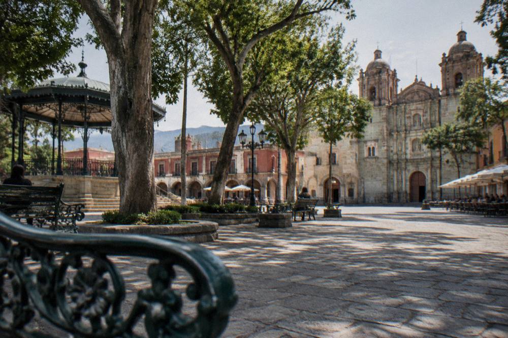
The Zócalo of Oaxaca is the plaza at the centre of the grid, the Plaza de la Constitución, with the Cathedral on its north side. The Cathedral faces the plaza directly. From the Zócalo the Andador Macedonio Alcalá runs north as a pedestrian street, ending at the Santo Domingo de Guzmán church complex, where the Museo de las Culturas de Oaxaca occupies the former convent and the Jardín Etnobotánico sits beside it. That single north-south spine, Zócalo to Santo Domingo, is the axis of the whole centre.
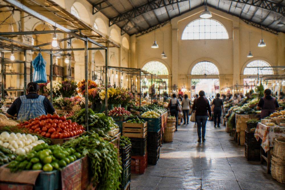
South and west of the Zócalo the commercial grid takes over. Mercado Benito Juárez and Mercado 20 de Noviembre anchor the market streets, and the surrounding blocks carry the restaurants, mezcal rooms and craft shops the city is known for. The streets between the plaza and the markets are where the centre's daily life happens, and they reward aimless walking as much as any listed sight. If one day is all you have, the one-day Oaxaca itinerary follows exactly this spine, and a longer plan such as two days in Oaxaca adds the barrios and a valley day trip.
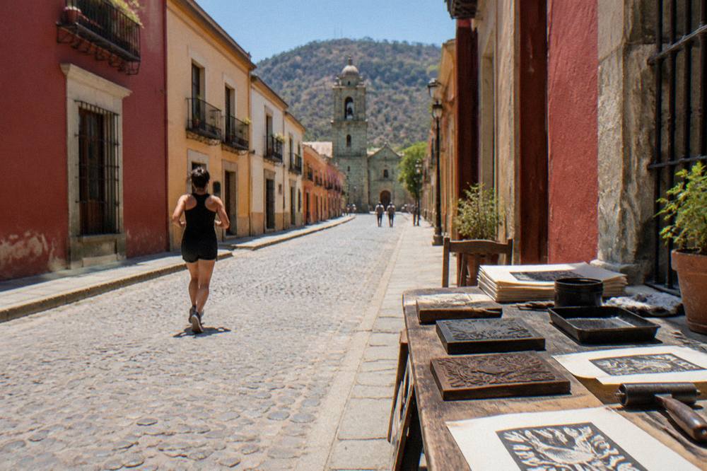
Three tours fit this district well. The Culture, History and Traditions of Oaxaca City walk covers the centre's streets with a local guide, a printmaking session with a local artist puts you at a worktable instead of a gift shop, and a food and markets tour with traditional tastings connects the grid to its market buildings.
Which Hours And Entry Fees Apply In Oaxaca's Historic Centre?
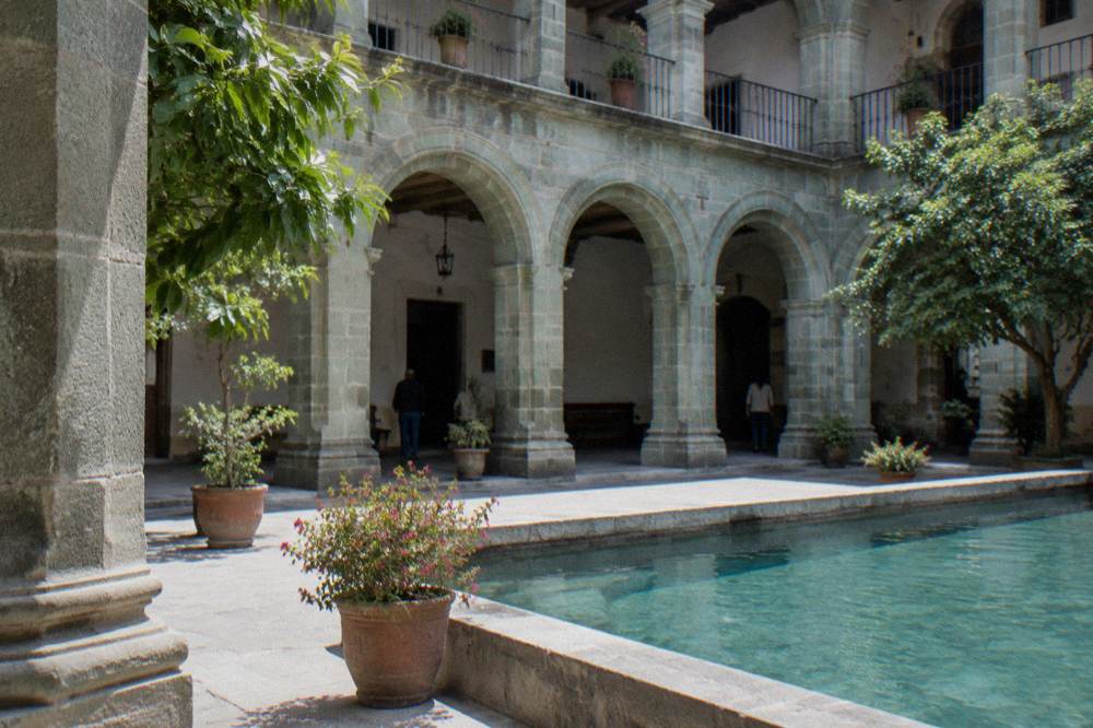
The Museo de las Culturas de Oaxaca, inside the Santo Domingo complex, is open Tuesday to Saturday 10:00 to 16:00 and charges 105 MXN for Mexican nationals and 210 MXN for foreign visitors. The Jardín Etnobotánico runs free guided tours Monday to Friday at 10:30, 11:00, 11:30, 12:00 and 17:00, and Saturday 10:30 to 12:00. These are the two fixed schedules in the grid that shape a visit.
The museum's Tuesday-to-Saturday schedule matters for planning: a Monday or Sunday in the centre means the museum is closed, while the church of Santo Domingo itself and the streets around it are open to walk any day. The Jardín Etnobotánico lists its visits as free, with large and school groups asked to book two weeks ahead. The INAH page for the museum lists the same 105/210 MXN fee category used at Monte Albán, Mitla and Yagul.
| Site in the Centro | Open days | Hours | Entry fee (MXN) |
|---|---|---|---|
| Museo de las Culturas de Oaxaca (Santo Domingo) | Tuesday to Saturday | 10:00 to 16:00 | 105 nationals, 210 foreigners |
| Jardín Etnobotánico (guided visits) | Monday to Saturday | Mon-Fri 10:30, 11:00, 11:30, 12:00, 17:00; Sat 10:30 to 12:00 | Free guided tours |
| Zócalo and Andador Macedonio Alcalá | Daily | Public space | No entry fee |
Two clarifications the official pages settle. First, visits outside normal INAH hours can be arranged at listed INAH zones for 730 MXN, a figure that appears on the INAH pages including the Museo de las Culturas.
A guided walk is the efficient way to absorb the grid's history without researching every facade, and this guide's related pick for this area is the Culture, History and Traditions of Oaxaca City tour, which covers the centre's streets with a professional local guide. You can compare it against the wider Oaxaca walking tour options or Check availability directly on the operator's booking page.
How Walkable Is The Grid Around The Zócalo?
The grid around the Zócalo is fully walkable: the spine from the Zócalo to Santo Domingo is a few flat blocks, the market streets sit a short walk south and west, and no transport is needed inside the centre itself. Oaxaca City sits at about 1,550 m, so the walk is easy going for anyone used to altitude and steady for everyone else. The pedestrian Andador Macedonio Alcalá carries much of the traffic on foot.
Walkability is the centre's defining feature. The grid pattern means almost no street in the core is more than a few blocks from the Zócalo, and the main routes are pedestrian or slow-traffic. The question of whether the wider city deserves the same answer has its own page, is Oaxaca walkable and how to get around, and the answer for the barrios beyond the grid, Jalatlaco and Xochimilco in particular, is still yes on foot with slightly longer walks. For trips that leave the city entirely, the best way to get around Oaxaca compares the options in one place.
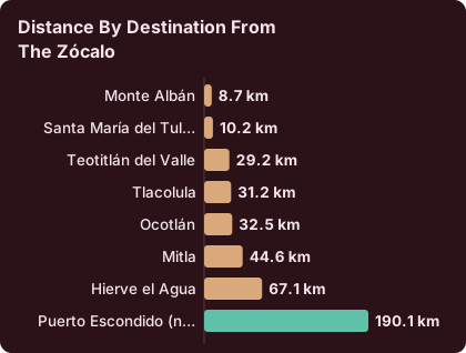
| Destination from the Zócalo | Distance | Free-flow drive time |
|---|---|---|
| Monte Albán | 8.7 km | about 15 minutes |
| Santa María del Tule | 10.2 km | about 11 minutes |
| Teotitlán del Valle | 29.2 km | about 26 minutes |
| Tlacolula | 31.2 km | about 25 minutes |
| Ocotlán | 32.5 km | about 37 minutes |
| Mitla | 44.6 km | about 37 minutes |
| Hierve el Agua | 67.1 km | about 57 minutes |
| Puerto Escondido (new highway) | 190.1 km | about 165 minutes |
Real traffic and mountain roads make these slower in practice, and the coastal row is a far extension, not a day trip from the grid. For the valley destinations, the colectivos and mototaxis guide covers how shared transport works. Every valley town on the table also pairs with a guided option, from a Monte Albán tour to a mezcal tour out toward Santiago Matatlán, so a week in the city can alternate walking days inside the grid with driven days beyond it.
What Does A Day In The Centro Histórico Look Like?
A day in the Centro Histórico runs along one axis: start at the Zócalo and the Cathedral, walk the Andador Macedonio Alcalá north to Santo Domingo de Guzmán, take a Jardín Etnobotánico guided visit at one of the listed times, spend the afternoon in the museum if it is Tuesday to Saturday, then finish among the market streets and dinner streets south and west of the plaza. Nothing on that route needs a vehicle.
Timing the fixed pieces is the only real planning. The botanical garden's weekday visit times are 10:30, 11:00, 11:30, 12:00 and 17:00, so a morning garden visit followed by the museum, open 10:00 to 16:00 Tuesday to Saturday, fills the middle of the day. A second day in the centre can wander outward: the hidden corners of the grid and its edges have their own page of Oaxaca hidden gems, and the barrios described below extend the same walk by twenty minutes in either direction.
Eating is the centre's other half. The market buildings and the streets around them carry the dishes the city is known for, mole, tlayudas, quesillo and chocolate, and the Oaxaca food tour guide pages lay out the options district by district. For a deeper historical route through the same blocks, a guided culture and history walk is the related pick this page carries, and the printmaking workshop adds a hands-on afternoon inside the grid without a vehicle.
Where Does The Grid End And The Barrios Begin?
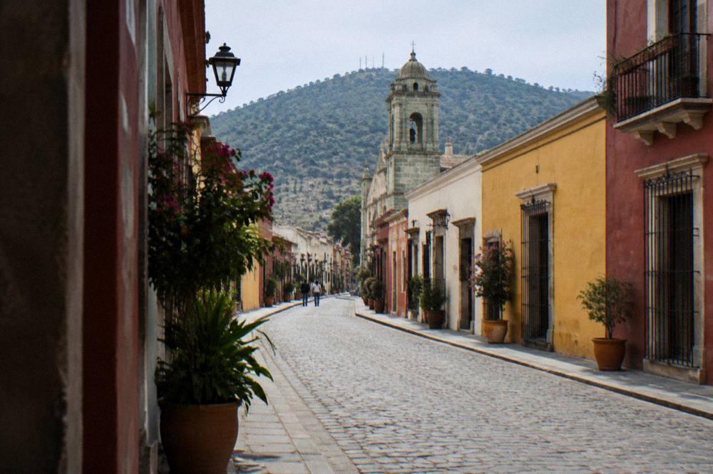
The Centro Histórico grid blends into named barrios at its edges: Jalatlaco lies to the north-east, Xochimilco to the north, Reforma beyond it, and the market streets and Barrio de la Merced area run south of the centre toward Santa Lucía del Camino and Xoxocotlán further out. Each has its own area page, and all are walkable extensions of the Zócalo rather than separate trips.
The borders are soft. Jalatlaco and Xochimilco sit close enough that a walk out of the grid and back takes an easy loop, and the Jalatlaco guide and the Xochimilco guide describe them street by street. The full set, including Reforma and the streets south of the centre around the mercados, is collected in the Oaxaca neighbourhoods overview, and the south-of-centro and mercados area page covers the transition zone where the grid dissolves into market streets.
Choosing a base inside or beside the grid is a lodging question rather than a transport one, and where to stay in Oaxaca breaks the centre against the barrios. At night the centre stays the city's walking core, and the question of safety after dark has a dedicated answer at is it safe to walk around Oaxaca at night.
| Area | Direction from the Zócalo | Character |
|---|---|---|
| Centro Histórico grid | The centre | Colonial grid, cathedral, Santo Domingo, markets |
| Jalatlaco | North-east | Barrio of painted streets north-east of the grid |
| Xochimilco | North | Barrio with its own aqueduct-side streets |
| Reforma | North of Xochimilco | Residential extension |
| South of centre and mercados | South | Market streets and the Barrio de la Merced area |
| Santa Lucía del Camino and Xoxocotlán | Further out | Outer areas toward the airport |
When Is The Weather Right For Walking Oaxaca's Centro Histórico?
The dry season in Oaxaca City runs November to April and the rainy season May to October, with June averaging 188.3 mm of rain, September 163.6 mm and January just 2.4 mm, per the SMN station normals for 1991-2020. April's average daily high is 34.9 C, while December and January average lows of 11.0 and 10.3 C. Any month is walkable in the grid; rain shapes the afternoons, not the itinerary.
The full monthly picture from the station normals:
| Month | Mean high C | Mean low C | Rain mm |
|---|---|---|---|
| Jan | 28.9 | 10.3 | 2.4 |
| Feb | 31.1 | 11.6 | 4.6 |
| Mar | 33.3 | 13.6 | 17.6 |
| Apr | 34.9 | 15.8 | 47.3 |
| May | 33.8 | 16.7 | 97.9 |
| Jun | 30.9 | 16.7 | 188.3 |
| Jul | 30.1 | 15.9 | 118.6 |
| Aug | 30.0 | 15.9 | 131.8 |
| Sep | 29.1 | 16.1 | 163.6 |
| Oct | 29.3 | 14.5 | 63.1 |
| Nov | 29.0 | 12.3 | 9.1 |
| Dec | 28.9 | 11.0 | 9.0 |
Daytime highs stay in a narrow band across the year, roughly 29 to 35 C, so the grid is a warm walk in any month; the bigger differences are the nights, which drop to about 10 C in December and January, and the rain, which concentrates between June and September. The rain pattern is also strongly seasonal in frequency, not just volume: the station normals count 1.4 days with rain in January against 21.4 in September, so a rainy-season visit means planning museum and market hours around wet afternoons rather than abandoning the walk. Oaxaca keeps UTC-6 all year, since Mexico abolished seasonal clock changes with the law published on 28 October 2022, so there is no daylight saving shift to plan around.
How Does The Centro Histórico Connect To Oaxaca's Festival Calendar?
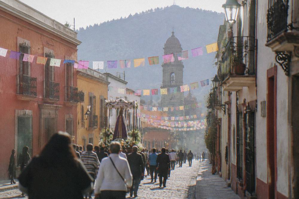
The Centro Histórico is the stage for the city's three big calendar moments: Día de Muertos centres on the traditional dates of 31 October to 2 November, Guelaguetza fills two July Mondays on the Cerro del Fortín, and Noche de Rábanos falls on 23 December. All three pull their processions, decorations and crowds through the grid around the Zócalo.
Guelaguetza, in its standing pattern, is two Mondays (Lunes del Cerro) in July at the Auditorio Guelaguetza on the Cerro del Fortín, with the 2026 edition held on 20 and 27 July at 10:00 and 17:00, Palco A at 1,632 MXN and Palco B at 1,321 MXN, and the Palcos C and D free. That edition is past and the 2027 dates are not announced, but the pattern holds: July fills the centre with visitors moving between the grid and the hill. Día de Muertos keeps its traditional core on 31 October, 1 and 2 November, with cemeteries open at night in Xoxocotlán and comparsas moving through barrio streets including Jalatlaco; the detailed 2026 programme is not announced, so plan against the traditional dates rather than a published schedule. Noche de Rábanos holds to 23 December as its traditional date, with the 2026 edition likewise not yet announced.
What this means for a visit to the grid is simple: during these windows the centre is at its fullest, lodging tightens, and the walks described above gain processions and decorations they do not have in an ordinary week. Outside them, the same streets run at the pace the rest of this page describes.
What Should You Know Before Walking The Grid?
Bring pesos for the INAH museum ticket and market food, plan the Museo de las Culturas for Tuesday to Saturday, and treat the Jardín Etnobotánico's listed visit times as fixed appointments.
A few practicalities round out the plan. The INAH ticket prices in this guide are pesos, not converted dollars, and they apply to the museum inside the Santo Domingo complex; the churches, plazas and streets of the grid are public space with no entry fee. The botanical garden's tours are listed as free, which makes them the best-value fixed appointment in the centre if you arrive at one of the stated times. Beyond the grid, the valley table above governs how far each destination sits, and the barrios at the edges need no planning at all, only an extra half hour of walking.
The calendar also moves through the centre. Beyond the grid, the full city picture and every bookable option live on the things to do in Oaxaca page, and valley extensions such as a Monte Albán tour or a mezcal tasting pair naturally with days spent walking the centre. The combination this guide would sketch for a first visit: two days inside the grid and its barrios, one day at Monte Albán, one day down the Tlacolula Valley, and a food or history walk early in the stay to fix the geography.
Common Questions About The Centro Histórico Of Oaxaca
Is The Centro Histórico Of Oaxaca Walkable?
Yes. The grid runs a few blocks in every direction from the Zócalo, the Andador Macedonio Alcalá is pedestrianised, and the market streets, the Cathedral and the Santo Domingo complex are all within an easy walk of the plaza. No transport is needed inside the centre.
What Are The Entry Fees In Oaxaca's Centro Histórico?
The Museo de las Culturas de Oaxaca charges 105 MXN for Mexican nationals and 210 MXN for foreign visitors, the same INAH Category I rate as Monte Albán. The Jardín Etnobotánico's guided visits are free. The Zócalo, the Andador and the streets themselves are public space.
When Is The Museo De Las Culturas De Oaxaca Open?
Tuesday to Saturday, 10:00 to 16:00. It is closed Sunday and Monday, so plan museum days accordingly and use the start of the week for the churches, streets and markets instead.
How Do I Visit The Jardín Etnobotánico?
Free guided tours run Monday to Friday at 10:30, 11:00, 11:30, 12:00 and 17:00, and Saturday from 10:30 to 12:00. Large and school groups are asked to reserve two weeks ahead.
Which Barrios Sit Next To The Centro Histórico?
Jalatlaco and Xochimilco border the grid on the north-east and north, Reforma lies beyond Xochimilco, and the market streets extend south of the centre. All are walking extensions of the Zócalo rather than separate journeys.
What Is The Best Time Of Year To Walk The Grid Around The Zócalo?
The dry season runs November to April, with January averaging just 2.4 mm of rain. From June to September the averages climb, with June at 188.3 mm. Daytime highs sit between about 29 and 35 C year-round, so the walk itself is warm in every month.
How Far Is Monte Albán From The Centro Histórico?
The drive from the Zócalo to Monte Albán is 8.7 km, about 15 minutes in free-flow conditions, and real traffic on the mountain access road makes it slower. Many visitors pair a morning at the site with an afternoon back inside the grid.
The Centro Histórico of Oaxaca City rewards exactly the kind of slow, repeated walking its grid was built for: one plaza, one spine, two fixed museum schedules to plan around, and barrios at every edge waiting for the next loop.