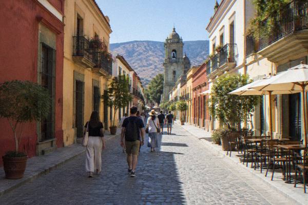
Zócalo De Oaxaca: The Plaza De La Constitución
The Zócalo de Oaxaca, formally the Plaza de la Constitución, is the main square of Oaxaca City, the inland highland capital of the state of Oaxaca in Mexico, sitting at about 1,550 m in the Valles Centrales.
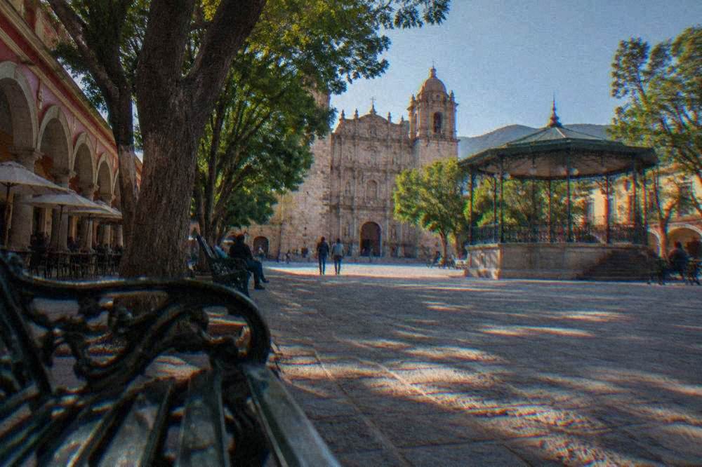
The Zócalo de Oaxaca (Plaza de la Constitución) is the open main square of Oaxaca City's Centro Histórico, a UNESCO World Heritage property together with Monte Albán, ringed by the cathedral, the Palacio de Gobierno and arcaded buildings, and it is free to walk through at any hour.
The Zócalo de Oaxaca, formally the Plaza de la Constitución, is the main square of Oaxaca City (Oaxaca de Juárez), the capital of the state of Oaxaca in Mexico and an inland highland city at about 1,550 m in the Valles Centrales. The square sits inside the Historic Centre of Oaxaca, inscribed on the UNESCO World Heritage List together with the Archaeological Site of Monte Albán as property 415 under the name "Historic Centre of Oaxaca and Archaeological Site of Monte Albán". Oaxaca de Juárez was founded in 1529 as Antequera, and the grid of the centre still reads as a colonial plan in which the plaza is the anchor: the Oaxaca Cathedral on one side, the Palacio de Gobierno and arcaded buildings on the others, and the pedestrian Andador Macedonio Alcalá climbing north from the square toward Santo Domingo de Guzmán. This page sets out what the plaza is, what sits around it, how it changes through the year, and what is worth booking within a few blocks of it.
What Is The Zócalo De Oaxaca?
The Zócalo de Oaxaca is the Plaza de la Constitución, the principal public square of Oaxaca City in the state of Oaxaca, an open, tree-planted plaza at the centre of the Centro Histórico, inscribed as part of the UNESCO property "Historic Centre of Oaxaca and Archaeological Site of Monte Albán" (property 415), and it costs nothing to enter at any hour.
The name "Zócalo" is the everyday Mexican term for a main square, and the formal name, Plaza de la Constitución, is the one on the maps. The square is the reference point from which the whole of this guide measures distance: the coordinates for the plaza are 17.0605953, -96.7253435, and every drive time quoted on this site, from Monte Albán at about 15 minutes to Hierve el Agua at about 57, starts from these coordinates. The municipality of Oaxaca de Juárez counted 270,955 inhabitants at the 2020 census, and the state 4,132,148, so the plaza serves a capital city of modest size by Mexican standards.
The square is also the city's default stage. Official state releases describe temporary decorative installations being mounted on the Zócalo for Día de Muertos, with a 2026 state procurement notice reporting structures mounted between 25 and 28 October 2026 and dismantled after 6 November 2026, and no street closures attached to the works. The 2026 festival programme itself has not been announced, so treat those dates preparations rather than a published schedule, and confirm locally before planning a trip around them. The traditional dates of the festival centre on 31 October to 2 November.
Where Is The Zócalo In Oaxaca City And How Do You Reach It?
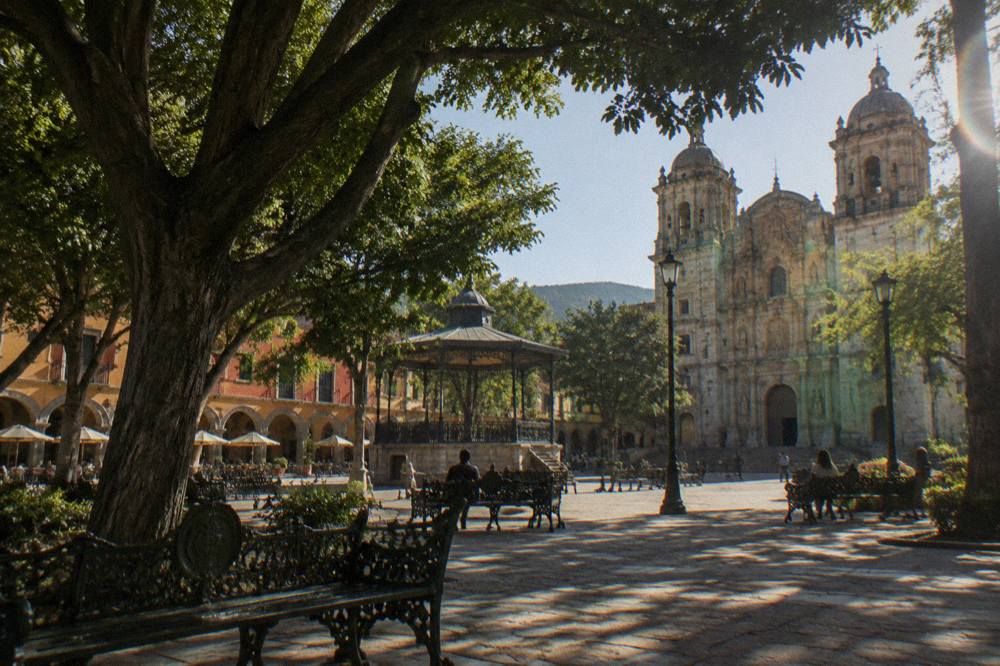
The Zócalo sits at the heart of the Centro Histórico of Oaxaca City, at about 1,550 m of altitude, roughly nine kilometres by road from the Monte Albán archaeological zone and a short walk from every central sight, with the Andador Macedonio Alcalá pedestrian street running north from the square to the Santo Domingo complex.
The plaza is the natural orientation point for the whole city. North of the square, the Andador Macedonio Alcalá is the pedestrian spine that leads to Santo Domingo de Guzmán and the Museo de las Culturas de Oaxaca, which is open Tuesday to Saturday only, from 10:00 to 16:00, with admission at 105 MXN for Mexican nationals and 210 MXN for foreign visitors. South and east of the square lie the market quarter around the Mercado 20 de Noviembre and the Mercado Benito Juárez, and the neighbourhoods of Xochimilco and Jalatlaco beyond them. The whole of this core is covered in the Centro Histórico area guide.
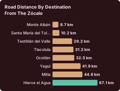
For scale, the table below lists road distances and free-flow drive times from the Zócalo to the main destinations of the Valles Centrales, computed on OSM roads. Real traffic and mountain roads make every journey slower than the free-flow figure, so read these as floors, not promises.
| Destination from the Zócalo | Road distance | Free-flow drive time |
|---|---|---|
| Monte Albán | 8.7 km | about 15 minutes |
| Santa María del Tule | 10.2 km | about 11 minutes |
| Teotitlán del Valle | 29.2 km | about 26 minutes |
| Tlacolula | 31.2 km | about 25 minutes |
| Ocotlán | 32.5 km | about 37 minutes |
| Yagul | 41.9 km | about 38 minutes |
| Mitla | 44.6 km | about 37 minutes |
| Hierve el Agua | 67.1 km | about 57 minutes |
Oaxaca City keeps a single time zone, UTC-6, all year: Mexico abolished seasonal clock changes in a law published on 28 October 2022, so the plaza never shifts between standard and daylight time.
What Sits Around The Zócalo De Oaxaca?
Within one block of the Zócalo stand the Cathedral of Oaxaca on the north side, the Palacio de Gobierno, and the portals and arcades that house cafes and shops, while a five-minute walk north along the Andador Macedonio Alcalá reaches Santo Domingo de Guzmán, the Jardín Etnobotánico and the Museo de las Culturas de Oaxaca.
The cathedral is treated in full on its own page, as is the Basílica de la Soledad a few blocks west, and the Santo Domingo church. Two cultural institutions sit within an easy walk up the andador. The Museo de las Culturas de Oaxaca, inside the former convent of Santo Domingo, charges the Category I INAH rates: 105 MXN for nationals, 210 MXN for foreign visitors, Tuesday to Saturday from 10:00 to 16:00. The Jardín Etnobotánico next door runs free guided visits, Monday to Friday at 10:30, 11:00, 11:30, 12:00 and 17:00, and Saturdays from 10:30 to 12:00, with large groups and school groups asked to book two weeks ahead.
Textile lovers can add the Museo Textil de Oaxaca, also in the centre. The table below pulls the INAH-run sites of the centre and valley into one view, with the two fee categories the INAH pages actually list: Category I at 105 MXN for nationals and 210 MXN for foreigners, Category III at 80 and 145. Note the day-closure column, since two of these sites do not open every day.
| Site | Hours | Closed | Fee nationals / foreigners (MXN) |
|---|---|---|---|
| Museo de las Culturas de Oaxaca | Tue to Sat 10:00-16:00 | Sunday and Monday | 105 / 210 |
| Monte Albán | Mon to Sun 08:00-17:00, last access 16:00 | no closed day listed | 105 / 210 |
| Mitla | Mon to Sun 08:00-17:00, last access 16:30 | no closed day listed | 105 / 210 |
| Yagul | Mon to Sun 08:00-17:00, last access 16:00 | no closed day listed | 105 / 210 |
| Dainzú | Mon to Sun 08:00-17:00, last access 16:30 | no closed day listed | 80 / 145 |
| Lambityeco | Mon to Sun 08:00-17:00, last access 16:30 | no closed day listed | 80 / 145 |
| Zaachila | Thu to Sun 10:00-16:00 | Monday to Wednesday | 80 / 145 |
| Atzompa | Mon to Sun 08:00-16:00, last access 15:00 | no closed day listed | hours only on the INAH page |
The INAH pages also list a flat 730 MXN rate for visits outside normal opening hours at Yagul, Lambityeco, Atzompa and the Museo de las Culturas, for anyone with a reason to arrange one.
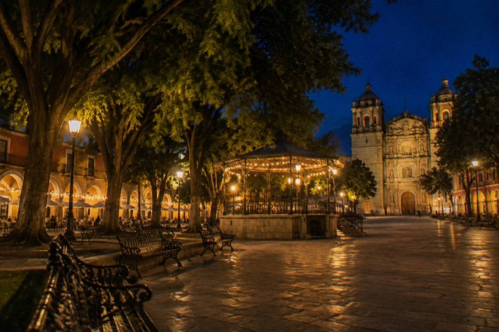
Is The Zócalo De Oaxaca Free To Visit And When Is It Open?
The Zócalo is a public square with no gate, no ticket and no opening hours: it is free and physically accessible at any hour of any day, and the things that do charge around it, the cathedral, the museums and the markets, each keep their own published hours, several of which close one or more days per week.
This is the practical difference between the plaza and its surroundings. The square itself asks nothing of a visitor. The Museo de las Culturas de Oaxaca is closed Sunday and Monday. The Jardín Etnobotánico can only be visited on its guided schedule, which ends by early afternoon on Saturdays and does not run at all on Sundays. Zaachila, if a valley itinerary takes in the Thursday market town, opens Thursday to Sunday only, 10:00 to 16:00. Anyone planning a single dense day around the plaza should sequence the timed visits first, morning for the Jardín Etnobotánico, afternoon for the Museo de las Culturas, and let the square absorb whatever time is left.
Weather rarely decides the question. The SMN station normals for Oaxaca show January averaging a 28.9 C mean daily high and a 10.3 C mean nightly low, and July averaging 30.1 C by day and 15.9 C by night, so the square is walkable year-round and the practical constraint is rain, not heat. June averages 188.3 mm of rain across 19.9 days with rain; January averages 2.4 mm across 1.4 days. The full monthly picture is in the climate section below.
How Does The Zócalo De Oaxaca Change Through The Year?
The Zócalo is decorated and busiest around three fixed points of the Oaxaca calendar, the Guelaguetza performances on two Mondays in July at the Auditorio Guelaguetza on the Cerro del Fortín, Día de Muertos around 31 October to 2 November, and the Noche de Rábanos on 23 December, each of which brings city-centre events reported in official state releases.
The Guelaguetza is the largest of them. The 2026 edition held its Lunes del Cerro and Octava performances on 20 and 27 July 2026, at 10:00 and 17:00, at the Auditorio Guelaguetza on the Cerro del Fortín, with paid seats at 1,632 MXN in Palco A and 1,321 MXN in Palco B plus fees, and free entry in Palcos C and D; tickets were sold exclusively through Superboletos with a limit of two per account, and the A and B sections sold out quickly. The 2027 dates have not been announced, so treat July as the standing pattern rather than a promise. The surrounding programme, billed as "Julio, mes de la Guelaguetza", carried more than 140 activities in 2026, including Calendas on 18 and 25 July and Convites on 1, 10 and 11 July, processions that move through the streets around the Zócalo. The Guelaguetza guide covers the pattern in depth, and the Cerro del Fortín page covers the hill itself.
Día de Muertos centres on the traditional dates of 31 October to 2 November. A state release describes the 2025 programme as running 25 October to 4 November with more than 140 activities, and that edition, not a 2026 schedule, is the published record; the 2026 programme had not been announced. The Día de Muertos guide explains the standing customs. Noche de Rábanos keeps its traditional date of 23 December; the 128th edition was held in December 2025, and no 2026 details had been announced, as the Noche de Rábanos page and the answer on its timing set out.
| Event | Standing pattern | Most recent published edition | 2026 or 2027 status |
|---|---|---|---|
| Guelaguetza | Two Mondays in July, Auditorio Guelaguetza | 20 and 27 July 2026, two shows each day | 2027 not announced |
| Feria del Mezcal | July, during Guelaguetza month | 17 to 28 July 2026 at the CCCO, about 80 MXN entry | 2027 not announced |
| Día de Muertos | Centres on 31 October to 2 November | 2025 programme 25 Oct to 4 Nov, 140+ activities | 2026 programme not announced |
| Noche de Rábanos | 23 December | 128th edition, December 2025 | 2026 not announced |
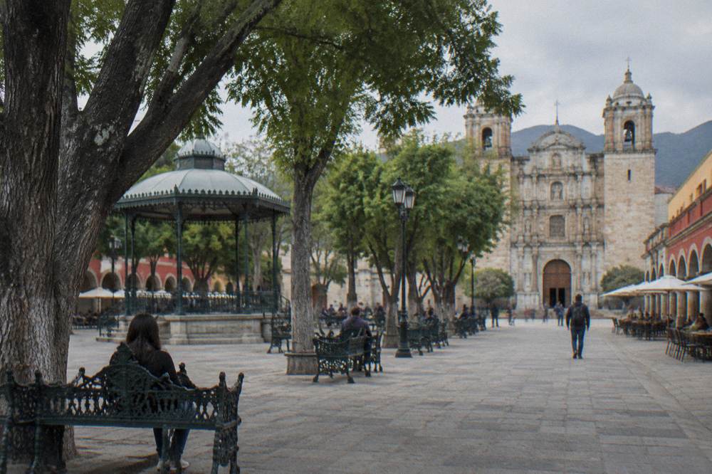
What Is The Weather Like Around The Zócalo De Oaxaca By Month?
The SMN station normals for Oaxaca City show a dry season from November to April with monthly rain below 20 mm from November to March, and a rainy season from May to October peaking between June and September, with June at 188.3 mm the highest monthly figure in the table and January at 2.4 mm the lowest, on an annual total of 853.3 mm.
The normals below are the 1991-2020 values for SMN station 20079 in Oaxaca City, and they are the only climate figures this site prints. April carries the highest mean daily high at 34.9 C and January the lowest mean nightly low at 10.3 C. The table is the answer to the month-by-month question, and it applies as much to a morning on the plaza as to a day trip up the valley. The wider set of guides lives on Oaxaca Travel Guide.
| Month | Mean daily high (C) | Mean nightly low (C) | Rain (mm) | Days with rain |
|---|---|---|---|---|
| Jan | 28.9 | 10.3 | 2.4 | 1.4 |
| Feb | 31.1 | 11.6 | 4.6 | 1.1 |
| Mar | 33.3 | 13.6 | 17.6 | 4.1 |
| Apr | 34.9 | 15.8 | 47.3 | 7.6 |
| May | 33.8 | 16.7 | 97.9 | 13.7 |
| Jun | 30.9 | 16.7 | 188.3 | 19.9 |
| Jul | 30.1 | 15.9 | 118.6 | 20.4 |
| Aug | 30.0 | 15.9 | 131.8 | 20.5 |
| Sep | 29.1 | 16.1 | 163.6 | 21.4 |
| Oct | 29.3 | 14.5 | 63.1 | 12.0 |
| Nov | 29.0 | 12.3 | 9.1 | 3.5 |
| Dec | 28.9 | 11.0 | 9.0 | 2.4 |
In the rainy season the pattern is afternoon rain rather than all-day rain in most of the table's months, but the site does not forecast; the figures say only what averaged over thirty years. September averages 163.6 mm of rain and 21.4 days with rain, the highest day count in the table, and November drops to 9.1 mm. What this means for the plaza is simple: the square has shade trees but little shelter, so in the wet months the mornings are the safer bet.
What Food And Markets Sit Within Walk Of The Zócalo De Oaxaca?
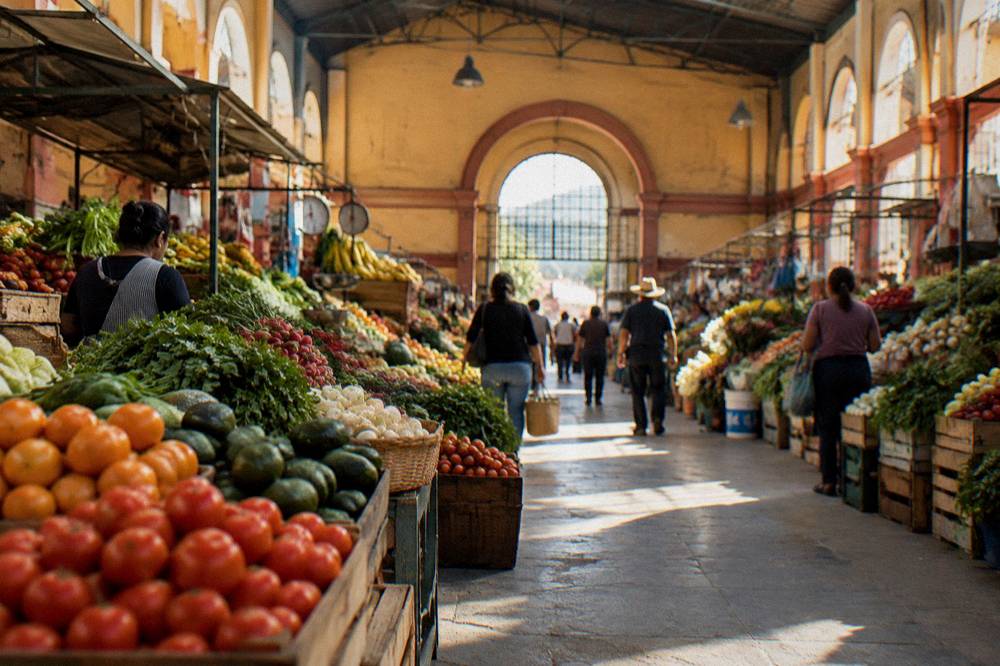
The market quarter begins two blocks south of the Zócalo, where the Mercado Benito Juárez and the Mercado 20 de Noviembre sit facing each other, the first a historic central market inaugurated in 1893 according to the state's own history of its markets and the second the city's key food market with Saturday tianguis stalls, both within a five-minute walk of the square.
The state government's own communications describe the Mercado 20 de Noviembre as founded in 1893 and the Mercado Benito Juárez as a historic central market near the Zócalo, and both descriptions come from official pages. Neither market's current opening hours are published on an official source this site could verify; plan for daytime visits and check locally. The food of the city, mole, tlayudas, tejate, chapulines and quesillo, is covered across the food pages of this site, and the markets are where much of it is assembled.
One 2026 change reported in a state release does affect access to the market quarter: Calle 20 de Noviembre underwent a full vehicular closure of roughly two months from February 2026 under the "Oaxaca Camina 2026" works, for sidewalk widening and accessibility work, after which the street was reduced to one lane. The market itself was not closed by the works. Beyond the centre, the valley's weekly markets, Tlacolula on Sunday, Ocotlán on Friday, Etla on Wednesday, Zaachila on Thursday, follow their standing patterns; the Ocotlán and Friday market day trip is the closest to the city at about 37 minutes by road from the Zócalo.
| Central food stop | Distance from the Zócalo | What the official record states |
|---|---|---|
| Mercado Benito Juárez | adjacent, south side of the centre | Historic central market near the Zócalo |
| Mercado 20 de Noviembre | adjacent, south side of the centre | Founded 1893, key food market, Saturday tianguis |
| Andador Macedonio Alcalá | starts at the square | Pedestrian street running north to Santo Domingo |
| Mercado de Abastos | west of the centre, beyond the ring | Large wholesale market serving the capital since 1978 |
What Art And Craft Experiences Start Near The Zócalo De Oaxaca?
The most direct art experiences near the Zócalo are a street art walking tour led by a working artist and a printmaking workshop with a local artist, both city-based products that begin from central meeting points minutes from the square, alongside craft routes that reach San Martín Tilcajete, Jalieza and Ocotlán in the Valles Centrales.
The street art of Oaxaca City is concentrated in the neighbourhoods around the centre, above all Jalatlaco and Xochimilco, and the street art page maps the standing murals. A walking tour led by the artist who paints the walls reframes them as work rather than decoration, and it pairs naturally with the Jalatlaco guide. The Street Art Tour With An Artist in Oaxaca runs from a central meeting point; the tour's own listing carries the current price, meeting details and availability, and Check availability on the operator's booking page before committing a day.
For hands-on making, an art printing workshop with a local artist covers relief printing technique in a studio session, and the tour list's craft routes run outward to the alebrije painters of San Martín Tilcajete, the weavers of Teotitlán del Valle and the black pottery of San Bartolo Coyotepec. The Teotitlán del Valle guide and the alebrijes page describe the standing craft villages. The state's reporting notes that Teotitlán's weaving workshops generally operate Tuesday to Sunday, with many closed on Mondays, and that mornings are recommended for natural-light demonstrations.
How Does The Zócalo De Oaxaca Fit Into A First Visit To Oaxaca?
A first visit anchored on the Zócalo works outward in rings: the cathedral, the portals and the andador on the first morning, the markets and the Basílica de la Soledad on the first afternoon, Monte Albán at about 15 minutes by road on the second morning, and the Tlacolula Valley chain of Tule, Mitla and Hierve el Agua on a full third day.
The site's itinerary pages do this in detail, from one day through three days to a week, and the first-time visitor guide sets out the sequencing logic. The essential arithmetic is that the valley's headline sites are 37 to 57 minutes from the plaza by road, close enough to chain, far enough that each deserves a half day. The Monte Albán page, the Mitla page and the Hierve el Agua page carry the site-by-site detail, and the Santa María del Tule tree sits at about 11 minutes, the easiest excursion of all.
Two practical rules govern the sequencing. First, respect the closed days: the Museo de las Culturas on Sunday and Monday, Zaachila on Monday to Wednesday, and the Jardín Etnobotánico on Sunday entirely. Second, respect the rain: in June through September, with 19.9 to 21.4 days with rain per month in the table above, put the open-air plaza and the valley sites in the morning and keep museums for the afternoon. For a longer stay, the Sierra Norte village of Capulalpam de Méndez sits about 142 minutes from the square by road, and the ex-convent of Cuilapan de Guerrero is a short stop on the valley route.
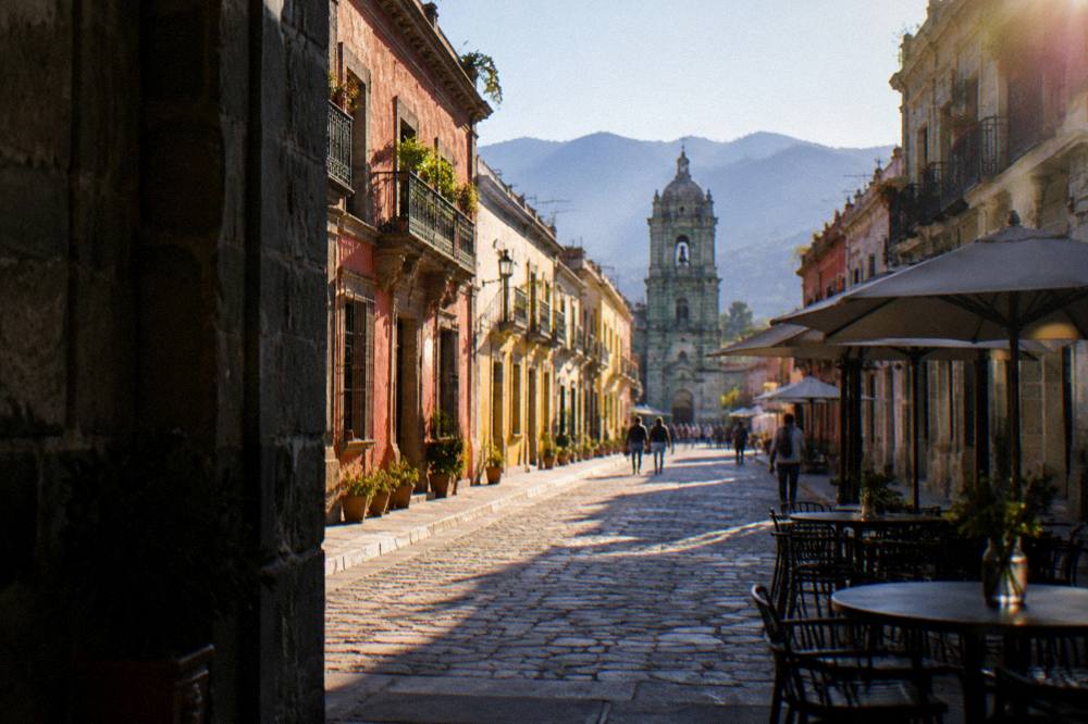
Is The Area Around The Zócalo De Oaxaca Safe For Visitors?
The published advisories treat Oaxaca City as ordinary for Mexico: the UK FCDO advises against all but essential travel to parts of Mexico and does not name Oaxaca on its main page, Canada advises a high degree of caution in Mexico overall with regional advisories and does not list Oaxaca as an avoid-travel area, and the US State Department lists Oaxaca state at Level 2, exercise increased caution, with no restrictions for its staff in Oaxaca City, Monte Albán, Puerto Escondido or Huatulco.
The US advisory's restrictions apply to the Isthmus region, not the Valles Centrares. One standing risk does touch travel around the plaza: road blockades by teachers' unions have repeatedly disrupted road and airport access in the state, including sporadic 24-hour actions reported in October 2026, and no date can be predicted for them, so a visitor should keep schedule slack on arrival and departure days. The full analysis, including the night-walking question, is on the Oaxaca safety page.
The plaza itself is a family space in the ordinary Mexican pattern, busy through the day and evening. Nothing in the published record speaks against ordinary city-centre precautions, and this site prints nothing beyond the advisories above.
How Does The Zócalo De Oaxaca Compare With The Other Great Squares Of Mexico?
The Zócalo de Oaxaca is smaller and lower-key than the giant squares of Mexico City or Puebla, but it carries the same UNESCO weight in its own way: the historic centre it anchors is a World Heritage property in its own right, and its scale, one block of arcades around a planted plaza, makes it a square you cross on foot a dozen times a day rather than one you walk around once.
The site's own comparison pages do this properly: Oaxaca versus Mexico City, Oaxaca versus Puebla and Oaxaca versus San Miguel de Allende. The short version for the plaza question: the Zócalo is at its best in the evening and during the festival calendar, when the state's processions and installations make it the stage the rest of the city faces. The comparison that matters most within Oaxaca is not with another city's square at all but with the Alameda and the Jardín Etnobotánico end of the andador, which is where the centre's calm sits; the plaza is where its noise sits, in the good sense.
| Oaxaca plaza or garden | Character | Standing use |
|---|---|---|
| Zócalo (Plaza de la Constitución) | Main square, bandstand, arcades, cafes | Festivals, processions, everyday gathering |
| Alameda de León | Small formal square off the Zócalo | Quieter sitting space, shade |
| Jardín Etnobotánico | Walled garden behind Santo Domingo | Free guided visits on a fixed schedule |
| Plaza de la Danza | Open forecourt below the Cerro del Fortín | Large public events, Guelaguetza season |
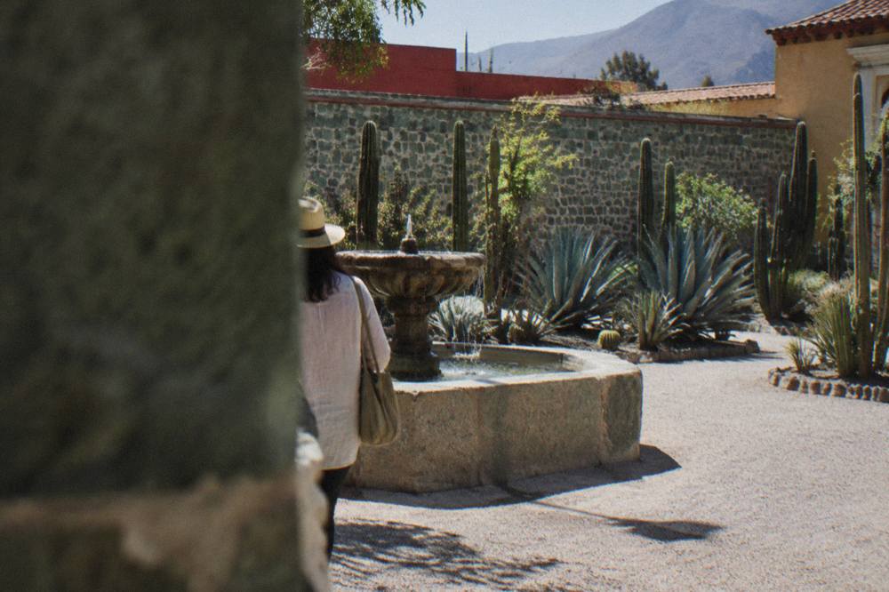
What Tours In Oaxaca City Work Best Alongside The Zócalo?
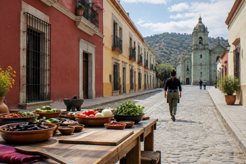
The products that fit a Zócalo-anchored stay are the city walking experiences, the food and market tours of the centre, the cooking classes, and the valley day trips to Monte Albán and the Tlacolula chain, all of which depart from or near the central streets and return to them, so the plaza works as both the start and the end of the day.
The Monte Albán tours page and the full things to do in Oaxaca index cover the valley day trips and the mezcal experiences, several of which collect from central hotels within a few blocks of the Zócalo.
Common Questions About The Zócalo De Oaxaca
Is The Zócalo De Oaxaca Free?
Yes. The Plaza de la Constitución is an open public square with no gate, ticket or opening hours. The museums and sites around it charge their own INAH admission, and the Jardín Etnobotánico is free but only on its guided schedule.
What Is The Formal Name Of The Zócalo In Oaxaca City?
The formal name is Plaza de la Constitución. "Zócalo" is the everyday Mexican term for a main square, and both names refer to the same plaza in the Centro Histórico of Oaxaca de Juárez.
Is The Zócalo De Oaxaca Part Of A UNESCO World Heritage Site?
Yes. The Historic Centre of Oaxaca, which the plaza anchors, is inscribed together with the Archaeological Site of Monte Albán as property 415, "Historic Centre of Oaxaca and Archaeological Site of Monte Albán".
How Far Is Monte Albán From The Zócalo?
About 8.7 km by road, a free-flow drive of about 15 minutes from the plaza's coordinates. Real traffic on the mountain approach road makes the journey slower, so allow more than the free-flow figure.
When Is The Zócalo Decorated For Día De Muertos In Oaxaca?
The festival centres on the traditional dates of 31 October to 2 November. A state notice reports Zócalo decorative structures being mounted 25 to 28 October 2026 and dismantled after 6 November 2026, but the 2026 festival programme itself has not been announced, so confirm locally before planning around it.
What Is The Best Time Of Day At The Zócalo De Oaxaca?
The square is in shade under its trees through the middle of the day and lit in the evening. In the rainy season, June through September average 19.9 to 21.4 days with rain per month, so mornings are the drier window for time on the plaza.
The Zócalo de Oaxaca asks nothing of a visitor and gives the whole city its bearings, and any stay in Oaxaca City will pass through it whether planned or not.