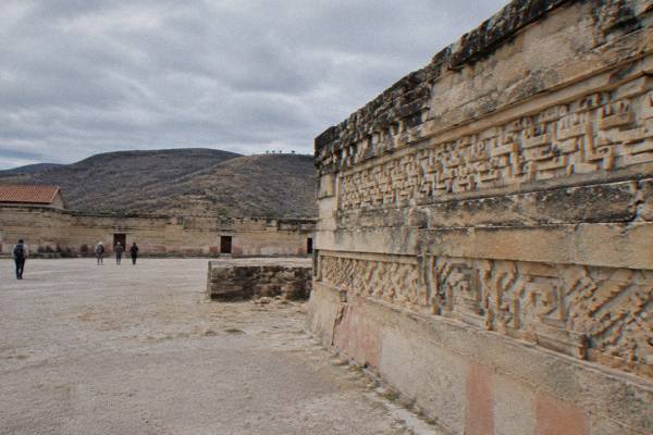
Oaxaca To Mitla And Tlacolula: The Eastern Valley Loop
The road east of Oaxaca City strings the Tule tree, Teotitlán del Valle, Tlacolula and Mitla along one highway, with Yagul, Dainzú and Lambityeco on the way and Hierve el Agua beyond. Here are the hours, fees and drive times that shape the loop.
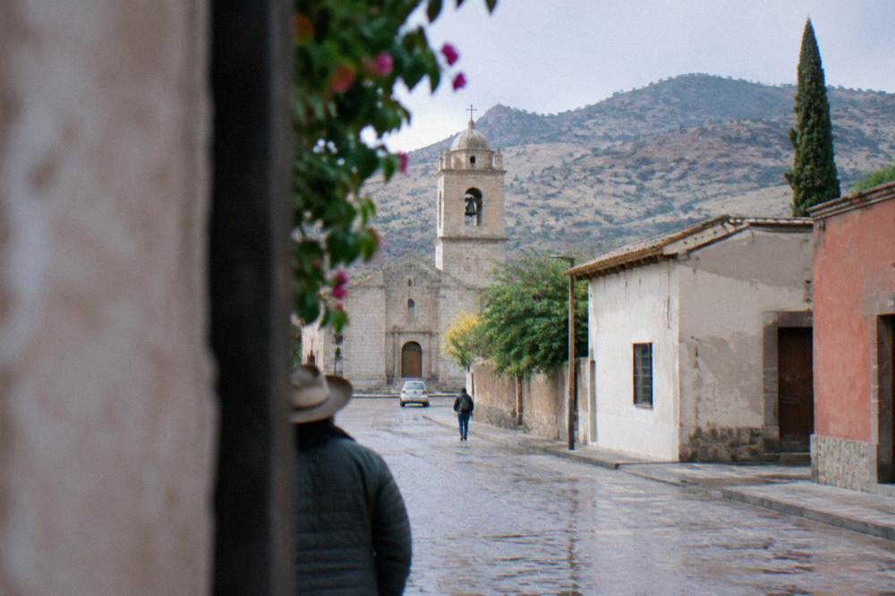
Mitla sits about 45 km east of Oaxaca City, about a 37 minute drive, and pairs naturally with Tlacolula about 31 km out, plus the Tule tree, Teotitlán del Valle, Yagul, Dainzú and Lambityeco on the same road. Mitla is open daily 08:00 to 17:00, last access 16:30, and charges 105 MXN for Mexican nationals and 210 MXN for foreign visitors.
The road east out of Oaxaca City, the inland highland capital of the state of Oaxaca at about 1,550 m, is the most concentrated day-trip corridor in the Valles Centrales: one highway carries you past the Tule tree, through Teotitlán del Valle and Tlacolula, and on to the INAH archaeological zone at Mitla, with Yagul, Dainzú and Lambityeco strung along the same route and Hierve el Agua a further climb beyond Mitla.
What Is The Eastern Valley Loop From Oaxaca?
The eastern valley loop is the chain of stops east of Oaxaca City that runs from Santa María del Tule through Teotitlán del Valle and Tlacolula to Mitla, with Yagul, Dainzú and Lambityeco sitting along the same highway and Hierve el Agua a further drive beyond Mitla: Tule is about 11 minutes from the Zócalo, Tlacolula about 25 and Mitla about 37, all free-flow driving estimates.
Everything on the loop sits in the Valles Centrales, the system of highland valleys around the capital, and none of it involves the coast: Puerto Escondido, Mazunte and Huatulco are a separate long extension, about 165 minutes to Puerto Escondido on the new highway from the Zócalo, never a stop on this road. The loop is instead a compact set of valley destinations, close enough together that the driving between the first and last stops is measured in tens of minutes rather than hours.
Because the stops line up on one axis, the loop works in either direction. Outbound via Tule and Teotitlán del Valle, then Tlacolula, then Yagul or Dainzú and Lambityeco, then Mitla, is the sequence most itineraries use, and the return retraces the same road. The Tlacolula Sunday market guide covers the market town in depth, and the Mitla attraction guide does the same for the archaeological zone.
The full loop, with a mezcal stop in the Tlacolula valley, is the single most packaged day trip out of the city, and the tour list of valley day trips reflects that: guided options bundle the Tule tree, Teotitlán weaving stops, Tlacolula, Mitla and Hierve el Agua in varying combinations. The sections below give the driving data, the site fees and hours, and the decisions that shape the day.
How Long Is The Drive From Oaxaca To Mitla And Tlacolula?
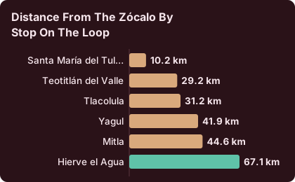
Driving from the Zócalo, Santa María del Tule is about 10 km and 11 minutes away, Teotitlán del Valle about 29 km and 26 minutes, Tlacolula about 31 km and 25 minutes, Yagul about 42 km and 38 minutes and Mitla about 45 km and 37 minutes, with Hierve el Agua pushing the loop to about 67 km and 57 minutes from the centre.
These are free-flow estimates computed on OpenStreetMap roads, not official figures, and real traffic through the valley towns runs slower. The practical reading is that no leg of the core loop is long: Tlacolula to Mitla is a short highway hop, and the whole Zócalo-to-Mitla run is shorter than many city commutes. The one outlier is Hierve el Agua, which adds about 20 minutes of mountain road beyond Mitla and is covered in detail on the Hierve el Agua day trip guide.
| Stop on the loop | Distance from the Zócalo | Free-flow drive time |
|---|---|---|
| Santa María del Tule | 10.2 km | about 11 minutes |
| Teotitlán del Valle | 29.2 km | about 26 minutes |
| Tlacolula | 31.2 km | about 25 minutes |
| Yagul | 41.9 km | about 38 minutes |
| Mitla | 44.6 km | about 37 minutes |
| Hierve el Agua | 67.1 km | about 57 minutes |
Straight-line, Mitla is about 42 km from the city and Hierve el Agua about 52 km, so the road adds only a modest detour over the crow-flies distance.
For travellers who would rather not sequence six stops themselves, guided valley day trips cover the corridor end to end.
What Are Mitla's Opening Hours And Ticket Prices?
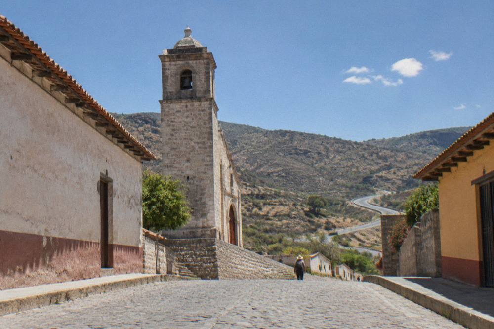
Mitla is open Monday to Sunday from 08:00 to 17:00, with last access at 16:30, and entry costs 105 MXN for Mexican nationals and 210 MXN for foreign visitors, the INAH Category I rate it shares with Monte Albán and Yagul. Visits outside normal INAH hours can be arranged for 730 MXN, a rate listed on the INAH pages for several valley sites.
The hours and prices come straight from the INAH listing for the zone. The Category I and Category III structure matters for loop planning because the smaller sites on this road do not charge what Mitla charges, and a day that stacks several zones should budget for each gate separately rather than assume one flat fee. There is no basis for the claim that Sundays are free at INAH sites; nothing on the pages supports it, so plan on the posted rate on every day of the week.
| INAH site on the eastern loop | Days open | Hours | Last access | Nationals | Foreigners |
|---|---|---|---|---|---|
| Mitla | Monday to Sunday | 08:00 to 17:00 | 16:30 | 105 MXN | 210 MXN |
| Yagul | Monday to Sunday | 08:00 to 17:00 | 16:00 | 105 MXN | 210 MXN |
| Dainzú | Monday to Sunday | 08:00 to 17:00 | 16:30 | 80 MXN | 145 MXN |
| Lambityeco | Monday to Sunday | 08:00 to 17:00 | 16:30 | 80 MXN | 145 MXN |
Two of these zones close their gates a full hour before Mitla does, which sets the sequencing: if Yagul is on the list, it belongs before Mitla, not after, because a late Mitla departure leaves no margin for Yagul's 16:00 last access. Dainzú and Lambityeco share Mitla's 16:30 cutoff but sit on the near side of the valley, so they work early or mid-day.
The single most packaged way to see Mitla in context is a valley day trip that strings Hierve el Agua, Mitla and the Tule tree with a mezcal distillery stop; the Hierve el Agua valley tour overview describes what that product covers, and Check availability for live dates and pricing on the operator's booking page.
Why Is Tlacolula The Natural First Stop On The Loop?
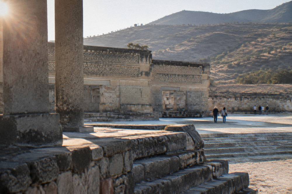
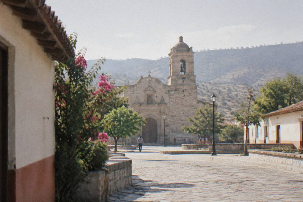
Tlacolula sits about 31 km east of the Zócalo, about a 25 minute free-flow drive, and works as the loop's natural first stop for its market and its church before the road continues toward Yagul and Mitla. The Sunday market gives the town its name on the map, and the plaza and church sit at the centre of a walkable grid.
Tlacolula is the working town of the eastern valley, and its Sunday market is the event the town is booked around: the Tlacolula market guide and the answer on what Tlacolula market is known for cover it in detail. No market hours are printed anywhere on this site because no official primary source publishes them, so a Sunday plan should simply follow the market's own rhythm rather than a timetable.
| Loop build | Stops | Furthest point from the Zócalo | Approximate driving reach |
|---|---|---|---|
| Short loop | Tule, Teotitlán del Valle, Tlacolula | Tlacolula, 31.2 km | about 25 minutes each way |
| Core loop | Tule, Teotitlán del Valle, Tlacolula, Mitla | Mitla, 44.6 km | about 37 minutes each way |
| Archaeology loop | Tlacolula, Dainzú, Lambityeco, Yagul, Mitla | Mitla, 44.6 km | about 37 minutes each way |
| Full loop | Tule, Tlacolula, Mitla, Hierve el Agua | Hierve el Agua, 67.1 km | about 57 minutes each way |
On days that are not Sunday, Tlacolula still earns its stop as the place to eat before the archaeological zones, and it is the last full town before the road splits toward Mitla and the climb to Hierve el Agua. Teotitlán del Valle, about 26 minutes out, sits just before it and is covered on the Teotitlán del Valle guide.
The valley between Tlacolula and Mitla is also mezcal country, with Santiago Matatlán on the road east; the mezcal route guide covers the distillery town. Many of the guided loop products weave a distillery stop between Mitla and the return drive, which is one reason the packaged day holds together so well.
What Else Can You Add To The Loop: Tule, Yagul, Dainzú, Lambityeco?
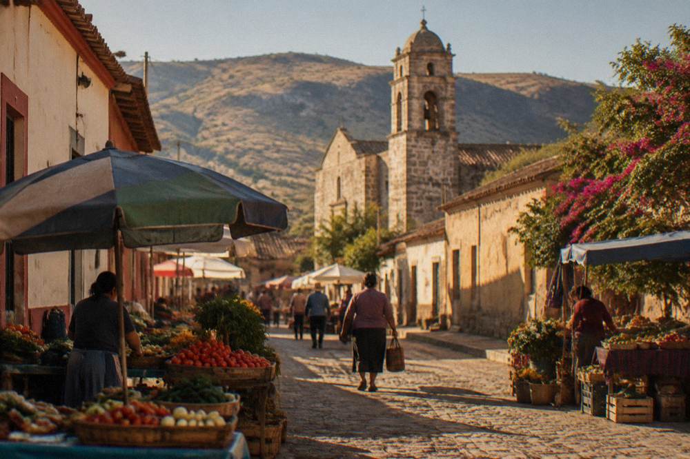
Between the Zócalo and Mitla the same highway serves Santa María del Tule at about 11 minutes, Teotitlán del Valle at about 26, Yagul at about 38 and Dainzú and Lambityeco just off the route; Yagul charges the Category I rate of 105 or 210 MXN, while Dainzú and Lambityeco charge the Category III rate of 80 or 145 MXN.
The Tule tree is the quickest add-on of the lot, about 10 km out on the road east, and the Santa María del Tule tree guide covers it; no church fee or hours are printed for it anywhere on this site, because no primary source carries them. Yagul, Dainzú and Lambityeco are the loop's quiet archaeological zones, and the Yagul and Dainzú guide pairs the two that sit closest together.
| Add-on | Distance from the Zócalo | Drive time | Entry fee | Hours |
|---|---|---|---|---|
| Santa María del Tule | 10.2 km | about 11 minutes | no fee printed | no hours printed |
| Teotitlán del Valle | 29.2 km | about 26 minutes | not an INAH zone | not an INAH zone |
| Dainzú | near the highway | not measured | 80 / 145 MXN | 08:00 to 17:00, last access 16:30 |
| Lambityeco | near the highway | near Dainzú | 80 / 145 MXN | 08:00 to 17:00, last access 16:30 |
| Yagul | 41.9 km | about 38 minutes | 105 / 210 MXN | 08:00 to 17:00, last access 16:00 |
The fee split is the planning insight: a day that adds Dainzú and Lambityeco to Mitla costs less at the gate than a second Category I zone would, while adding Yagul doubles up on the top rate. The visitor numbers in the infogain section above show the trade-off in crowd terms as well: Mitla's 104,428 visitors in 2025 against Yagul's 10,185 is a tenfold difference in footfall between zones 4 km apart on the same road. The wider set of guides lives on Oaxaca Travel Guide.
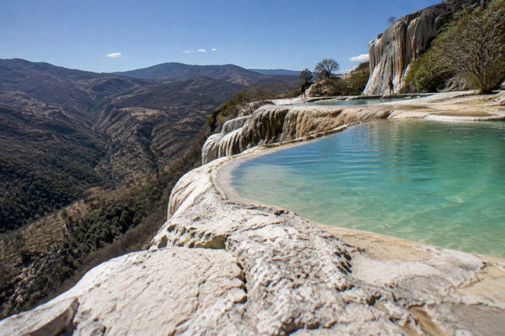
Hierve el Agua is the one add-on that changes the shape of the day, because it adds about 20 minutes of mountain driving beyond Mitla and no entry fee or hours can be printed for it, since it is run by local communities rather than INAH and no official page carries the figures. The practical rule is to treat the full loop as a long day and the core loop as a comfortable one.
Should You Drive The Eastern Valley Loop Yourself Or Join A Tour?
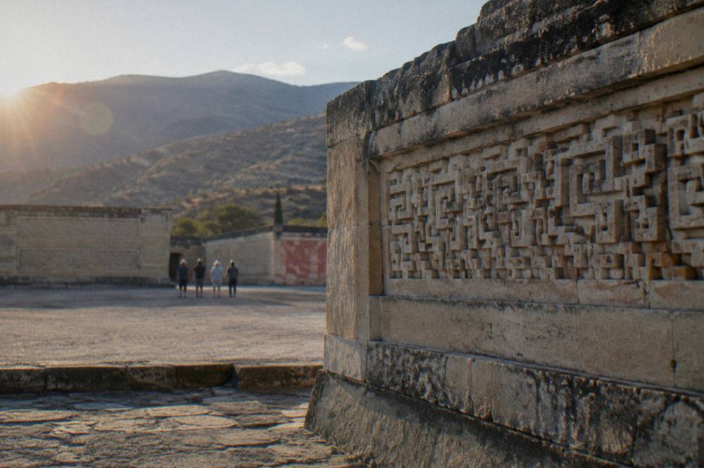
A self-driven loop and a guided day trip cover the same ground, so the choice turns on transport and appetite for logistics: the drive to Mitla is about 37 minutes each way from the Zócalo, the INAH zones post their hours and fees at the gate, and valley day trips that bundle Mitla with Hierve el Agua, the Tule tree and a mezcal distillery stop handle the driving entirely.
Driving yourself buys sequence freedom: Yagul's earlier last access, a long Tlacolula lunch, an early Tule stop before the crowds of mid-day, all rearrangeable on the fly. What it costs is the mezcal question, since a distillery stop plus a mountain road back is a pairing best resolved with a designated driver or a skip on the tasting side.
Guided products solve that problem outright, and the tour list covers several shapes of the same day: the flagship loop strings Hierve el Agua, Mitla and the Tule tree with rugs and a mezcal distillery; a sibling product does Hierve el Agua and mezcal-making without Mitla; another runs the same stops as a full-day loop with the Tule tree. All of them are valley day trips that depart from the city, not from the coast.
A private variant exists for groups who want the same corridor without the shared-bus timetable, pairing Mitla with a weavers' town, mezcal and Hierve el Agua on a private basis; it is priced per group rather than per person, which changes the arithmetic for parties of four or more.
How Does The Loop Fit Into A Longer Oaxaca Itinerary?
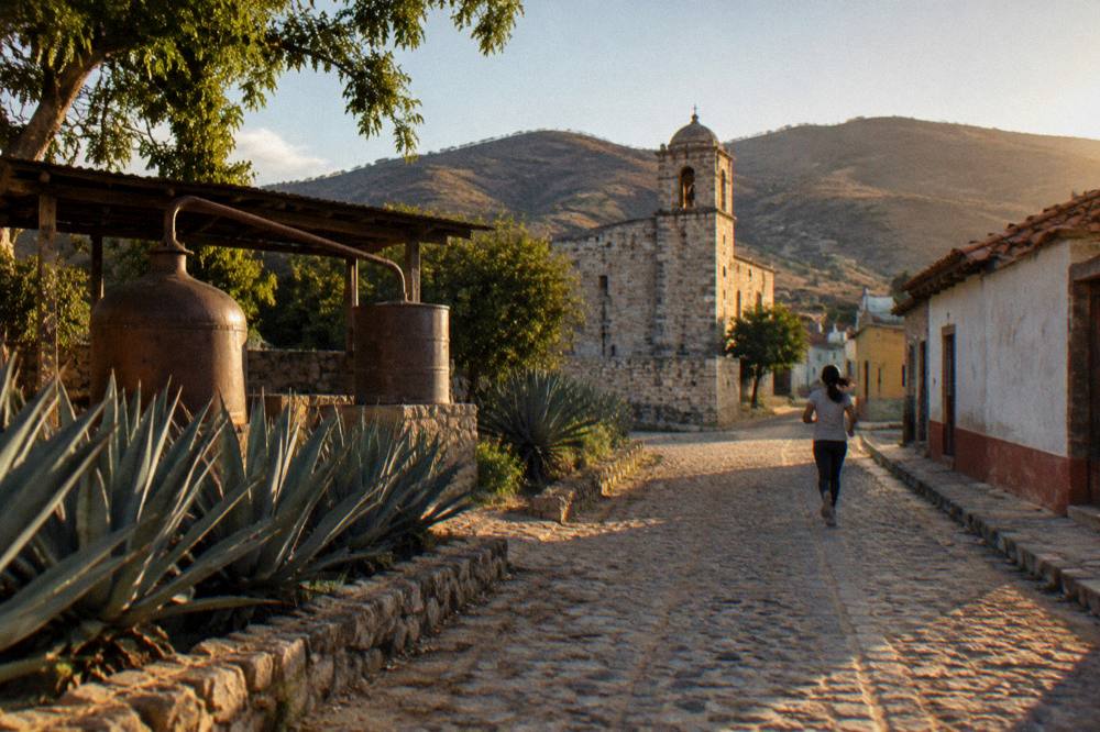
The loop compresses into a single long day trip and also anchors a longer eastern-valley focus, with Tlacolula, Teotitlán del Valle and the Tule tree close enough to the city to slot into a shorter itinerary; a three day Oaxaca itinerary can carry the full loop on its second day, and a four day plan can split Mitla and Hierve el Agua across two days.
The three and four day templates exist on this site for exactly this split: the three day Oaxaca itinerary assigns the eastern valley its own day alongside the city and Monte Albán, while the four day itinerary leaves room to separate the archaeology day from the Hierve el Agua and mezcal day. Shorter visits can still lift pieces of the loop, since Tule alone is an 11 minute drive.
The loop also pairs with the other valley corridors for travellers staying a week or more: the southern craft route through San Martín Tilcajete and alebrijes, the Ocotlán Friday market route and the Cuilapan de Guerrero stop on the western side. Grouping them by day of the week, Sunday for Tlacolula, Friday for Ocotlán, is the classic valley pattern, and the overview of things to do in Oaxaca places the loop in that bigger frame.
For visitors building the trip around one base in the city, the loop needs no second hotel: every stop on the core route is within about 40 minutes of the Zócalo, and even the full version with Hierve el Agua returns to the city the same evening at a civilized hour. That single-base logic is why the eastern valley, rather than the coast, is the day trip that anchors almost every first visit.
What Is The Weather Like On The Eastern Valley Loop?
The Oaxaca climate normals, SMN station data for 1991 to 2020, put the dry season from November to April and the rainy season from May to October, with June averaging 188.3 mm of rain, September 163.6 mm and January 2.4 mm; April's average daily high is 34.9 C and January's average overnight low is 10.3 C.
The loop sits at valley altitude, so the numbers in the table below describe the whole corridor from the city out to Mitla. Rainy-season days typically run dry mornings with afternoon rain, which matters for a loop whose outdoor stops, open-air zones and a market street, are the point; a morning departure keeps the archaeological stops ahead of the afternoon.
| Month | Average daily high (C) | Average overnight low (C) | Average rain (mm) |
|---|---|---|---|
| January | 28.9 | 10.3 | 2.4 |
| February | 31.1 | 11.6 | 4.6 |
| March | 33.3 | 13.6 | 17.6 |
| April | 34.9 | 15.8 | 47.3 |
| May | 33.8 | 16.7 | 97.9 |
| June | 30.9 | 16.7 | 188.3 |
| July | 30.1 | 15.9 | 118.6 |
| August | 30.0 | 15.9 | 131.8 |
| September | 29.1 | 16.1 | 163.6 |
| October | 29.3 | 14.5 | 63.1 |
| November | 29.0 | 12.3 | 9.1 |
| December | 28.9 | 11.0 | 9.0 |
The annual total across those months is 853.3 mm, and the spread is stark: November through March averages under 20 mm a month while June through September all sit above 118 mm. March and April bring the highest average daytime highs at 33.3 C and 34.9 C, and December and January the coolest average nights at 11.0 C and 10.3 C, so a loop in the early dry season pairs warm afternoons with jacket-level mornings.
None of this stops the loop in the rainy season; it just reshapes it. The zones are open year-round on the hours printed above, the valley is greenest after the rains, and the afternoon pattern leaves the morning intact for Mitla and Yagul before the last-access cutoffs bite.
Common Questions About The Mitla And Tlacolula Day Trip
Can You Visit Mitla And Tlacolula In One Day From Oaxaca?
Yes. Tlacolula is about 31 km and Mitla about 45 km from the Zócalo, roughly 25 and 37 minutes of free-flow driving, so the two pair comfortably in one day with the Tule tree and Teotitlán del Valle on the same road. Adding Hierve el Agua turns it into a longer but still single-day loop of about 67 km each way at the farthest point.
How Much Does It Cost To Enter Mitla?
Mitla charges the INAH Category I rate: 105 MXN for Mexican nationals and 210 MXN for foreign visitors, per the INAH listing for the zone. Yagul charges the same rate; Dainzú and Lambityeco charge the Category III rate of 80 and 145 MXN. A visit outside normal INAH hours is listed at 730 MXN.
What Time Does Mitla Open And Close?
Mitla is open Monday to Sunday from 08:00 to 17:00, with last access at 16:30. Yagul closes its last access earlier, at 16:00, so on a day combining the two, Yagul comes first. The full hours table for every INAH zone on the loop sits higher up this page.
How Do You Get To Tlacolula Without A Car?
Shared colectivos run east from the city through the valley towns, and the site's guide to colectivos and mototaxis in Oaxaca explains how the system works; no fare figure is printed because no official primary source publishes one. The alternative is a guided valley day trip, which covers Tlacolula, Mitla and further stops with the transport handled.
Is Hierve El Agua On The Same Loop?
It is the extension of it. Hierve el Agua sits about 67 km and 57 minutes of free-flow driving from the Zócalo, beyond Mitla on the mountain road, and many guided loop products bundle the two with the Tule tree and a mezcal distillery stop. No entry fee or hours are printed for Hierve el Agua on this site, since it is community-run and no official page carries the figures.
Do You Need A Tour For The Eastern Valley Loop?
No. Every stop is reachable by private car or colectivo, and the INAH zones post their hours and fees at the gate. A tour earns its place on the full loop with Hierve el Agua and a mezcal stop, where the driving, the mountain road and the tasting add up to a day that is easier to buy than to build, and the picks higher up this page show what that product covers.