Driving In Oaxaca: Roads, Tolls And Parking
Oaxaca City sits inland in the Valles Centrales at about 1,550 m, and the roads that fan out from it reach Monte Albán, the Tlacolula Valley craft towns and the petrified pools of Hierve el Agua. Here is what the drive times, site hours and published fees actually look like.
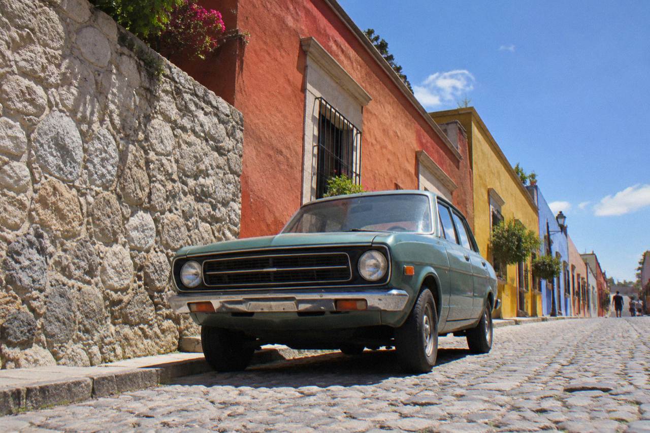
Driving works well for the Valles Centrales: Monte Albán is about 15 minutes from the Zócalo, Mitla about 37 and Hierve el Agua about 57 on free-flow roads. INAH sites open 08:00 and charge 105 MXN for nationals and 210 MXN for foreigners at Category I sites. In the city centre itself, parking beats driving.
Oaxaca City is the capital of the state of Oaxaca in Mexico, an inland highland city in the Valles Centrales at about 1,550 m, and the road network around it is one of the reasons the region rewards a car. Monte Albán is about 15 minutes from the Zócalo on a good road, the Tlacolula Valley towns sit within an hour, and the petrified pools of Hierve el Agua are about 57 minutes of free-flow driving away on mountain roads that are slower in practice. Within the historic centre itself the calculus flips: the centre is compact, walkable and served by colectivos, and the practical pattern many drivers land on is a car for the valley and feet for the city. Readers will find here the drive times the mapping data supports, the published INAH opening hours and fees, what the toll picture looks like, where parking fits into a centro visit, and how the advisories read for the state.
Is Driving In Oaxaca A Good Idea?
A car earns its keep for the Valles Centrales and pays for nothing inside the historic centre. The valley sights sit on a fan of roads where a private vehicle cuts waiting for colectivos, while the centro is dense, walkable and better served by the local alternatives than by four wheels.
The split matters because the two halves of a typical trip have opposite economics. A day that strings together Monte Albán in the morning, Santa María del Tule at about 11 minutes, Teotitlán del Valle at about 26 and Tlacolula at about 25 is straightforward in a car and awkward in anything shared. A day that strings together the Zócalo, Santo Domingo de Guzmán, the Andador Macedonio Alcalá and Mercado 20 de Noviembre is entirely on foot, and a parked car is a liability rather than a tool. The full picture of buses, colectivos and ride-hailing sits on getting around Oaxaca.
Drivers who stay several days should also weigh the fact that the valley's biggest single draw, Hierve el Agua, sits at the end of about 57 minutes of free-flow driving that includes mountain sections, and that the tour market has built an entire category around that road. The operator's booking page for the Hierve el Agua and mezcal-making tour is one example of a product built for travellers who would rather not drive it themselves, and the article returns to that choice later.
What Are The Roads Like Around Oaxaca City?
The valley roads out of Oaxaca City are a mix of paved federal and state highways in good condition and narrower local roads through towns and mountain sections, and the practical planning rule is to treat published drive times as floors, not estimates. Free-flow figures from mapping data assume ideal conditions, and real traffic, market days and mountain grades make every trip longer.
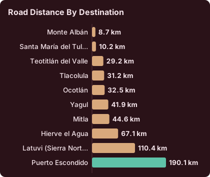
The free-flow baseline comes from routing on OpenStreetMap roads, so every figure on this page is a derived baseline rather than an official journey time. What the baseline shows is that the valley is tight: eight of the ten destinations listed below are under 40 minutes from the Zócalo at free flow, and only the Sierra Norte village of Latuvi and the Pacific coast at Puerto Escondido cross the two-hour line. Road quality on the main valley axes is generally the strongest of the set, while the final approaches to Hierve el Agua involve climbing roads where the derived time understates a cautious driver's real pace.
Weather changes the picture more than distance does. The rainy season runs May to October with a peak from June to September, and the SMN station normals show what that means in numbers: June averages 188.3 mm of rain across 19.9 days with rain, September 163.6 mm across 21.4 days, against January's 2.4 mm across 1.4 days. Rain in the valleys tends to arrive in afternoon downpours rather than all-day drizzle, but a wet mountain road to Hierve el Agua is a different drive from a dry one, and the normals say June through September give a driver roughly two days in three with rain somewhere in them.
| Month | Average rain (mm) | Days with rain |
|---|---|---|
| January | 2.4 | 1.4 |
| February | 4.6 | 1.1 |
| March | 17.6 | 4.1 |
| April | 47.3 | 7.6 |
| May | 97.9 | 13.7 |
| June | 188.3 | 19.9 |
| July | 118.6 | 20.4 |
| August | 131.8 | 20.5 |
| September | 163.6 | 21.4 |
| October | 63.1 | 12.0 |
| November | 9.1 | 3.5 |
| December | 9.0 | 2.4 |
Figures are SMN station 20079 climate normals for 1991-2020. The dry season runs November to April, and November through March all sit under 20 mm for the month. That stretch, plus the shoulder weeks of April and October, is when the roads are at their most predictable, and the fuller month-by-month picture sits on Oaxaca weather by month.
How Long Does It Take To Drive From Oaxaca City To The Main Sights?
Free-flow drive times from the Zócalo run about 15 minutes to Monte Albán, 11 to Santa María del Tule, 26 to Teotitlán del Valle, 25 to Tlacolula, 37 to Ocotlán, 38 to Yagul, 37 to Mitla, 57 to Hierve el Agua, 142 to Latuvi in the Sierra Norte and 165 to Puerto Escondido on the new highway. All are derived from mapping data and all run longer in real traffic.
Those figures deserve their own table, because they are the backbone of any valley itinerary. The distances are from the Zócalo, routed on OpenStreetMap roads with no traffic. A driver should read them as the fastest a trip could possibly go and budget upward, especially on the mountain legs.
| Destination | Road distance | Free-flow time |
|---|---|---|
| Monte Albán | 8.7 km | about 15 min |
| Santa María del Tule | 10.2 km | about 11 min |
| Teotitlán del Valle | 29.2 km | about 26 min |
| Tlacolula | 31.2 km | about 25 min |
| Ocotlán | 32.5 km | about 37 min |
| Yagul | 41.9 km | about 38 min |
| Mitla | 44.6 km | about 37 min |
| Hierve el Agua | 67.1 km | about 57 min |
| Latuvi (Sierra Norte) | 110.4 km | about 142 min |
| Puerto Escondido | 190.1 km | about 165 min |
Two of those rows carry a caveat worth spelling out. Latuvi is a Pueblos Mancomunados village in the Sierra Norte, and the road to it is long and mountainous enough that the derived 142 minutes should be treated as optimistic rather than typical. Puerto Escondido's 165 minutes rides on the new highway through the Barranca Larga to Ventanilla section, and the practical range cited in earlier route guides runs to about three and a half hours, so a coast day trip by car is a serious drive each way and belongs in an itinerary as an extension, not a spur-of-the-moment excursion. Straight-line distances put the scale in perspective: Mitla is about 42 km from the city as the crow flies, Hierve el Agua about 52 and Zaachila about 12, so road miles consistently exceed crow miles in the valley.
Arrival times matter as much as drive times, because several valley sites stop admitting visitors well before they close. The INAH pages give the current hours, and the pattern is 08:00 opening everywhere with staggered last-access cutoffs.
| INAH site | Hours | Last access |
|---|---|---|
| Monte Albán | Mon to Sun 08:00 to 17:00 | 16:00 |
| Mitla | Mon to Sun 08:00 to 17:00 | 16:30 |
| Yagul | Mon to Sun 08:00 to 17:00 | 16:00 |
| Dainzú | Mon to Sun 08:00 to 17:00 | 16:30 |
| Lambityeco | Mon to Sun 08:00 to 17:00 | 16:30 |
| Atzompa | Mon to Sun 08:00 to 16:00 | 15:00 |
| Zaachila | Thu to Sun 10:00 to 16:00 | 16:00 |
Two traps hide in that table. Atzompa closes at 16:00 with last access at 15:00, an hour ahead of Monte Albán's rhythm, so a driver looping Atzompa after Monte Albán needs to watch the clock. Zaachila opens Thursday to Sunday only and starts at 10:00, which makes it a natural pair with the Thursday market tradition in the town rather than an any-day stop. Admission is charged by INAH category, and the fee table is short: Category I sites, which are Monte Albán, Mitla and Yagul, charge 105 MXN for Mexican nationals and 210 MXN for foreign visitors, while Category III sites, Dainzú, Lambityeco and Zaachila, charge 80 and 145 MXN.
Do You Pay Tolls Driving Around Oaxaca?
The valley routes a visitor actually drives, meaning Monte Albán, Tule, Teotitlán del Valle, Tlacolula, Mitla and Hierve el Agua, run on free public roads, so a Valles Centrales itinerary can be driven without paying a single toll. The tolled driving associated with Oaxaca sits on the long-distance cuota highways, above all the route toward Mexico City, not on the valley loop a car is rented for.
That distinction shapes the budget. A traveller who flies into Xoxocotlán, rents a car for five days of valley loops and returns it pays nothing in tolls, because every destination in the drive-time table above except the coast is reached on libre roads. A traveller who drives down from Mexico City on Mexican Federal Highway 135D is on a tolled autopista for the long haul, and tolls are one more reason that corridor competes with the alternatives laid out on Mexico City to Oaxaca and the ADO bus route, where the road is someone else's problem. The Puerto Escondido run on the new highway is the other case where tolled or paid sections can enter the picture.
Mountain roads deserve one more caution that is not about money. The final approach to Hierve el Agua passes through communities that have at times set up local collection or access arrangements on the road, a pattern documented in older state diagnostics of the site, and news reporting from October 2026 described sporadic road and airport-access blockades during teacher-union protest actions in the state. Such blockades are standing background risk rather than a scheduled event, and a driver heading into the mountains on any given day simply keeps the itinerary flexible.
Where Can You Park In Oaxaca City?
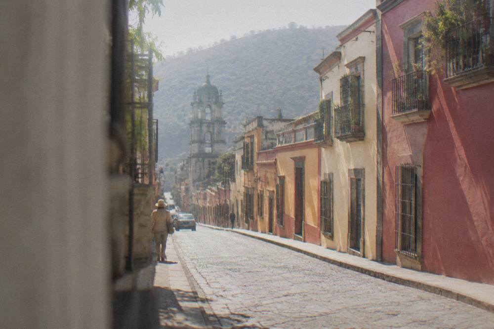
Parking in Oaxaca City works best as a park-once strategy: leave the car at or near the hotel and move through the historic centre on foot, because the centro's street plan predates cars, its key streets are pedestrian priority, and the walks between the Zócalo, Santo Domingo de Guzmán and the markets take minutes rather than the circulation time a car would consume. Hotel parking is the anchor; street parking in the centre is the exception, not the plan.
The geography makes the case by itself. The Zócalo, the Basílica de la Soledad, the Andador Macedonio Alcalá, Mercado 20 de Noviembre and Mercado Benito Juárez all sit within a few blocks of one another, and the whole ensemble is the walkable core described on is Oaxaca walkable. A driver who insists on moving the car between those stops spends more time circling than walking, and one municipal intervention illustrates how the centre's priorities run: the state announced a temporary full vehicular closure of Calle 20 de Noviembre from February 2026 as part of the Oaxaca Camina sidewalk-widening programme, later reduced to a single lane. Streets in the centro are being reshaped around pedestrians, not around parked cars.
Choosing where to stay therefore doubles as choosing where to park, and the accommodation options on where to stay in Oaxaca and the hotel guide should be filtered for on-site parking if a car is part of the plan. For the day a car does come into the centre, private lots and hotel arrangements are the practical options, and arriving with cash covers them, in line with the general cash guidance on money, ATMs and cash in Oaxaca.
The park-once pattern also frees the evenings. Night drives out of the centre to look for street parking after dinner are the least pleasant driving Oaxaca offers, and the city's evening life, from the Zócalo to the options on the rooftop and nightlife scene, is concentrated in the same walkable core as everything else. A car that sleeps at the hotel is doing its job.
Is It Safe To Drive In Oaxaca?
The official advisories read calmly for the parts of Oaxaca a visitor drives: the UK FCDO advises against all but essential travel to parts of Mexico and does not name Oaxaca on its main page, Canada advises a high degree of caution for Mexico overall without listing Oaxaca among its avoid areas, and the US State Department lists Oaxaca state at Level 2, exercise increased caution, with its staff restrictions confined to the Isthmus region rather than the city or valley.
The Level 2 wording on the State Department's Mexico page comes with a geographic detail drivers should actually use: the restrictions that apply to US government employees cover the Isthmus region east of the Valles Centrales, including Federal Highway 185D and points toward Juchitán de Zaragoza and Salina Cruz, plus Highway 200 between Pinotepa and the Guerrero border, while Oaxaca City, Monte Albán and the valley corridors carry no such restriction. In plain terms, every drive in the table above except the coast runs through areas the advisories treat as ordinary caution rather than restricted.
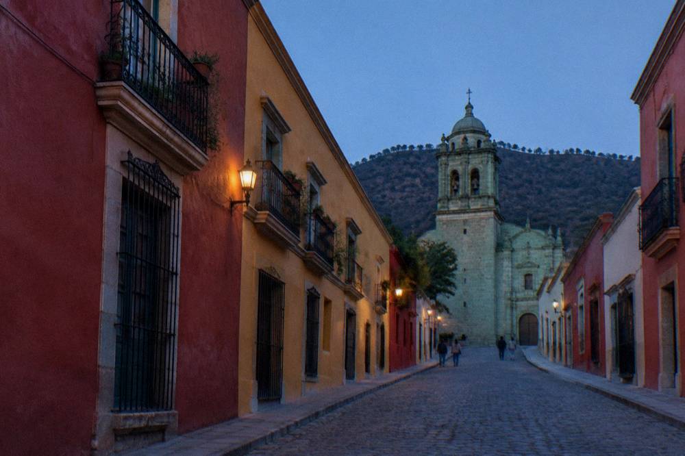
The hazards that actually matter on valley roads are mundane. Rain-slick mountain grades in the June-to-September peak, topes, the ubiquitous speed bumps at town entrances, shared roads with colectivos and mototaxis in the valleys, and livestock or market spillage on market-day approaches all do more to shape a day's driving than any security concern. The fuller safety picture for the city itself, including the night-time question, sits on is Oaxaca safe. The standing blockade risk noted above rounds it out: sporadic, protest-related and resolved within hours or days in the reported cases, but worth a headline check before a long mountain drive.
One more environmental note belongs here. Oaxaca City sits at about 1,550 m, and visitors adjusting to altitude sometimes feel it on the very drives the valley invites, particularly the higher Sierra Norte routes toward Latuvi and the Pueblos Mancomunados. The altitude and sun guidance covers the acclimatisation side of that.
Driving To The Sierra Norte And The Pacific Coast: What Changes?
Everything past the valley edge changes character: the Sierra Norte village of Latuvi is about 142 free-flow minutes from the Zócalo on long mountain roads, and Puerto Escondido on the Pacific is about 165 minutes via the new Barranca Larga to Ventanilla highway, with real-world runs toward three and a half hours. Both are legitimate drives, but neither is a casual add-on to a valley day, and the coast in particular should be planned as an extension with its own nights.
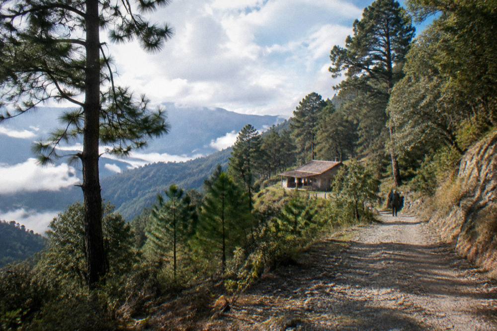
The Sierra Norte rewards a different kind of driver. The Pueblos Mancomunados communities sit high above the valleys, the roads are long and the derived times understate a careful pace, so the pattern that works is an early start, a single destination village such as Latuvi or Capulalpam de Méndez, and a daylight return. Mountain weather compounds this in the rainy season: the June-to-September normals put rain on roughly two days in three, and a wet Sierra road late in the day is the one genuinely avoidable mistake in an Oaxaca driving trip.
The coast is a different question, because the new highway changed it. At about 165 free-flow minutes, Puerto Escondido is now close enough that the drive competes with flying, but the practical guidance is still to treat it as its own block of a trip rather than a round trip squeezed beside valley days. Mazunte and Zipolite sit beyond Puerto Escondido, Huatulco beyond that again, and the state's beach extensions each deserve the planning depth in the dedicated coast guides. For a trip that is valley-first, the honest summary is that a car is for the Valles Centrales, and the coast is a decision, not a detour.
Renting A Car In Oaxaca: What Should You Check?
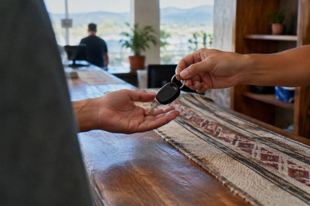
Check four things before signing in Oaxaca City: that the car can handle unpaved mountain approaches, above all the final stretch to Hierve el Agua, that the rental agreement's mileage and state-boundary terms cover the Sierra Norte and any coast plan, that parking at the hotel is included or arranged, and that the pickup and return logistics match the flight into Xoxocotlán rather than fighting the centro's street plan.
The airport point is the practical one. Xoxocotlán International is the city's airport, operated by ASUR, with normal operating hours of 06:00 to 20:00, and picking a car up there and dropping it there keeps the whole centro parking question out of arrival and departure days. The alternatives on Oaxaca airport and flights to Oaxaca cover getting in and out; the rental desk is simply one more variable at the same terminal.
Vehicle choice follows the itinerary. A standard compact handles Monte Albán, Tule, Teotitlán del Valle, Tlacolula, Ocotlán and Mitla without complaint, since those runs are on paved valley roads. Ground clearance starts to matter at Hierve el Agua and matters more in the Sierra Norte, and it is worth confirming with the rental company that the planned routes are within their terms before driving them. Fuel planning belongs in the same conversation: valley loops are short, but the Sierra and coast runs are long enough that a full tank before leaving the city is the simple rule.
Car Or No Car: How The Choice Maps Onto A Trip
The pattern that fits a typical visit is car for the valley days and no car for the city days, and the arithmetic is blunt about why: the drive-time table above shows seven valley destinations inside 40 free-flow minutes, while every headline sight inside the centro is inside a 15-minute walk of the Zócalo. A trip of three or more days can split cleanly between the two modes.
The split question deserves a longer answer than one paragraph, and how many days in Oaxaca is the page that frames it, because a short trip forces the choice while a longer one dissolves it.
It is also a pattern with an escape hatch. The valley's flagship road day, Hierve el Agua plus Mitla plus Tule plus a distillery stop, is exactly the day the local tour market packages, because the driving is the chore and the pools, ruins and mezcal are the point. For a traveller who would rather not take the mountain road at all, the operator's booking page carries the details and the Oaxaca Travel Guide covers the alternatives in depth, including the valley day-trip options and the mezcal route out to Santiago Matatlán.
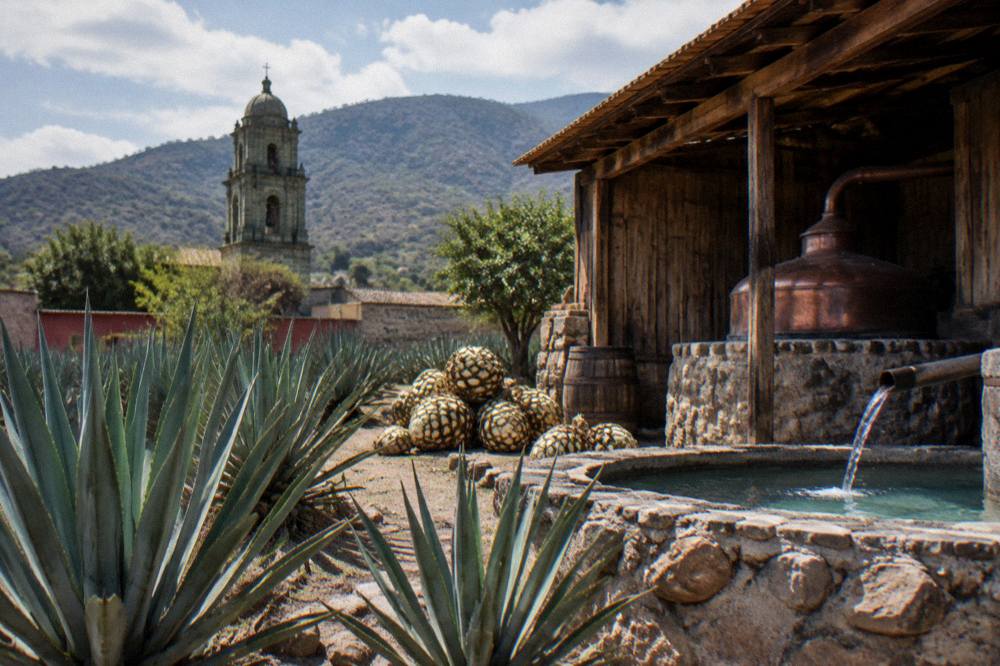
The mixed mode has a final virtue worth naming. The rainy-season afternoons, and the normals put June at 188.3 mm and 19.9 rain days, are exactly when a guided day with a professional driver at the wheel beats a rented car on a wet mountain grade, and the dry-season months from November to April are exactly when the same drive is at its simplest. Whichever half of the year a trip lands in, the drive times, the 08:00 INAH openings and the two-hour coast threshold on this page are the numbers to plan around.
Common Questions About Driving In Oaxaca
Is Driving In Oaxaca Difficult?
The valley roads to Monte Albán, Tule, Teotitlán del Valle, Tlacolula and Mitla are paved and straightforward, and the free-flow times run 11 to 37 minutes from the Zócalo. The difficult parts are the mountain approaches to Hierve el Agua and the Sierra Norte, plus the historic centre itself, where the practical move is to park once and walk.
Do You Need A Car In Oaxaca City?
Not for the city: the Zócalo, Santo Domingo de Guzmán, the Andador Macedonio Alcalá and the central markets are all within walking range of one another. A car earns its place for the Valles Centrales loops and the coast, and a park-once strategy at the hotel covers the overlap.
Are There Toll Roads In Oaxaca?
The valley routes visitors drive, including everything from Monte Albán to Hierve el Agua in the drive-time table, run on free public roads. Tolled cuota highway driving enters the picture on the long-distance route toward Mexico City and on parts of the run to the Pacific coast, not on a Valles Centrales loop.
How Long Is The Drive From Oaxaca City To Hierve El Agua?
About 57 minutes in free-flow conditions over 67.1 km from the Zócalo, per routing on OpenStreetMap roads. The final section is mountain road, so real runs are longer, and wet-season afternoons add more.
Can You Drive From Oaxaca City To Puerto Escondido?
Yes, in about 165 free-flow minutes via the new Barranca Larga to Ventanilla highway, with practical runs toward three and a half hours over 190.1 km. Plan it as an extension with its own nights rather than a day trip.
Is It Safe To Drive Around Oaxaca?
The UK FCDO does not name Oaxaca among the parts of Mexico it advises against, Canada lists no avoid area for the state, and the US advisory for Oaxaca state stands at Level 2, exercise increased caution, with restrictions only in the Isthmus region. The everyday hazards are rain-slick mountain roads in the June-to-September peak and topes at town entrances.