Capulálpam De Méndez: The Sierra Norte Pueblo Mágico Near Oaxaca
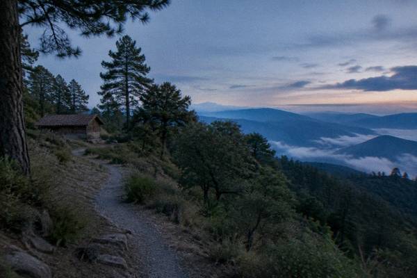
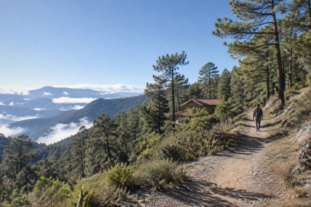
Capulálpam de Méndez sits in the Sierra Norte, the high mountain range north of Oaxaca City in the Valles Centrales of Mexico, and this page covers what to know about getting there, the climate at altitude, and the guided hikes that reach the region.
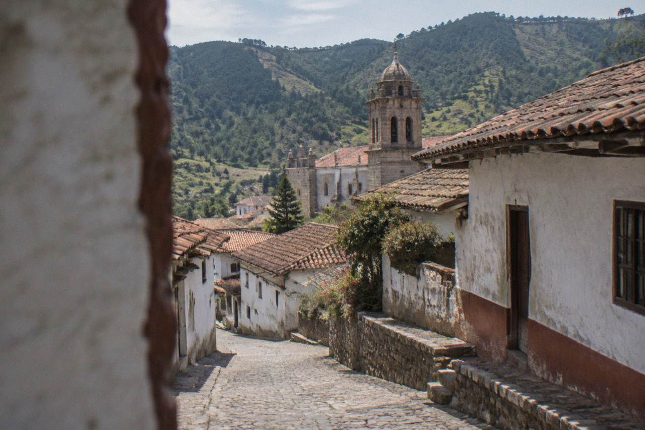
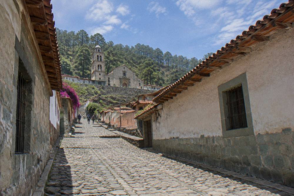
Capulálpam de Méndez is a highland village in the Sierra Norte north of Oaxaca City, reached by a mountain road; neighbouring Latuvi is about 142 minutes' drive from the Zócalo, and guided hikes in the Sierra Norte are the practical way to visit the range's trails.
Capulálpam de Méndez is a village in the Sierra Norte, the mountain range that rises north of Oaxaca City (Oaxaca de Juárez), the inland highland capital of the state of Oaxaca in the Valles Centrales of Mexico. The city itself sits at about 1,550 m, and the Sierra Norte climbs well above it; Latuvi, one of the Pueblos Mancomunados villages of that range, sits about 142 minutes' drive from the Zócalo by the derived free-flow road figures this site uses. The site's wider coverage of the range starts at Sierra Norte And Pueblos Mancomunados, and the Oaxaca Travel Guide homepage carries the full tour list of things to do.
Where Is Capulálpam De Méndez In Oaxaca?
Capulálpam de Méndez lies in the Sierra Norte, the high mountain range north of Oaxaca City in the state of Oaxaca, and it belongs to the network of Pueblos Mancomunados villages that includes Latuvi, which the derived road figures place about 142 minutes' drive from the Zócalo. The range is a world away from the Valles Centrales below, reached by mountain roads that real traffic makes slower than the free-flow numbers suggest.
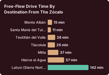
Oaxaca City is an inland highland city at about 1,550 m, with no sea, no beach and no navigable river. Everything about a Sierra Norte day trip happens uphill from it. The derived drive times this site uses come from routing on OpenStreetMap roads at free flow, and they are labelled "about" precisely because mountain roads, gradients and weather change the real figure.
| Destination from the Zócalo | Distance | Free-flow drive time |
|---|---|---|
| Monte Albán | 8.7 km | about 15 min |
| Santa María del Tule | 10.2 km | about 11 min |
| Teotitlán del Valle | 29.2 km | about 26 min |
| Tlacolula | 31.2 km | about 25 min |
| Mitla | 44.6 km | about 37 min |
| Hierve el Agua | 67.1 km | about 57 min |
| Latuvi (Sierra Norte) | mountain route | about 142 min |
The Sierra Norte row is the one that matters here. A trip to the Pueblos Mancomunados is not a quick valley hop like Teotitlán Del Valle or Tlacolula Sunday Market; it is a committed mountain journey, and the pairing decisions later on this page reflect that.
How Do You Get To The Sierra Norte From Oaxaca City?
You can reach Capulálpam and the Sierra Norte by mountain road from Oaxaca City, with a driving time of about 142 minutes to Latuvi from the Zócalo, and the practical options are a guided tour with transport included, a private driver, or self-driving, since no public bike-share and no rail link exist in Oaxaca.
Real traffic and mountain roads are slower than free-flow figures, so a Sierra Norte day should be planned as a full day, not a half-day. Road blockades by teachers' unions are a standing risk in Oaxaca that can disrupt road and airport access, and this site never dates one; on any travel day in the state it is sensible to leave buffer time for road conditions. For the valley alternatives, the distances are short and the drive times above hold.
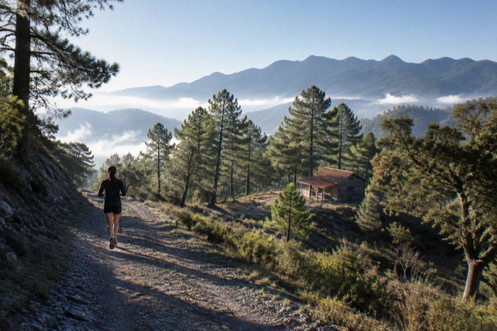
The guided option deserves real weight. The tour list carries two Sierra Norte hiking products: a trek in Benito Juárez National Park and a hiking tour described as covering the range's trails, plus a 10-hour Cuajimoloyas hike in the Pueblos Mancomunados. A tour folds the mountain drive, the trail choice and local guiding into one booking, which is exactly what a long mountain day calls for. The featured hike for this page can be checked here: Check availability, and there is more on the hike choices below.
What Is The Weather Like In The Sierra Norte Above Oaxaca?
The Sierra Norte is higher and wetter than Oaxaca City, where the SMN station normals for 1991-2020 put June at an average 188.3 mm of rain against January's 2.4 mm, with dry season from November to April and rainy season from May to October peaking June to September. Mountain villages sit above the city's about 1,550 m, so temperatures fall further with altitude, and the city figures below are a floor, not a ceiling, for what to expect uphill.
The climate table this site uses is the SMN station 20079 normals for Oaxaca, and it is the only climate source printed. The city's own numbers already show the pattern a Sierra Norte visitor plans around: afternoon rain in the wet months, dry air in the spring months, and cool nights in December and January. April carries an average maximum of 34.9 C in the city, and December and January carry average minimums of 11.0 C and 10.3 C. State the figure and the month, and plan the mountain layer from there.
| Month | Avg high C (Oaxaca station) | Avg low C | Avg rain mm | Rain days |
|---|---|---|---|---|
| Jan | 28.9 | 10.3 | 2.4 | 1.4 |
| Feb | 31.1 | 11.6 | 4.6 | 1.1 |
| Mar | 33.3 | 13.6 | 17.6 | 4.1 |
| Apr | 34.9 | 15.8 | 47.3 | 7.6 |
| May | 33.8 | 16.7 | 97.9 | 13.7 |
| Jun | 30.9 | 16.7 | 188.3 | 19.9 |
| Jul | 30.1 | 15.9 | 118.6 | 20.4 |
| Aug | 30.0 | 15.9 | 131.8 | 20.5 |
| Sep | 29.1 | 16.1 | 163.6 | 21.4 |
| Oct | 29.3 | 14.5 | 63.1 | 12.0 |
| Nov | 29.0 | 12.3 | 9.1 | 3.5 |
| Dec | 28.9 | 11.0 | 9.0 | 2.4 |
Every row above is a city figure. The Sierra Norte adds altitude on top, and the rainy season's 19 to 21 rain days per month from June to September is the number that should shape a hiking calendar: trails in the wet months mean mud, cloud and reduced views, and the dry months mean the reverse. For readers weighing the seasons against other trip ideas, the site's rain-month planning pages carry more, including Oaxaca In The Rain framing and the wider Best Time To Visit Oaxaca picture.
Which Sierra Norte Hike Should You Book From Oaxaca?
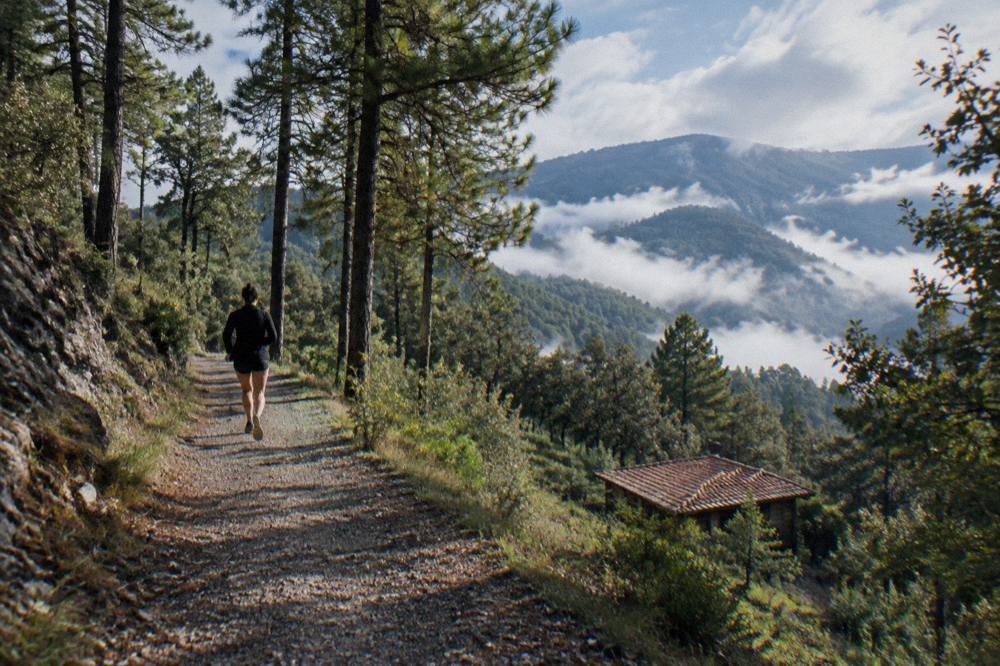
The tour list carries three guided Sierra Norte products that fit a Capulálpam-focused day: the featured trails hike across the range, a trek in Benito Juárez National Park, and a longer hike in the Pueblos Mancomunados from Cuajimoloyas, each departing from Oaxaca City with transport and a guide in the booking.
The three products differ in shape, not in kind. The featured hike covers the range's trails as a single guided day from the city. The Benito Juárez National Park trek is the shorter park option. The Cuajimoloyas hike is the full Pueblos Mancomunados commitment, a long day on mountain trails at village altitude. All three are bike-and-hiking tours listed here, all are guided, and there is no public bike-share in Oaxaca to substitute for any of them: hiking in this range is a guided-tour or self-organised proposition.
| Product | Area | What it covers | Where it starts |
|---|---|---|---|
| Sierra Norte trails hike | Sierra Norte | Guided trails across the range | Oaxaca City |
| Benito Juárez National Park trek | Sierra Norte | Guided park trekking | Oaxaca City |
| Cuajimoloyas hike | Sierra Norte | Guided Pueblos Mancomunados hike | Oaxaca City |
A reasonable plan pairs the mountain day with lighter city days around it. The culture and history walk and the mezcal tasting in the picks band above are both city products, and the itinerary pages show how to sequence a week that includes the mountains: Oaxaca In A Week is the natural frame, with the hike slotted as the one long outbound day.
Can You Combine Capulálpam With Other Oaxaca Day Trips?
You can combine a Sierra Norte village day with valley destinations only as separate legs, because the range sits about 142 minutes from the Zócalo while the eastern valley stops cluster within 25 to 57 minutes, and no combined route figure for a single loop exists. The honest structure is one mountain day plus one valley day, not a single loop, and the valley day trips have their own pages with their own numbers.
The valley alternatives are compact. Mitla is about 37 minutes, Hierve el Agua about 57, Tlacolula about 25, Teotitlán del Valle about 26, and Ocotlán about 37, all derived free-flow from the Zócalo. The classic eastern pairing is documented at Hierve El Agua Day Trip and Mitla And Tlacolula Day Trip, and the craft-village alternatives sit at San Bartolo Coyotepec Black Pottery and Ocotlán And Friday Market.
| Day-trip option from the Zócalo | Free-flow time | Type of day |
|---|---|---|
| Sierra Norte (Latuvi reference point) | about 142 min | Mountain village and hikes |
| Hierve el Agua | about 57 min | Springs and valley scenery |
| Mitla | about 37 min | INAH archaeological zone |
| Ocotlán | about 37 min | Market and craft town |
| Teotitlán del Valle | about 26 min | Weaving village |
| Tlacolula | about 25 min | Valley town and market |
| Cuilapan de Guerrero | valley drive | Convent stop |
The INAH valley sites carry published entry figures worth knowing when you build the valley day: Category I zones (Monte Albán, Mitla, Yagul) charge 105 MXN for Mexican nationals and 210 MXN for foreign visitors, while Category III zones (Dainzú, Lambityeco, Zaachila) charge 80 and 145 MXN, per the INAH pages. Zaachila opens Thursday to Sunday only, 10:00 to 16:00, which matters if the valley leg lands on a Monday.
What Should You Pack For A Sierra Norte Day From Oaxaca?
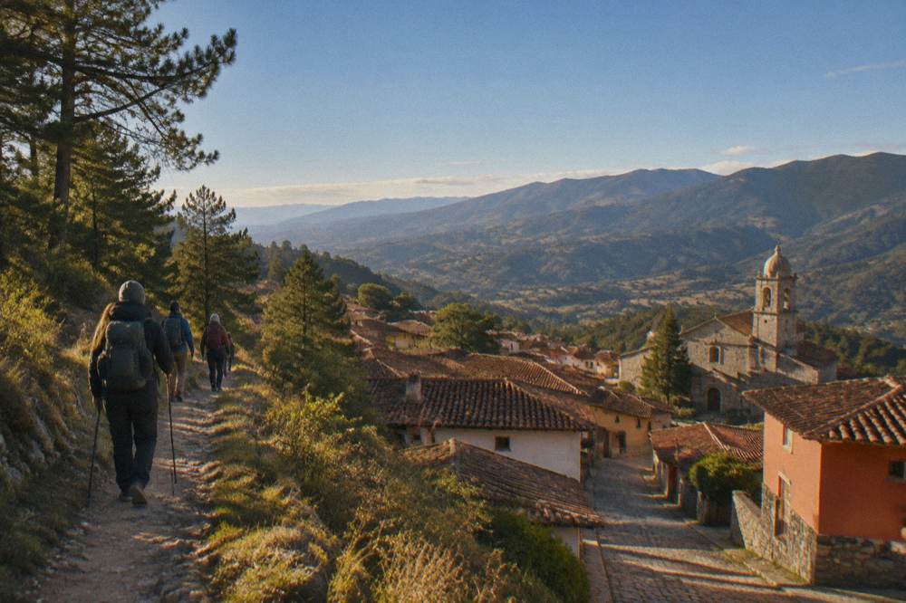
Pack for altitude and two climates in one day: the city averages run from about 10.3 C at night in January to 34.9 C daytime highs in April, the Sierra Norte is cooler again at village height, and the rainy season brings 19 to 21 rain days per month from June to September, so layers, rain gear in the wet months and sun protection for high-altitude exposure are the planning frame, with no month carrying snow anywhere in the region.
The sun point follows from the altitude rule this site prints everywhere: Oaxaca City sits at about 1,550 m, and the Sierra Norte villages sit above it. Altitude and sun exposure are the pairing the Oaxaca Altitude And Sun page covers in depth. Rain follows the SMN table: June's 188.3 mm and September's 163.6 mm are the two ends of the wet frame, and January's 2.4 mm the dry end. Footwear for mountain trails is a trail decision, so plan with the tour operator's trail description rather than a printed kilometre count.
Is The Sierra Norte Safe For Visitors From Oaxaca City?
The advisory picture for Oaxaca state is the standing frame: the UK FCDO advises against all but essential travel to parts of Mexico and does not name Oaxaca on its main page, Canada advises a high degree of caution with regional advisories, and the US State Department lists Oaxaca state at Level 2, exercise increased caution, with its restriction language in the Isthmus region rather than the city or the mountains.
The advisories name regions away from the Valles Centrales and the Sierra Norte in their restriction language: the US material, places its employee restrictions in the Isthmus, and the UK and Canada pages do not name Oaxaca among their avoid-travel areas. The practical mountain-specific point is road dependence. A Sierra Norte day is a long drive on mountain roads, blockades by teachers' unions are a standing risk in the state, and no date is attached to them here. The response is buffer time and a check of conditions on the day, not a change of destination. The Is Oaxaca Safe page carries the full wording.
Where Does Capulálpam Fit In A Week In Oaxaca?
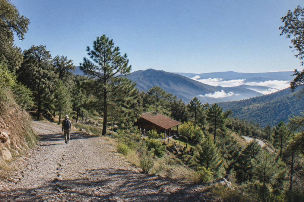
Capulálpam and the Sierra Norte work as the single mountain day in a week-long Oaxaca itinerary, with the other days spent in the city's centro histórico and the closer valley destinations at 11 to 57 minutes' drive, a structure the site's itinerary pages already document from one day through a full week. The average visitor stay in the city in 2025 was 2.00 nights per the Sectur indicators, so a Sierra Norte day is a deliberate add-on rather than a default.
The 2025 figures give the planning context: 1,324,332 tourist arrivals in the city that year, 1,111,799 national and 212,533 foreign, with hotel occupancy at 51.73 percent. A mountain day is a minority structure by those numbers, which is part of its appeal for a reader with seven days. A sensible week is one Sierra Norte day, one eastern valley day (Mitla, Hierve el Agua, Tlacolula), one craft-village day, and city days built around the Zócalo, Santo Domingo Church and the Museo De Las Culturas De Oaxaca, which opens Tuesday to Saturday only, 10:00 to 16:00.
What Does A Capulálpam Day Trip Cost From Oaxaca?
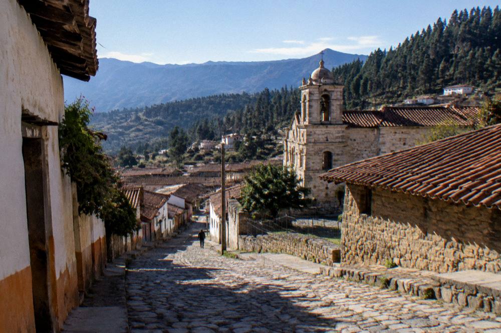
The costs you can plan from are the INAH valley entry fees (105 MXN nationals and 210 MXN foreigners at Category I sites, 80 and 145 MXN at Category III), the state lodging tax of 3 percent on hotel-type stays if the trip becomes an overnight, and the guided-hike prices shown in the tours listed on this page.
What prose can carry is structure: a guided Sierra Norte day bundles transport and guiding, so its price replaces a rental or driver plus a guide, and the lodging tax line matters only if the mountain day stretches into a village overnight, which the Pueblos Mancomunados network supports. Currency is MXN for local costs, and no exchange rate is printed because none is a standing figure.
For the city days around the mountain day, the Mercado 20 De Noviembre and the Basílica De La Soledad sit inside the walkable centre, and the Andador Macedonio Alcalá corridor ties the cathedral end of the centre to Santo Domingo.
When Is The Best Time To Visit The Sierra Norte From Oaxaca?
The dry season, November to April, is when rain days are at their lowest (1.1 to 7.6 per month from January to April) and the mountain trails at their most reliable, while June to September brings 19.9 to 21.4 rain days per month and the heaviest monthly totals, 188.3 mm in June and 163.6 mm in September.
December and January carry the coolest nights by the table, 11.0 C and 10.3 C average minimums in the city, which the mountains deepen. April carries the highest average daytime figure, 34.9 C in the city, though the Sierra Norte sits above that heat. Event timing also shapes calendars: the Guelaguetza runs as two Mondays in July at the Auditorio Guelaguetza, and Día de Muertos centres on 31 October to 2 November, with the 2026 programme not announced; the details sit at Guelaguetza Oaxaca and Día De Muertos In Oaxaca.
The mezcal option belongs on the evening after a mountain day, or on a separate city day entirely: it is a city product, and the tour list's mezcal pages, including the Mezcal Route Santiago Matatlán day trip, show the full spread from tastings to distillery visits.
Common Questions About Capulálpam De Méndez And The Sierra Norte
How Far Is Capulálpam De Méndez From Oaxaca City?
The drive from the Zócalo to Latuvi, one of the Pueblos Mancomunados villages in the Sierra Norte region, takes about 142 minutes in free-flow conditions, but real traffic and mountain roads are slower.
Can You Visit The Sierra Norte As A Day Trip From Oaxaca?
Yes, as a full day. The tour list carries three guided hikes that depart from Oaxaca City, covering the range's trails, Benito Juárez National Park and Cuajimoloyas in the Pueblos Mancomunados, with transport and guiding included in each booking.
What Is The Weather Like In The Sierra Norte?
The Sierra Norte is higher and cooler than Oaxaca City at about 1,550 m. The city's SMN station normals for 1991-2020 show dry season from November to April and rainy season from May to October, with June averaging 188.3 mm of rain and January 2.4 mm; the villages add altitude on top of those figures.
Is Capulálpam De Méndez Safe To Visit?
The advisory frame for the state is the standing one: the UK FCDO does not name Oaxaca among its avoid-travel areas, Canada advises a high degree of caution in Mexico overall, and the US State Department lists Oaxaca state at Level 2, exercise increased caution, with its employee restrictions in the Isthmus region rather than the mountains. Road blockades are a standing risk in the state and no date is attached to them.
Do You Need A Guide To Hike In The Sierra Norte?
A guided hike covers the mountain drive, the trail choice and local knowledge in one booking.
What Else Can You Combine With A Sierra Norte Day?
The realistic structure is one mountain day plus separate valley days: Mitla at about 37 minutes, Hierve el Agua at about 57 and Teotitlán del Valle at about 26 from the Zócalo, all documented on their own day-trip pages with the INAH entry fees where they apply.