Oaxaca Altitude: About 1,550 Metres, Sun And What To Expect
Oaxaca City, the inland highland capital of the state of Oaxaca in Mexico, sits at about 1,550 m in the Valles Centrales, far from any sea. The altitude thins the air a little and sharpens the sun, and the climate splits into a dry season from November to April and a rainy season from May to October.
Oaxaca City stands at about 1,550 m above sea level in the Valles Centrales, an inland valley in southern Mexico with no coast. Days are warm and nights are cool all year, the sun is strong at this elevation, and the year divides into a dry season from November to April and a rainy season from May to October with rainfall peaking from June to September.
Oaxaca City, officially Oaxaca de Juárez, is the capital of the state of Oaxaca in Mexico and an inland highland city in the Valles Centrales, standing at about 1,550 m above sea level with no sea, port or beach anywhere in the municipality. The altitude is the quiet fact behind almost everything a visitor notices: warm afternoons that slide into cool evenings, a sun that bites harder than the thermometer suggests, and a year that splits cleanly between a dry season from November to April and a rainy season from May to October. The CONAGUA climate station 20079 sits inside the city at 1,594 msnm, and the Open-Meteo digital elevation model puts the Zócalo at 1,552 m, which is why this guide, like the Oaxaca Travel Guide site as a whole, rounds the city to about 1,550 m rather than quoting a single precise figure. What follows is what the station normals, the reanalysis data and the measured terrain actually say, month by month, and what they mean for pacing a trip.
What Is The Altitude Of Oaxaca City?
Oaxaca City stands at about 1,550 m above sea level, an inland highland capital in the Valles Centrales of the state of Oaxaca. The CONAGUA climate station inside the city is recorded at 1,594 msnm and the digital elevation model gives the Zócalo at 1,552 m, so about 1,550 m is the honest round figure for the city floor.
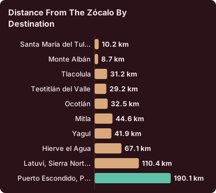
The municipality of Oaxaca de Juárez counted 270,955 inhabitants at the 2020 census, and the state it governs holds 4,132,148. Neither the city nor the state touches the sea: the Pacific coast at Puerto Escondido is about 165 minutes away by the new highway, measured as a free-flow drive of 190.1 km from the Zócalo, and it counts as a far extension of a trip rather than a local excursion. Everything within day-trip range of the centre, Monte Albán, Santa María del Tule, Teotitlán del Valle, Tlacolula, Mitla and Hierve el Agua, sits in the same highland valley system.
Two elevation numbers circulate for the city and only the rounding is disputed. The station figure of 1,594 msnm comes from the SMN normals for station 20079, and the Zócalo figure of 1,552 m comes from a digital elevation model. About 1,550 m covers what the two primary numbers actually support.
Altitude also fixes the clock, in a way that surprises visitors who expect Mexico to spring forward. Mexico abolished daylight saving time in 2022, and Oaxaca has kept UTC-6 all year since, so sunset shifts through the year only as the days lengthen and shorten. A sunrise walk to Monte Albán and a late mezcal on the Andador Macedonio Alcalá sit on the same unchanging clock all year.
How Does The Altitude Of Oaxaca City Affect Visitors?
At about 1,550 m, Oaxaca City is high enough to matter and low enough to be gentle: the air holds a little less oxygen than at sea level, afternoon effort can feel harder on the first day or two, and the sun's ultraviolet radiation is stronger than the temperature suggests. It is far below the elevations where severe altitude illness is typical, so the honest framing is pace, water and sun protection rather than alarm.
The classic threshold advice about altitude does not translate usefully here, because the city sits at a moderate elevation rather than a high one. What the elevation does change is the daily temperature swing. The SMN station normals for 1991 to 2020 put January's average daily high at 28.9 C with an average nightly low of 10.3 C, and April's average high at 34.9 C with nights near 15.8 C. A single day in the dry season can run from a jacket morning to a short-sleeve afternoon, and visitors who dress for the midday number get cold after sunset.
Hydration is the practical response. The combination of moderate altitude, dry-season air and a walking city means thirst arrives before you expect it, and the evenings ask for a layer even when the afternoon did not. The drinking water in Oaxaca question is separate from the altitude question, but the two meet in the same water bottle.
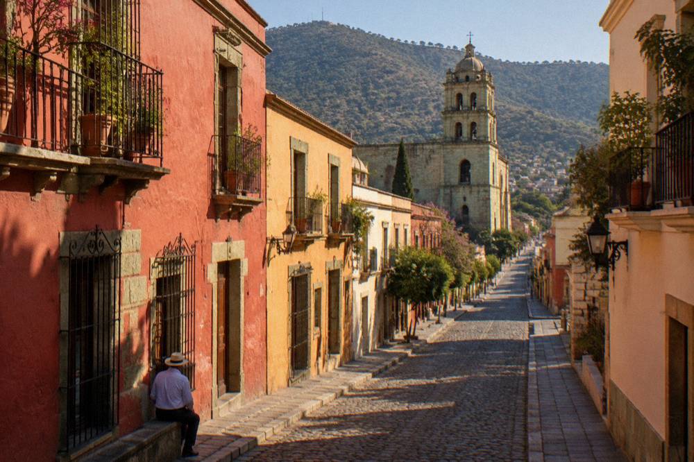
Pacing a first day well is mostly a matter of choosing low-effort, high-reward activities. A guided walk of the historic centre keeps the effort modest while the city unpacks itself, and the Culture, History and Traditions of Oaxaca City walk is the site's featured pick for exactly that first afternoon, Check availability on the operator's booking page.
How Strong Is The Sun In Oaxaca?
The sun in Oaxaca City is stronger than its latitude alone suggests, because about 1,550 m of elevation, a dry-season sky that is often cloudless from November to April, and midday temperatures that hover near 30 C combine into serious ultraviolet exposure. Sunscreen, a hat, sunglasses and shade at midday are the standard response, not optional extras for fair skin only.
Ultraviolet intensity climbs with elevation, and the dry season removes the cloud cover that would otherwise soften it. January averages 2.4 mm of rain across 1.4 rain days at the station, February 4.6 mm across 1.1 days and March 17.6 mm across 4.1 days: that is a sky with very little in it for months at a time. April then pushes the average daily high to 34.9 C, the highest of the year in the station normals, before the rains arrive to cool the afternoons down.
The practical arithmetic for a sightseeing day is simple. INAH sites open at 08:00, Monte Albán's last access is 16:00, and the strongest sun sits in the middle of that window. Starting at opening time trades an hour of harsh light for an hour of soft light, and the same logic applies to the city's own streets: the Andador Macedonio Alcalá and the Zócalo have shade, but many stretches of the Centro Histórico do not. The Oaxaca Centro Histórico guide maps which walks keep to the shaded core.
A first day that mixes the historic centre with a market lunch, the pattern the picks below follow, fits the sun and the altitude together: a walk in the softer hours, a roof or a hall at midday, and an evening outdoors once the light drops.
What Is The Weather Like In Oaxaca By Month?
Oaxaca City averages a daily high between 28.9 C and 34.9 C every month of the year, with nightly lows between 10.3 C and 16.7 C, so the weather question is really a rain question: the dry season from November to April is warm and almost rainless, and the rainy season from May to October brings afternoon rain peaking from June to September.
The SMN station 20079 normals, covering 1991 to 2020, give the full monthly picture. Annual rainfall totals 853.3 mm, and 128 days of the year carry some rain, but those days are not spread evenly: January has 1.4, while September has 21.4.
| Month | Average daily high | Average nightly low | Average rain |
|---|---|---|---|
| January | 28.9 C | 10.3 C | 2.4 mm |
| February | 31.1 C | 11.6 C | 4.6 mm |
| March | 33.3 C | 13.6 C | 17.6 mm |
| April | 34.9 C | 15.8 C | 47.3 mm |
| May | 33.8 C | 16.7 C | 97.9 mm |
| June | 30.9 C | 16.7 C | 188.3 mm |
| July | 30.1 C | 15.9 C | 118.6 mm |
| August | 30.0 C | 15.9 C | 131.8 mm |
| September | 29.1 C | 16.1 C | 163.6 mm |
| October | 29.3 C | 14.5 C | 63.1 mm |
| November | 29.0 C | 12.3 C | 9.1 mm |
| December | 28.9 C | 11.0 C | 9.0 mm |
Two readings of that table matter for planning. First, the nights: December and January average lows of 11.0 C and 10.3 C, which is jacket weather in a city where most evening life happens outdoors. Second, the afternoons: April's 34.9 C average high comes with only 47.3 mm of rain, so the month reads hot rather than wet, while June's 188.3 mm comes with a cooler 30.9 C average high. The rain, when it arrives in season, buys back the heat.
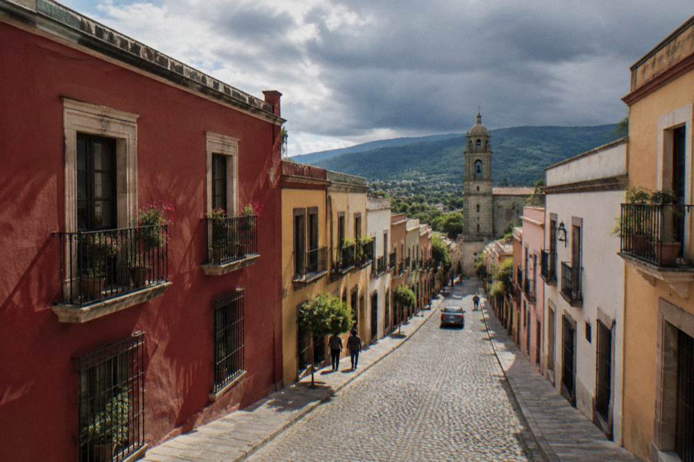
The count of rain days tells the same story from another angle, and it is the number that matters for how a day is actually shaped.
| Month | Average days with rain |
|---|---|
| January | 1.4 |
| February | 1.1 |
| March | 4.1 |
| April | 7.6 |
| May | 13.7 |
| June | 19.9 |
| July | 20.4 |
| August | 20.5 |
| September | 21.4 |
| October | 12.0 |
| November | 3.5 |
| December | 2.4 |
Twenty rain days a month in June through September does not mean twenty lost days. The month-by-month detail, including how rainy-season afternoons typically shape an itinerary, is laid out in the Oaxaca Weather By Month guide and the Best Time To Visit Oaxaca guide, and the Oaxaca In The Rain page collects what still works when the sky opens.
When Is The Rainy Season In Oaxaca?
The rainy season in Oaxaca City runs from May to October, with rainfall peaking from June to September: June averages 188.3 mm of rain, September 163.6 mm, August 131.8 mm and July 118.6 mm at the city's CONAGUA station. The dry season from November to April is the mirror image, with November at 9.1 mm and December at 9.0 mm.
State communications mark the Pacific rainy season as beginning around mid-May, and the station normals bear that out in the city itself: the jump from March's 17.6 mm to April's 47.3 mm to May's 97.9 mm is the season switching on, and October's fall back to 63.1 mm is it switching off. The rainy months also hold the steadiest temperatures of the year, with highs of about 30 C and lows of about 16 C from June through September, because cloud cover flattens both ends of the day.
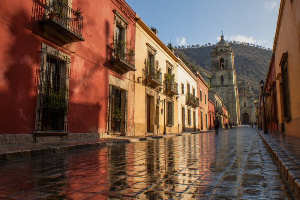
None of the climate facts rank months for you, and this site does not either: the station table says how much rain and heat each month carries, and the choice between a dry 31.1 C February and a rainy 30.9 C June is a traveller's own trade-off. What the numbers do rule out is worry about cold: no month's average daily high falls below 28.9 C, and there is no snow anywhere in the record.
What Should You Pack For Sun And Altitude In Oaxaca?
Pack for a warm day, a cool night and a strong sun: high-factor sunscreen, a wide-brimmed hat, sunglasses and a refillable water bottle for the altitude and the dry-season glare, plus a real layer for evenings that average 10.3 C to 11.0 C in December and January, and a compact rain option from June to September.
The packing list falls directly out of the numbers above. The dry season asks for sun protection first and a jacket second, because a 29.0 C November afternoon gives way to a 12.3 C average night. The rainy season swaps the priority: rain gear and quick-drying shoes matter more, and the sun returns on the many dry hours between showers, so the sunscreen stays. Footwear belongs on the list in every month, because the Centro Histórico's cobblestones and the valley's archaeological zones are walked, not driven.
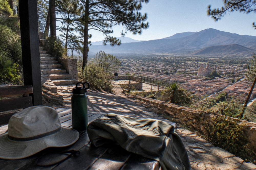
The What To Pack For Oaxaca guide carries the full checklist, and the Oaxaca Travel Costs And Budget page covers what a trip costs once the bag is packed. One altitude-specific note belongs here rather than there: the evening layer is the item visitors most often regret leaving behind, because the midday temperature is the one they packed for and the after-sunset temperature is the one they meet.
Which Day Trips From Oaxaca Stay In The Valley?
Every principal day trip from Oaxaca City stays inside the same highland valley system: Monte Albán is about 15 minutes away by road, Santa María del Tule about 11, Teotitlán del Valle about 26, Tlacolula about 25, Mitla about 37 and Hierve el Agua about 57, all measured as free-flow drives from the Zócalo, with real traffic and mountain roads making them slower.
The drive times below are computed from the Zócalo's coordinates over the road network, which means they describe an empty road; a shared van, a tour bus or market-day traffic adds time to each. Two Sierra Norte destinations are listed for contrast, because the Pueblos Mancomunados genuinely sit higher and farther than the valley circuit.
| Destination | Distance from the Zócalo | Free-flow drive time |
|---|---|---|
| Santa María del Tule | 10.2 km | about 11 minutes |
| Monte Albán | 8.7 km | about 15 minutes |
| Tlacolula | 31.2 km | about 25 minutes |
| Teotitlán del Valle | 29.2 km | about 26 minutes |
| Ocotlán | 32.5 km | about 37 minutes |
| Mitla | 44.6 km | about 37 minutes |
| Yagul | 41.9 km | about 38 minutes |
| Hierve el Agua | 67.1 km | about 57 minutes |
| Latuvi, Sierra Norte | 110.4 km | about 142 minutes |
| Puerto Escondido, Pacific coast | 190.1 km | about 165 minutes |
The sun-planning point for the valley circuit is that the archaeological zones are open sites. Monte Albán, Mitla and Yagul share INAH Category I hours, Monday to Sunday 08:00 to 17:00, with last access at 16:00 at Monte Albán and Yagul and 16:30 at Mitla, and entry of 105 MXN for Mexican nationals and 210 MXN for foreign visitors. An early start puts the strongest hours of the day behind you before the open ground does its work. The Monte Albán and Hierve El Agua guides carry the full site detail.
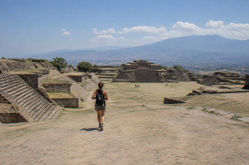
A loop that strings several valley stops into one day is the standard way to see them, and the craft-village variant below is the pick that pairs a Monte Albán morning with workshops in the afternoon shade.
Does The Highland Sun Change How You Plan A Day In Oaxaca?
Yes: the highland sun moves the day's centre of gravity toward the morning and the evening, because INAH sites open at 08:00, the strongest ultraviolet hours sit in the middle of the day, and the city's own life shifts outdoors after the light softens, so a first-day plan of early ruins or early streets, a shaded lunch and an evening in the open matches both the sun and the altitude.
The pattern writes itself once the numbers are on the table. A Monte Albán morning at opening time finishes before the afternoon heat peaks; a market lunch at Mercado 20 de Noviembre sits under a roof; a late walk through Jalatlaco or the Andador Macedonio Alcalá catches the low light that the elevation makes especially sharp. Cooking classes slot into the shaded midday hours exactly the way ruins slot into the morning.
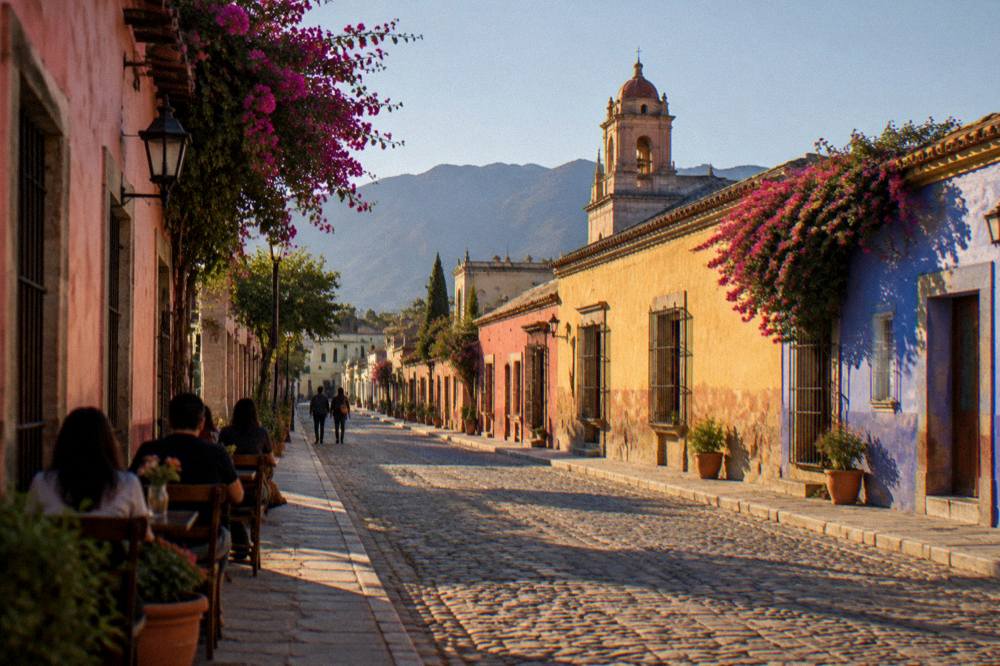
For a single-day plan built around this rhythm, the Oaxaca In One Day guide sequences the whole city, and the Things To Do In Oaxaca root page collects every option the site covers.
Common Questions About Oaxaca Altitude And Sun
Is Oaxaca City At A High Altitude?
Oaxaca City stands at about 1,550 m above sea level, which is a moderate elevation: high enough for cooler nights and stronger sun than the temperature suggests, and well below the elevations associated with severe altitude illness. The CONAGUA station inside the city is recorded at 1,594 msnm.
Do You Need To Worry About Altitude Sickness In Oaxaca?
At about 1,550 m the city is far below the elevations where altitude sickness is typical. The practical adjustments are pacing the first day, drinking water and protecting skin from the sun, which is stronger at this elevation than at sea level.
How Cold Does Oaxaca Get At Night?
Average nightly lows range from 10.3 C in January and 11.0 C in December to 16.7 C in June, per the SMN station normals for 1991 to 2020. Evenings from November to February ask for a real layer.
When Is The Rainy Season In Oaxaca?
The rainy season runs from May to October, peaking from June to September: June averages 188.3 mm of rain and September 163.6 mm at the city station. The dry season from November to April averages under 50 mm per month, with January at 2.4 mm.
Is The Sun Strong In Oaxaca?
Yes. About 1,550 m of elevation, dry-season skies that carry as few as 1.1 rain days a month and average daily highs near 30 C combine into serious ultraviolet exposure. Sunscreen, a hat, sunglasses and midday shade are the standard response.
Does Oaxaca Change Its Clocks For Daylight Saving?
No. Mexico abolished daylight saving time under a law published on 28 October 2022, and Oaxaca has kept UTC-6 all year since, so the clock never shifts.