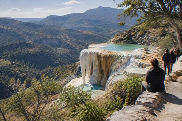
How Long Is The Drive From Oaxaca To Hierve El Agua?
The drive from Oaxaca City to Hierve el Agua is about 67 km and about 57 minutes in free-flow conditions, with the mountain approach often taking longer. Here is the full route picture.
The petrified waterfalls of Hierve el Agua sit in the mountains east of the Tlacolula Valley, and every route there starts in the highland basin where Oaxaca City lies at about 1,550 m. Route modelling on mapped roads, run from the Zócalo and measured in free-flow conditions, puts the one-way distance at about 67 kilometres and the driving time at about 57 minutes. That estimate is a derived figure, not an official one, and the final stretch of mountain road means the real trip usually takes longer, sometimes much longer in rain or on market days.
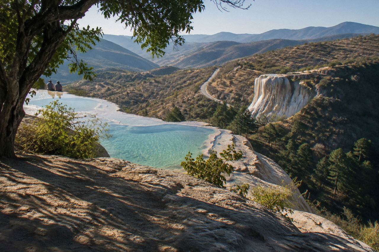
The drive from the Zócalo in Oaxaca City to Hierve el Agua covers about 67 kilometres and takes about 57 minutes in free-flow conditions, according to route modelling on mapped roads. The figure is derived rather than official, and the last section climbs mountain roads where traffic, weather and shared transit slow the pace, so a realistic door-to-door estimate runs well past the hour mark each way.
Straight-line distance is a different measure and a misleading one for planning: the mapped places put Hierve el Agua about 52 kilometres from the city as the crow flies, while the road you actually drive stretches that to about 67 kilometres because the route bends through the Tlacolula Valley before turning uphill. Anyone budgeting a day around the site should plan on the road figure, not the map measurement, and should pad it for the climb.
The 57-minute estimate comes from route modelling over OpenStreetMap road data with no traffic, no rain and no stops. The team at Oaxaca Travel Guide treats these as baseline numbers: they tell you the drive is a comfortable half-day outing rather than an epic crossing, and they are honest about being optimistic rather than realistic. In practice the two-lane roads through Tlacolula, Mitla and the villages beyond carry local traffic, topes and occasional freight, and the unpaved-feeling final ascent to the springs is where most of the extra minutes arrive.
For context within the same valley system, the other headline drives from the Zócalo are short: Santa María del Tule about 11 minutes, Teotitlán del Valle about 26, Tlacolula about 25 and Mitla about 37. Hierve el Agua is the far end of that chain, roughly twenty minutes of climbing beyond Mitla. A fuller run through these stops is mapped in the Hierve el Agua day trip guide, and the site itself is covered in detail at Hierve el Agua.
What Does The Route From Oaxaca City Look Like?
The route leaves Oaxaca City eastbound along the valley floor, passing the Tule tree, Teotitlán del Valle and Tlacolula before reaching Mitla at about kilometre 45, then turns north into the mountains for the final climb to Hierve el Agua. Valley sections are paved two-lane road, the last section is a slow mountain ascent, and the whole drive crosses three distinct speed regimes.
The first leg is fast. From the Zócalo the road heads out through the eastern edge of the city and onto the valley corridor, where the flat run to Tule takes about 11 minutes and Tlacolula about 25. Mitla sits at about 44.6 kilometres and about 37 minutes in the free-flow model, and it works as the natural last stop for fuel, cash and a look at the archaeological zone, which the INAH page lists as open daily 08:00 to 17:00 with last access at 16:30, entry 105 MXN for nationals and 210 MXN for foreign visitors.
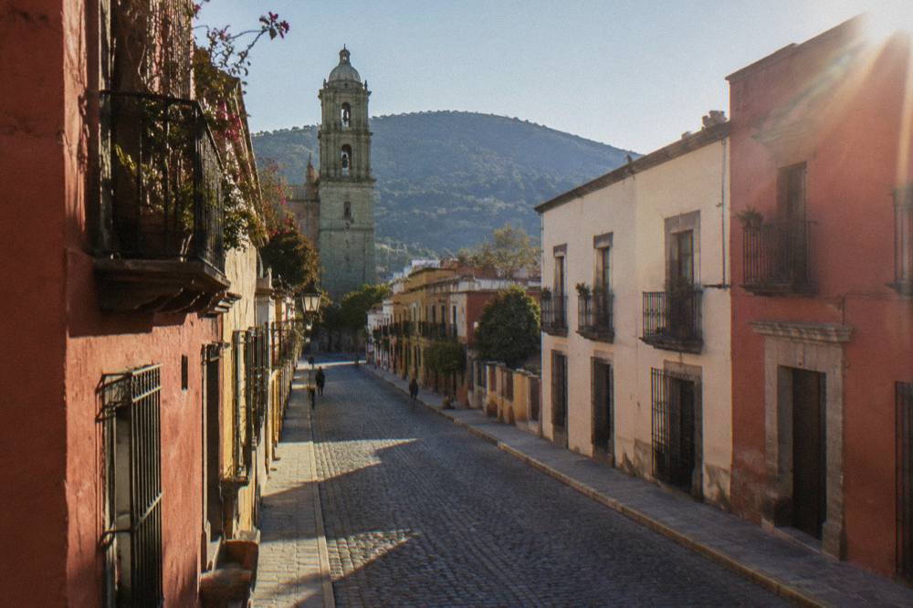
After Mitla the character changes. The road turns uphill toward San Lorenzo Albarradas and the communities that administer access to the springs, and average speeds drop sharply on the switchbacks. Route modelling still prices this last stretch at roughly twenty minutes, but that assumes a clear road. Community checkpoints, trucks and livestock can each add time, and rain in the May-to-October wet season can add more. September averages 163.6 mm of rain by the SMN station normals, and June 188.3 mm, so a wet-season drive deserves a generous buffer.
| Leg | Distance From The Zócalo | Free-Flow Time |
|---|---|---|
| Santa María del Tule | 10.2 km | about 11 min |
| Teotitlán del Valle | 29.2 km | about 26 min |
| Tlacolula | 31.2 km | about 25 min |
| Mitla | 44.6 km | about 37 min |
| Hierve el Agua | 67.1 km | about 57 min |
The table stacks up the whole eastern valley corridor. Note that the distances are modelled from the Zócalo, so the Mitla-to-Hierve segment is the difference between the two rows, about 22 kilometres of climbing that eats a disproportionate share of the clock.
Should You Drive Yourself Or Book A Tour To Hierve El Agua?
Driving yourself to Hierve el Agua takes about 57 minutes each way in ideal conditions and gives full control over timing, while a booked excursion hands the mountain driving, parking and community access to an operator and bundles valley stops into one loop. The road is navigable in a standard rental car in dry conditions, and the decision usually comes down to appetite for mountain driving versus schedule freedom.
The independent route suits travellers who want to reach the springs early or late and linger. There is no primary-source fee or timetable to quote for Hierve el Agua, since community administration means access terms are set locally and change, so independent drivers should carry cash and check conditions before setting out. The trade is real: the return drive after a full morning in the sun is the same 67 kilometres back down.
The tour route trades that wheel time for coverage. The tour list's valley loops pair Hierve el Agua with Mitla, the Tule tree, weaving villages and a mezcal stop, which in a rental would be four separate parking puzzles along the same corridor. A widely booked option is the Hierve el Agua, Tule Tree, Mitla, Rugs and Mezcal loop, whose listing carries its own price, rating and duration. Check availability on the operator's booking page to see current departure times and terms.
Whether a day at the springs is worth the drive at all is its own question, weighed in detail at Is Hierve el Agua worth it?, and the broader week plan that fits the drive in sits in Oaxaca in 5 days.
What Slows The Drive Down Beyond The Free-Flow Estimate?
Three things stretch the 57-minute baseline: mountain traffic and topes on the valley floor, the community-controlled final ascent where gates and checkpoints hold cars, and wet-season weather, with June through September averaging between 118.6 and 188.3 mm of rain per month at the Oaxaca station. None of these closes the road, but together they can push the drive well past ninety minutes.
The wet season deserves the most respect. The SMN station normals for Oaxaca put June at 188.3 mm of rain, July at 118.6 mm, August at 131.8 mm and September at 163.6 mm, and mountain runoff affects the climb beyond Mitla more than the paved valley floor. Drivers heading up in those months should leave a margin, aim to descend in daylight, and treat the dry November-to-April window as the forgiving one: November averages 9.1 mm and December 9.0 mm.
The second factor is administrative rather than meteorological. Hierve el Agua is run by the local communities, not by INAH, so access arrangements sit outside the state's published site system. That means no printed timetable here, and it also means the last stretch can include a wait at a control point in busy periods. The third factor is simply the corridor itself: the same two-lane road serves Tule, Teotitlán del Valle, Tlacolula and Mitla, so a Sunday or a festival day in any of them slows the first half of the drive.
How Does The Hierve El Agua Drive Compare With Other Trips From Oaxaca?
At about 67 kilometres and about 57 minutes free-flow, Hierve el Agua is the longest regular valley drive from Oaxaca City but still under half the distance of the coast runs: Puerto Escondido is about 190 kilometres and about 165 minutes on the new highway, and Latuvi in the Sierra Norte about 142 minutes. The springs sit at the far edge of what works as an easy day trip.
Inside the Valles Centrales everything else is closer. Monte Albán is about 15 minutes west, Yagul about 38 minutes out the same eastern corridor, Ocotlán about 37 minutes south. A visitor combining the eastern valley in one day can reasonably chain Tule, Teotitlán del Valle, Mitla and Hierve el Agua, because each leg is short once the corridor is entered; the modelling below shows how the distances stack.
| Destination From The Zócalo | Road Distance | Free-Flow Time | Character |
|---|---|---|---|
| Monte Albán | 8.7 km | about 15 min | Short western climb |
| Santa María del Tule | 10.2 km | about 11 min | Flat valley run |
| Teotitlán del Valle | 29.2 km | about 26 min | Valley corridor |
| Yagul | 41.9 km | about 38 min | Eastern valley |
| Mitla | 44.6 km | about 37 min | Eastern valley |
| Hierve el Agua | 67.1 km | about 57 min | Valley plus mountain climb |
| Latuvi, Sierra Norte | 110.4 km | about 142 min | High mountain road |
| Puerto Escondido | 190.1 km | about 165 min | Long highway crossing |
The comparison matters for planning. Hierve el Agua is comfortably a half-day-plus outing, and a two-night visitor on the city's average stay can fit it once with care. The coast is a different category entirely: about 165 minutes of modelled driving on the new highway makes Puerto Escondido an extension with its own overnight, never a day trip bolted onto the springs.
Common Questions About The Oaxaca To Hierve El Agua Drive
How Long Is The Drive From Oaxaca To Hierve El Agua?
About 67 kilometres and about 57 minutes each way in free-flow conditions, per route modelling on mapped roads from the Zócalo. Real mountain traffic, community checkpoints on the final climb and wet-season rain usually extend the drive beyond an hour.
Is The Road To Hierve El Agua Paved?
The valley floor section through Tlacolula and Mitla is paved two-lane road. The final climb beyond Mitla toward San Lorenzo Albarradas is the slow stretch, and conditions there vary; the free-flow model assumes a clear run that real driving rarely gets.
Can You Visit Mitla And Hierve El Agua On The Same Day?
Yes. Mitla sits at about 44.6 kilometres and about 37 minutes from the Zócalo, directly on the way to the springs, so the two combine naturally on one eastern-valley outing. The INAH page lists Mitla daily 08:00 to 17:00, last access 16:30, entry 105 MXN for nationals and 210 MXN for foreign visitors.
Is The Drive Safe In The Rainy Season?
The dry season runs November to April and the rainy season May to October, with June averaging 188.3 mm of rain at the Oaxaca station. The valley floor drains fast, but the mountain climb deserves daylight and a time buffer in wet months; there is no official road-status figure to quote, so local conditions govern.
Do You Need A Car To Get To Hierve El Agua?
No. Booked valley tours run the route from Oaxaca City and bundle stops such as Mitla, Tule and a mezcal distillery, which is why the loop is the most-listed day-trip product on the corridor. Driving independently is also routine in dry conditions, with the caveats about the final climb above.
Whichever way the trip is run, the honest planning number is not the 57-minute model but the hour-plus reality of a mountain approach, budgeted with a stop at Mitla on the way out and daylight on the way back.