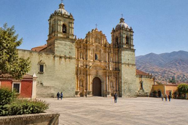
Oaxaca State Versus Oaxaca City: What Each Name Means
Oaxaca is both a Mexican state and the inland highland city at its heart, and the two names cover wildly different amounts of ground.
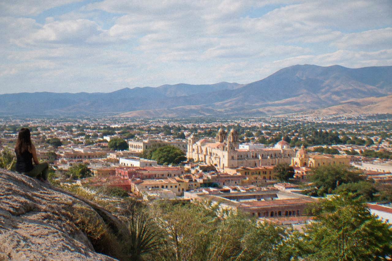
Oaxaca state is a Mexican federal entity with a population of 4,132,148, while Oaxaca City (Oaxaca de Juárez) is its capital, an inland valley city of 270,955 people at about 1,550 m of altitude.
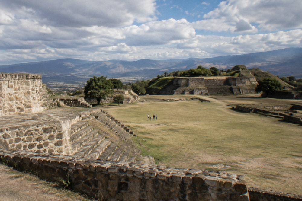
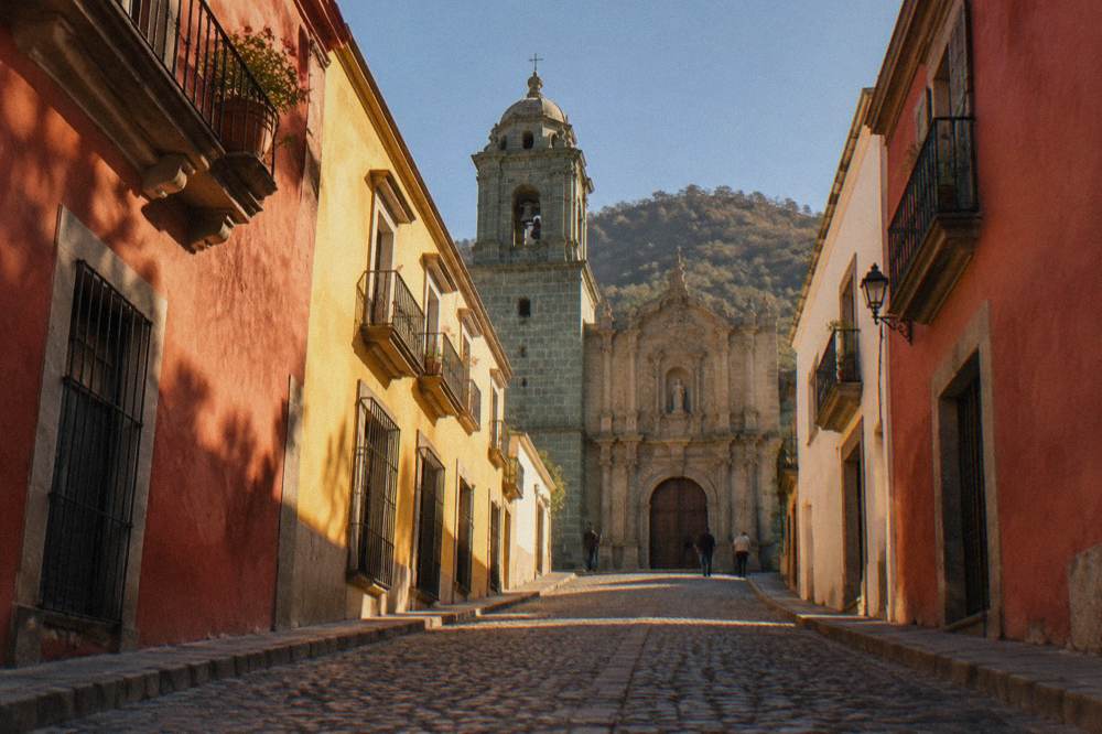
Oaxaca City, the capital of the state of Oaxaca in Mexico, sits inland in the Valles Centrales highlands at about 1,550 m, and the two names trip up almost every first-time researcher of the region. The state is enormous, a Mexican federal entity, with a population of 4,132,148 at the 2020 census. The city is a single municipality of 270,955 people, founded in 1529 under the name Antequera, and the historic core of it shares World Heritage listing with Monte Albán as property 415, "Historic Centre of Oaxaca and Archaeological Site of Monte Albán". This page separates the two cleanly and then maps what each one offers a visitor.
What Is The Difference Between Oaxaca State And Oaxaca City?
Oaxaca is both a state and a city, and the difference is one of scale and government: the state of Oaxaca is a federal entity of Mexico with a 2020 census population of 4,132,148, while Oaxaca City, formally Oaxaca de Juárez, is the state capital, a single municipality of 270,955 people in the inland Valles Centrales. Travellers who say "Oaxaca" usually mean the city, but the state covers coast, mountains and valleys far beyond it.
The repetition is a naming quirk rather than an accident. Mexico is divided into federal entities, and Oaxaca is one of them, stretching from the Pacific coast to the Sierra Norte. Its capital carries the state name plus the honorific "de Juárez", and the answer to the question is Oaxaca a state or a city is simply: both, at different scales. When a flight schedule, a bus ticket or a festival programme says Oaxaca, it almost always means the city, formally Oaxaca de Juárez.
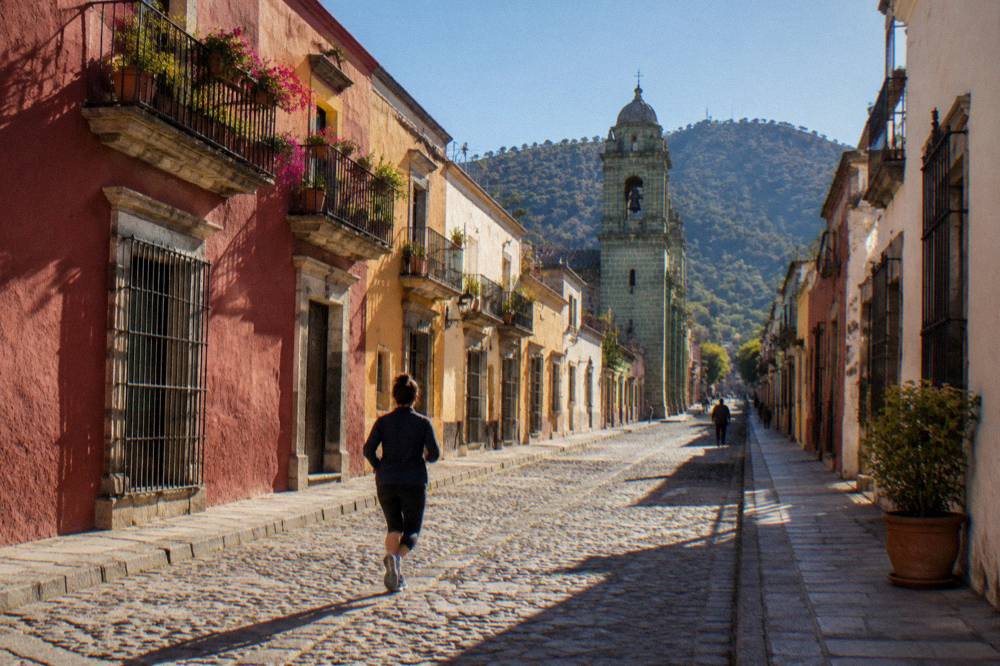
For trip planning the distinction matters immediately. Everything within walking distance of the Zócalo, every market stall in the centre, every rooftop bar and every museum on the Andador Macedonio Alcalá belongs to the city. The state is what you cross to reach the Pueblos Mancomunados in the Sierra Norte, the palm-lined stretches near the coast or the Isthmus region to the east, and those are multi-hour journeys by road, not extensions of a city walk.
Where Is Oaxaca City And Why Does The Name Repeat?
Oaxaca City lies inland, in the Valles Centrales of southern Mexico, at about 1,550 m of altitude, with no sea, no beach and no navigable river anywhere near it. The name repeats because the city is the state capital: founded in 1529 as Antequera, it later took the state's name plus de Juárez, and the Pacific coast, roughly a three-hour drive away on the new highway, belongs to the state but not to the city.
The altitude figure comes from mapping at the Zócalo, which sits at about 1,552 m, and the SMN climate station in the city at 1,594 m; the site rounds all of this to about 1,550 m. What that altitude buys the visitor is a highland climate rather than a tropical one: the SMN normals for 1991 to 2020 give January a mean daily low of 10.3 C and April a mean daily high of 34.9 C, with an annual rain total of 853.3 mm concentrated between May and October.
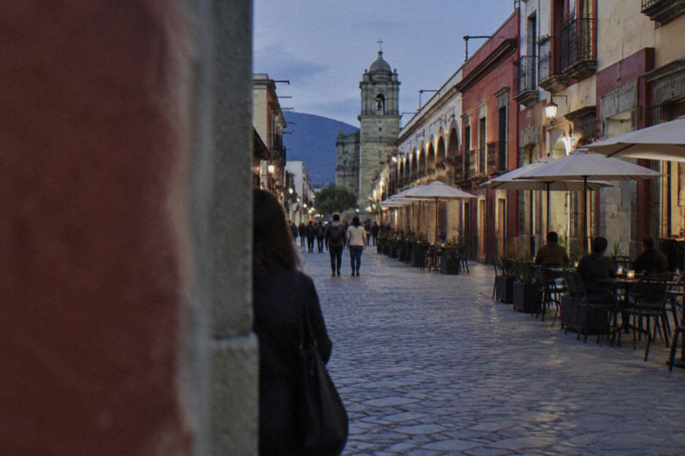
The naming also explains a common booking error. A search for beaches "in Oaxaca" returns Puerto Escondido, Mazunte and Huatulco, all of which are in the state but are hours from the city by mountain road. The city itself is the base for Monte Albán, Mitla, Hierve el Agua and the craft villages of the valley, all reachable in under an hour of driving. Planning pages such as how many days in Oaxaca work from the city outward for exactly this reason.
How Big Is Oaxaca State Compared With The City?
By population the state holds 4,132,148 people against the city's 270,955, roughly fifteen times more, and the city municipality itself covers only the central valley floor while the state spans Pacific coastline, the Sierra Norte and the Isthmus. The state recorded about 6.3 million tourist arrivals in preliminary 2025 indicators, while the city alone recorded 1,324,332 arrivals in 2025, of which 212,533 were foreign visitors.
The visitor figures come from the state tourism indicators published for 2025, and they show where tourism actually concentrates. City hotel occupancy averaged 51.73 percent across the year, with an average stay of 2.00 nights, and the split was 83.95 percent national against 16.05 percent foreign. Within the archaeological zones, Monte Albán took 416,675 visitors in 2025 and Mitla 104,428, while smaller sites such as Yagul (10,185), Lambityeco (5,545) and Zaachila (4,229) took a fraction of that.
| Unit | Population (2020 census) | 2025 visitor figure | Source basis |
|---|---|---|---|
| Oaxaca state | 4,132,148 | about 6.3 million arrivals, preliminary | Censo 2020; Sectur indicators |
| Oaxaca de Juárez municipality | 270,955 | 1,324,332 arrivals (212,533 foreign) | Censo 2020; Sectur indicators |
| Monte Albán | part of state sites | 416,675 visitors | Sectur indicators |
| Mitla | part of state sites | 104,428 visitors | Sectur indicators |
A practical reading: the state's headline tourism numbers include the coast and the Isthmus, but the city and its valley sites absorb the clear majority of the archaeological visits. Anyone whose itinerary is built on Monte Albán, the markets and the craft villages is effectively staying inside a small radius of the capital, and pages like things to do in Oaxaca reflect that concentration.
What Does De Juárez Mean In The City's Name?
The city's formal name, Oaxaca de Juárez, attaches the honorific "de Juárez" to the state name, a naming pattern used for the capital municipality, and the city was founded in 1529 under the earlier name Antequera before the modern form took hold. The state constitution treats Oaxaca de Juárez as the seat of the state government, so the double name marks a capital city inside a same-named state.
The city also anchors the UNESCO property inscribed as "Historic Centre of Oaxaca and Archaeological Site of Monte Albán", property 415, which pairs the colonial centre with the hilltop zone above it. That inscription is a city-plus-site listing, not a state-wide one, and it is the formal recognition behind the phrase "World Heritage city" that appears across tourism material. The constraints of this page stop short of any further history beyond those dated facts.
Day-to-day, the name appears on transport and tickets. ADO lists the capital as Oaxaca de Juárez on its site, the airport code OAX serves the city at Xoxocotlán, and INAH site pages list Monte Albán under the municipality of Santa María Xoxocotlán just outside the capital. None of this changes what a visitor does; it only changes what the ticket says.
Which Places Sit In The Valles Centrales Around Oaxaca City?
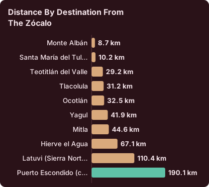
The Valles Centrales hold the city and its day-trip ring: Monte Albán about 15 minutes away by road, Santa María del Tule about 11 minutes, Teotitlán del Valle about 26, Tlacolula about 25, Ocotlán about 37, Mitla about 37 and Hierve el Agua about 57, all measured from the Zócalo as free-flow drives that real traffic and mountain roads make slower. These are the places a city-based visitor actually reaches.
Those drive times are derived from route mapping on OSM roads and are rounded up deliberately. They define a practical state-within-the-state: a circle of roughly an hour's driving that contains the INAH archaeological zones, the weaving town of Teotitlán del Valle, the black pottery and alebrije villages, the mezcal route around Santiago Matatlán and the petrified pools of Hierve el Agua. The craft villages cluster in this ring, which is why tours from the city bundle three or four of them in a single day. The rest of the planning pages sit on Oaxaca Travel Guide.
| Destination from the Zócalo | Distance | Free-flow drive time | What it is |
|---|---|---|---|
| Monte Albán | 8.7 km | about 15 min | INAH Category I archaeological zone |
| Santa María del Tule | 10.2 km | about 11 min | Town known for the Tule tree |
| Teotitlán del Valle | 29.2 km | about 26 min | Weaving village |
| Tlacolula | 31.2 km | about 25 min | Valley town with a Sunday market |
| Ocotlán | 32.5 km | about 37 min | Valley town with a Friday market |
| Yagul | 41.9 km | about 38 min | INAH Category I archaeological zone |
| Mitla | 44.6 km | about 37 min | INAH Category I archaeological zone |
| Hierve el Agua | 67.1 km | about 57 min | Petrified waterfalls and pools |
| Latuvi (Sierra Norte) | 110.4 km | about 142 min | Pueblos Mancomunados trailhead |
| Puerto Escondido (coast) | 190.1 km | about 165 min | Pacific beach town, new highway |
The two ends of that table make the state-versus-city point better than any statistic. Hierve el Agua is a feasible half-day from the city; Puerto Escondido is a distinct trip of its own, roughly three hours on the new highway before mountain roads and traffic add more. Treating the coast as a day trip from the capital is the single commonest planning error the name confusion produces.
How Do The INAH Sites Compare Across The State?
INAH zones in the state charge by category: Category I sites, Monte Albán, Mitla and Yagul, cost 105 MXN for Mexican nationals and 210 MXN for foreign visitors, while Category III sites, Dainzú, Lambityeco and Zaachila, cost 80 MXN and 145 MXN, with Zaachila open only Thursday to Sunday, 10:00 to 16:00, and Atzompa closing at 16:00 with last access at 15:00.
The fees and hours come from the individual INAH pages for each zone, and the differences matter for planning. Monte Albán, Mitla and Yagul keep 08:00 to 17:00 hours, with last access at 16:00 at Monte Albán and Yagul and 16:30 at Mitla. Zaachila's four-day week is the trap: it opens Thursday to Sunday only. Atzompa's early closing is the other one. The Museo de las Culturas de Oaxaca, in the Santo Domingo complex in the city, is open Tuesday to Saturday, 10:00 to 16:00, at the Category I rate of 105 and 210 MXN.
| INAH site | Days | Hours | Last access | Nationals | Foreigners |
|---|---|---|---|---|---|
| Monte Albán | Mon to Sun | 08:00 to 17:00 | 16:00 | 105 MXN | 210 MXN |
| Mitla | Mon to Sun | 08:00 to 17:00 | 16:30 | 105 MXN | 210 MXN |
| Yagul | Mon to Sun | 08:00 to 17:00 | 16:00 | 105 MXN | 210 MXN |
| Dainzú | Mon to Sun | 08:00 to 17:00 | 16:30 | 80 MXN | 145 MXN |
| Lambityeco | Mon to Sun | 08:00 to 17:00 | 16:30 | 80 MXN | 145 MXN |
| Zaachila | Thu to Sun | 10:00 to 16:00 | listed at closing | 80 MXN | 145 MXN |
| Atzompa | Mon to Sun | 08:00 to 16:00 | 15:00 | not on the page | not on the page |
Visits outside normal INAH hours are possible at several zones at a flat 730 MXN, a figure listed on the Yagul, Lambityeco, Atzompa and Museo de las Culturas pages. For the city-based visitor the practical reading is simple: Category I sites anchor the big day trips, and the smaller Category III zones slot into craft-village routes when their days align.
What Does The State Offer Beyond The Valles Centrales?
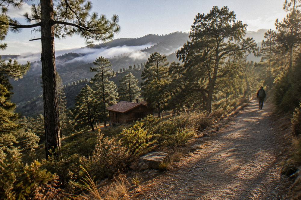
Beyond the valleys, the state offers the Sierra Norte and the Pueblos Mancomunados, whose trailheads such as Latuvi sit about 142 minutes by road from the Zócalo, and the Pacific coast at Puerto Escondido about 165 minutes on the new highway, both multi-hour journeys that belong to a separate leg of a trip rather than to a day out of the city. The state, not the city, is the scale these routes demand.
The Sierra Norte holds community-managed villages linked by trails, with hikes offered from the city covering around five hours on those routes, and the state's altitude range is the reason: the valleys sit near 1,550 m while the mountains climb well above that, changing the weather, the vegetation and the logistics in a single drive. Coast pages such as Oaxaca to Puerto Escondido sibling coverage aside, the coast is reached either by road through the mountains or by air, and every listed coast product departs from the city side, never the reverse.
The Isthmus region sits to the east, and the US State Department lists Oaxaca state at Level 2, exercise increased caution, with restrictions for its own staff in the Isthmus while carrying none for Oaxaca City, Monte Albán, Puerto Escondido or Huatulco. The UK FCDO page advises against all but essential travel to parts of Mexico and does not name Oaxaca among them; Canada advises a high degree of caution for Mexico overall. A dedicated page covers is Oaxaca safe in full, including the standing risk of road blockades by teachers' unions that can disrupt road and airport access.
What Is The Weather Like In The City And The State?
The SMN station normals for Oaxaca City, 1991 to 2020, give a dry season from November to April and a rainy season from May to October with its peak from June to September, a mean daily high of 34.9 C in April and mean daily lows of 10.3 C in January and 11.0 C in December, and an annual rain total of 853.3 mm, with June alone averaging 188.3 mm against January's 2.4 mm.
Those are station normals for the city, and the state around it varies with altitude: the coast runs hotter, the Sierra Norte cooler. The monthly pattern, though, holds across the region, and it drives everything from festival timing to trail conditions. Rain falls on an average of 19.9 days in June and 21.4 in September, against 1.4 days in January, which is why the dry half of the year carries the visitor weight.
| Month | Mean high C | Mean low C | Rain mm | Days with rain |
|---|---|---|---|---|
| Jan | 28.9 | 10.3 | 2.4 | 1.4 |
| Feb | 31.1 | 11.6 | 4.6 | 1.1 |
| Mar | 33.3 | 13.6 | 17.6 | 4.1 |
| Apr | 34.9 | 15.8 | 47.3 | 7.6 |
| May | 33.8 | 16.7 | 97.9 | 13.7 |
| Jun | 30.9 | 16.7 | 188.3 | 19.9 |
| Jul | 30.1 | 15.9 | 118.6 | 20.4 |
| Aug | 30.0 | 15.9 | 131.8 | 20.5 |
| Sep | 29.1 | 16.1 | 163.6 | 21.4 |
| Oct | 29.3 | 14.5 | 63.1 | 12.0 |
| Nov | 29.0 | 12.3 | 9.1 | 3.5 |
| Dec | 28.9 | 11.0 | 9.0 | 2.4 |
A month-by-month breakdown lives on Oaxaca weather by month, and timing questions are covered on best time to visit Oaxaca. What the state-versus-city lens adds is this: the city's normals describe the valley floor, and any plan that leaves the valley, uphill to the Sierra or down to the coast, should budget for different weather on the same day.
How Do You Get Into Oaxaca State And Around?
Almost every visitor enters through Oaxaca City: Xoxocotlán International Airport (OAX) is operated by ASUR with normal operating hours of 06:00 to 20:00, ADO buses run into the capital's terminal from Mexico City and other cities, and once in the valley the practical radius is the day-trip ring of the Valles Centrales, with the coast and the Sierra Norte as separate road legs. The city is the hub; the state is the network around it.
Arrival pages cover each option in detail, from flights to Oaxaca and the Oaxaca airport itself to Mexico City to Oaxaca and the ADO bus alternative. Within the state, movement splits cleanly: the valley ring by tour, colectivo or rental car, the Sierra by pre-booked transport, and the coast by highway or a connecting flight. The card constraints here do not license printed fares for taxis, colectivos or buses, so those figures stay off the page and live on the getting-around pages instead.
How Many Days Should The State Get Versus The City?
A city-and-valley plan needs three to five days to cover the centre, Monte Albán, one craft-village day and either Hierve el Agua or a cooking class, while adding the Sierra Norte or the coast means adding one to three more days each, because the drive times of roughly 142 minutes to Latuvi and 165 minutes to Puerto Escondido make them destinations rather than detours.
The city's own average stay of 2.00 nights in 2025 suggests many visitors compress exactly this way, and the itinerary pages are built to match: Oaxaca in 3 days coverage and its siblings run from one day to a full week. The honest split is that the city rewards depth, markets, museums, meals and a food tour logic of eating widely, while the state rewards distance, adding a coast leg or a mountain hike as a deliberate second act.
A one-week state plan that keeps the city as base might run: two days in the centre including Santo Domingo and the museums, one day for Monte Albán plus Atzompa, one full valley loop for Mitla, Tule, Teotitlán del Valle and Hierve el Agua, one day for markets and mezcal around Santiago Matatlán, and the final two days either on the coast or on a Sierra Norte trail. That is a state trip. Anything shorter stays a city trip, and there is nothing wrong with that; the centre alone holds the UNESCO listing.
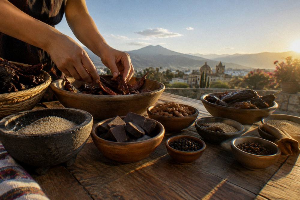
For visitors who want the city interpreted rather than just walked, the street art tour led by a working artist covers the mural routes of the capital's neighbourhoods, and the operator's booking page carries the current price and availability: Check availability. Lodging bases across the centre and the surrounding neighbourhoods are compared on where to stay in Oaxaca.
Common Questions About Oaxaca State Versus Oaxaca City
Is Oaxaca A State Or A City?
Both. Oaxaca is a Mexican federal entity, with a population of 4,132,148 at the 2020 census, and Oaxaca de Juárez is its capital city, a municipality of 270,955 people in the Valles Centrales.
How Far Is The Beach From Oaxaca City?
Puerto Escondido is about 190 km and about 165 minutes of free-flow driving from the Zócalo on the new highway, and real mountain traffic makes it slower. The city itself is inland, with no sea or beach.
What Does Oaxaca De Juárez Mean?
It is the capital's formal name: the state name plus the de Juárez honorific. The city was founded in 1529 under the earlier name Antequera.
Do All The Archaeological Sites In The State Charge The Same?
No. INAH Category I sites, Monte Albán, Mitla and Yagul, charge 105 MXN for nationals and 210 MXN for foreigners. Category III sites, Dainzú, Lambityeco and Zaachila, charge 80 MXN and 145 MXN.
Can You Visit The Whole State From Oaxaca City?
The Valles Centrales, yes, as day trips of roughly 15 to 57 minutes of driving each way. The Sierra Norte trailheads at about 142 minutes and the coast at about 165 minutes are separate legs, not day trips from the city.
Is Monte Albán In The City Or The State?
Monte Albán is an INAH archaeological zone in the municipality of Santa María Xoxocotlán, about 15 minutes by road from the Zócalo, and it shares the UNESCO World Heritage listing with the city's historic centre as property 415.
The short version: Oaxaca City is the walkable, UNESCO-listed capital in the valley, Oaxaca state is the vast entity around it, and a well-planned trip uses the first as a base for the parts of the second that fit inside an hour of driving before it commits to the longer roads.