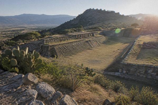
Oaxaca Map: City, Valleys And Coast In One View
Oaxaca City sits inland in the highland Valles Centrales of Mexico, about 1,550 m above sea level, with Monte Albán to the west, craft villages to the east and south, and the Pacific coast a long drive or a short flight away. This page lays the destination out the way a map does: distances first, then the valleys, then the coast.
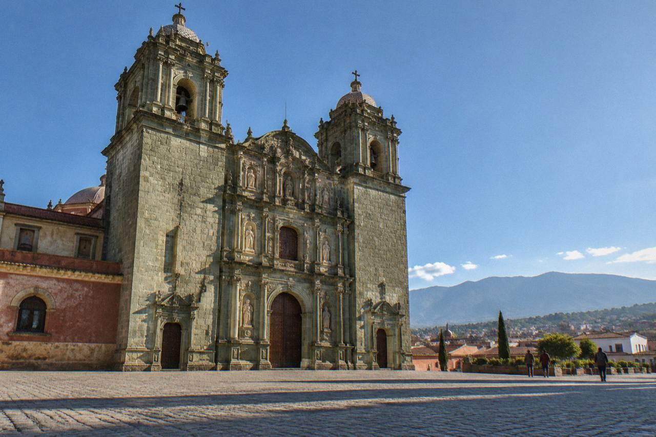
Oaxaca City (Oaxaca de Juárez) is the capital of the state of Oaxaca, an inland highland city at about 1,550 m in the Valles Centrales. Monte Albán lies about 15 minutes west by road, the Tlacolula Valley villages 25 to 60 minutes east, and the Pacific coast about 165 driving minutes away on the newer highway.
The map of this destination confuses people before they arrive, and the confusion starts with the name. Oaxaca is a state, and Oaxaca City (Oaxaca de Juárez) is its capital, an inland highland city in the Valles Centrales of Mexico at about 1,550 m, with no sea, no port and no beach anywhere near the centre. The municipality counted 270,955 inhabitants at the 2020 census, and the state 4,132,148. Everything a visitor does here sorts onto one clear map: a compact colonial core, a ring of archaeological zones and craft villages within an hour of the Zócalo (Plaza de la Constitución), the Sierra Norte rising beyond, and the Pacific coast far to the southwest as an extension rather than a day trip. The UNESCO World Heritage property, "Historic Centre of Oaxaca and Archaeological Site of Monte Albán" (property 415), covers the two anchors of that map. This page walks the map outwards from the centre, with distances checked against mapped roads.
Where Is Oaxaca City On The Map?
Oaxaca City is the capital of the state of Oaxaca in southern Mexico, an inland highland city in the Valles Centrales at about 1,550 m of altitude, founded in 1529 as Antequera, with the Zócalo at its centre and Monte Albán on a hill about 8.7 km to the west. The city has no coastline, no navigable river and no winter snow; its year divides into a dry season from November to April and a rainy season from May to October. The timezone is UTC-6 all year, since Mexico abolished seasonal clock changes in 2022.
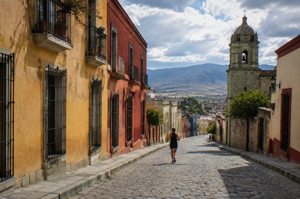
The Zócalo (Plaza de la Constitución) is the reference point for every distance on this page, sitting at the heart of the colonial grid. From there the Andador Macedonio Alcalá runs north to the Church of Santo Domingo de Guzmán, and the neighbourhoods of Jalatlaco and Xochimilco fringe the core. The Cerro del Fortín rises on the city's western edge, and beyond it the road climbs to Monte Albán. If you are mapping a first visit, the one-day itinerary for Oaxaca keeps entirely within this core plus one ruins stop, and it is a sensible test of how walkable the centre is.
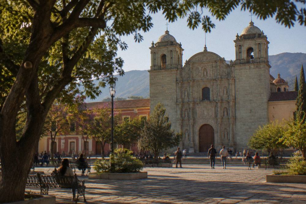
Two map facts save planning errors. First, the airport (Xoxocotlán, OAX) lies south of the centre in the Santa Lucía del Camino and Xoxocotlán area, and ASUR operates it. Second, the city is the transport hub for the whole state: buses and flights fan out from here to the coast, to Puebla and to Mexico City, so the map of day trips and the map of onward journeys are two different scales. The main overview of things to do in Oaxaca sorts by that same geography.
| Map fact | Figure | Note |
|---|---|---|
| Altitude | About 1,550 m | Highland valley floor |
| Municipality population | 270,955 | Censo 2020 |
| State population | 4,132,148 | Censo 2020 |
| Timezone | UTC-6 | All year, no DST since 2022 |
| Founded | 1529, as Antequera | Oaxaca de Juárez |
| UNESCO property | 415 | Historic Centre and Monte Albán |
How Far Is Each Major Sight From The Oaxaca Zócalo?
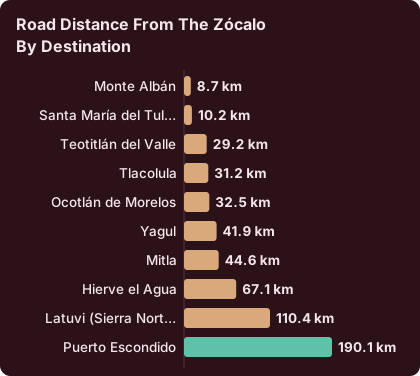
Driving distances from the Zócalo run short in every direction on the map: Monte Albán about 8.7 km or 15 minutes, Santa María del Tule about 10.2 km or 11 minutes, Teotitlán del Valle about 29.2 km or 26 minutes, Tlacolula about 31.2 km or 25 minutes, Mitla about 44.6 km or 37 minutes, and Hierve el Agua about 67.1 km or 57 minutes on free-flowing roads. These are derived from mapped roads, not official figures, and real traffic and mountain stretches run slower, so treat every one as "about".
That ring of destinations is what fills a week here without ever leaving the Valles Centrales. Tule, Teotitlán, Tlacolula, Mitla and Hierve el Agua string along the eastern valley, while Monte Albán, Atzompa and Cuilapan sit west and Ocotlán and Zaachila lie south. A single booked loop is the simplest way to cover the eastern string, and the full-day Tule, Mitla, Hierve el Agua and mezcal tour does exactly that from a city departure. This guide's comparison of the two scales is simple: the centre is walked, the valley is driven.
| Destination | Road distance from the Zócalo | Free-flow drive time |
|---|---|---|
| Monte Albán | 8.7 km | About 15 min |
| Santa María del Tule | 10.2 km | About 11 min |
| Teotitlán del Valle | 29.2 km | About 26 min |
| Tlacolula | 31.2 km | About 25 min |
| Ocotlán de Morelos | 32.5 km | About 37 min |
| Yagul | 41.9 km | About 38 min |
| Mitla | 44.6 km | About 37 min |
| Hierve el Agua | 67.1 km | About 57 min |
| Latuvi (Sierra Norte) | 110.4 km | About 142 min |
| Puerto Escondido | 190.1 km | About 165 min |
Planning by minutes, not kilometres, is the habit that works on this map.
Where Do The Archaeological Zones Sit Around Oaxaca?
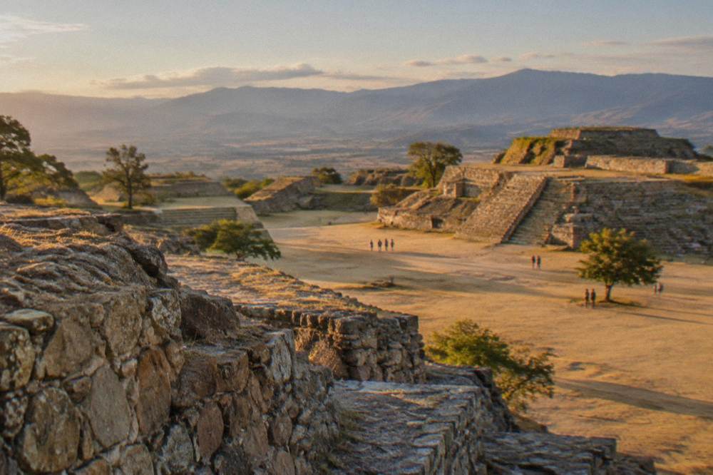
Seven INAH archaeological zones ring the city on the map, and they split into two price categories: Monte Albán, Mitla and Yagul charge 105 MXN for Mexican nationals and 210 MXN for foreign visitors (Category I), while Dainzú, Lambityeco and Zaachila charge 80 and 145 MXN (Category III), with Atzompa's page listing hours only, 08:00 to 16:00 with last access at 15:00. Monte Albán and Mitla both open Monday to Sunday 08:00 to 17:00, with last access at 16:00 and 16:30 respectively, per the INAH site pages.
Zaachila is the map's schedule trap: it opens Thursday to Sunday only, 10:00 to 16:00, and it sits in the southern valley, so it looks like an easy any-day stop until the calendar intervenes. The Museo de las Culturas de Oaxaca at Santo Domingo runs Tuesday to Saturday, 10:00 to 16:00, at the Category I rates. INAH also lists visits outside normal hours at 730 MXN on several of the zone pages. The details for each zone are covered in this guide's guides to Monte Albán and Mitla.
| Site | Map direction from the centre | Hours | Nationals | Foreigners |
|---|---|---|---|---|
| Monte Albán | West, 8.7 km | Mon to Sun 08:00 to 17:00 | 105 MXN | 210 MXN |
| Atzompa | West | Mon to Sun 08:00 to 16:00 | Fee not listed | Fee not listed |
| Yagul | East, 41.9 km | Mon to Sun 08:00 to 17:00 | 105 MXN | 210 MXN |
| Dainzú | East | Mon to Sun 08:00 to 17:00 | 80 MXN | 145 MXN |
| Lambityeco | East | Mon to Sun 08:00 to 17:00 | 80 MXN | 145 MXN |
| Mitla | East, 44.6 km | Mon to Sun 08:00 to 17:00 | 105 MXN | 210 MXN |
| Zaachila | South | Thu to Sun 10:00 to 16:00 | 80 MXN | 145 MXN |
For visitors who want the ruins explained rather than just located, a guided half-day at Monte Albán pairs the western edge of the map with the city's biggest draw. Check availability for the valley loop if the eastern string suits your dates better.
How Do The Valleys And Craft Villages Sit On The Map?
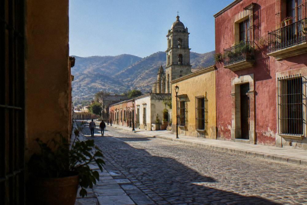
The Valles Centrales place the craft villages in three map wedges around the city: Teotitlán del Valle, Tlacolula, Mitla and Hierve el Agua to the east along one road corridor; San Martín Tilcajete, Ocotlán and Zaachila to the south; and Atzompa, Cuilapan de Guerrero and San Agustín Etla to the west and northwest. The villages are working places, with weaving in Teotitlán del Valle, alebrije painting in San Martín Tilcajete and black pottery in San Bartolo Coyotepec, and each has its own guide page on this site.
Mapping the wedges matters because the market days give the valleys their weekly rhythm, and this guide's pages on the Tlacolula Sunday market, Ocotlán on Friday and Zaachila on Thursday lay out those days. A week planned around them reads the map as a calendar: one valley per market day, with Monte Albán and the city centre filling the gaps. The Sierra Norte and Pueblos Mancomunados sit on the map's northern edge, with Latuvi about 142 minutes from the centre, a different scale of trip altogether.
| Valley wedge | Villages | Known craft or draw | Road time from the Zócalo |
|---|---|---|---|
| East (Tlacolula Valley) | Tule, Teotitlán del Valle, Tlacolula, Mitla, Hierve el Agua | Textiles, ruins, springs | About 11 to 57 min |
| South | San Martín Tilcajete, Ocotlán, Zaachila, San Bartolo Coyotepec | Alebrijes, markets, black pottery | Ocotlán about 37 min |
| West | Atzompa, Cuilapan de Guerrero | Pottery, convent | On the west road out of the city |
| North (Sierra Norte) | Pueblos Mancomunados, Latuvi | Mountain trails | About 142 min to Latuvi |
Where Are The Oaxaca City Neighbourhoods On The Map?
The city core maps onto a small walkable set: the Zócalo and the cathedral at the centre, the Andador Macedonio Alcalá running north to Santo Domingo, Jalatlaco and Xochimilco as older barrios on the eastern flank, Reforma spreading north of the centre, and the market district (Mercado 20 de Noviembre, Benito Juárez and the Abastos area) south and southwest of the grid. The whole walkable core fits inside a couple of kilometres, which is why the question is Oaxaca a walkable city usually answers itself once the map is in view.
Each of these quarters has a dedicated guide on this site: Jalatlaco, Xochimilco, Reforma and the centro histórico. For choosing where to sleep, this guide's where to stay in Oaxaca guide follows the same map, and getting around Oaxaca covers how the centre connects to the valleys once walking stops being enough. There is no bike-share system in the city, so the map beyond the core is a taxi, colectivo or tour-bus map.
How Far Is The Pacific Coast From Oaxaca City?
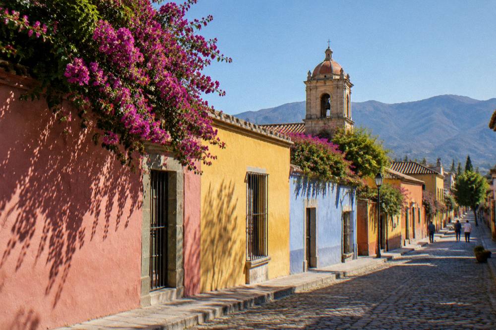
The Pacific coast is a far extension on this map, not a local trip: Puerto Escondido sits about 190.1 km and about 165 minutes of driving from the Zócalo on the newer highway, with prior guides citing 2.5 to 3.5 hours depending on conditions and vehicle, and Mazunte, Huatulco and San José del Pacífico all sit beyond city-day-trip range. The coast demands either a booked overnight extension or a short flight, and every coastal product on this site departs from the city, never from the beach.
This is the single most common map mistake: readers picture Oaxaca City as coastal because the state has famous beaches. It does not. The city is inland and highland, and the coastal towns belong to a second leg of the journey. This guide's guides to Oaxaca to Puerto Escondido, the Oaxaca beaches and the city-or-coast comparison map that leg properly, including the San José del Pacífico mountain stop on the road down. The rest of the planning pages sit on Oaxaca Travel Guide.
| Coastal or far destination | Map relation to the city | Practical reading |
|---|---|---|
| Puerto Escondido | About 190.1 km, about 165 min on the new highway | Extension or flight |
| San José del Pacífico | Mountain stop on the road southwest | Overnight extension |
| Mazunte and Zipolite | Beyond Puerto Escondido | Multi-day extension |
| Huatulco | Farther east along the coast | Multi-day extension |
| Puebla | Outside the state, northbound route | Stopover city, own guide |
How Do You Read The Oaxaca Map For A First Visit?
Read the map in three rings: the walkable historic core for your first one or two days, the valley ring within about an hour's drive (Monte Albán, Tule, Teotitlán, Tlacolula, Mitla, Hierve el Agua, Ocotlán, Zaachila) for day trips two through five, and the far extensions, the Sierra Norte to the north and the Pacific coast to the southwest, as separate legs with their own nights. This guide's itinerary planning guide and the how many days in Oaxaca breakdown both follow this ring logic, as does the week-long itinerary.
The rings also decide your transport map. The core is a walking map. The valley ring is a tour-bus, colectivo or rental-car map, with drive times from about 11 to about 57 minutes each way. The far ring is a flight or a full road-day map. Solo travellers often find the rings map neatly onto booked day tours, and the solo in Oaxaca guide works the same geography. Arrival logistics sit on the map's southern edge: the Oaxaca airport guide and flights to Oaxaca cover the air side, while the overland arrivals from the north are covered in Mexico City to Oaxaca and the ADO bus guide.
What Does The Oaxaca Weather Map Look Like Month By Month?
The climate map splits the year in two: a dry season from November to April, when monthly rainfall in the city runs from 2.4 mm in January to 47.3 mm in April, and a rainy season from May to October, when June averages 188.3 mm, September 163.6 mm and the annual total reaches 853.3 mm, per the SMN station normals for 1991 to 2020. Mean daily highs range from 34.9 C in April to 29.1 C in September, and mean daily lows sit between 10.3 C in January and 16.7 C in June.
The map lesson is that the weather does not change the geography, only the comfort of crossing it. Rainy-season afternoons can slow the valley roads and the mountain route to the coast, while the dry months make every ring on this page easier to drive. This guide's weather by month guide carries the full table, and the best time to visit guide maps the calendar against the festival year.
| Month | Mean high C | Mean low C | Rain mm | Days with rain |
|---|---|---|---|---|
| Jan | 28.9 | 10.3 | 2.4 | 1.4 |
| Feb | 31.1 | 11.6 | 4.6 | 1.1 |
| Mar | 33.3 | 13.6 | 17.6 | 4.1 |
| Apr | 34.9 | 15.8 | 47.3 | 7.6 |
| May | 33.8 | 16.7 | 97.9 | 13.7 |
| Jun | 30.9 | 16.7 | 188.3 | 19.9 |
| Jul | 30.1 | 15.9 | 118.6 | 20.4 |
| Aug | 30.0 | 15.9 | 131.8 | 20.5 |
| Sep | 29.1 | 16.1 | 163.6 | 21.4 |
| Oct | 29.3 | 14.5 | 63.1 | 12.0 |
| Nov | 29.0 | 12.3 | 9.1 | 3.5 |
| Dec | 28.9 | 11.0 | 9.0 | 2.4 |
Which Oaxaca Map Mistakes Do Planners Make?
The recurring map mistakes are five: treating the Pacific coast as a day trip from the city, assuming the state and the city are the same place, planning Zaachila or the Museo de las Culturas for a Monday or Sunday when their schedules do not allow it, underestimating mountain road time against straight-line distance, and forgetting that Hierve el Agua sits at the far end of the eastern valley about 57 minutes out rather than beside Mitla. Each error is easy to avoid once the rings are clear.
Safety belongs on the map too, in plain wording. The UK FCDO advises against all but essential travel to parts of Mexico and does not name Oaxaca on its main page; Canada advises a high degree of caution for Mexico overall with regional advisories; and the US State Department lists Oaxaca state at Level 2, exercise increased caution, with restrictions for its staff in the Isthmus region rather than the city or valleys. Road blockades by teachers' unions are a standing risk that can disrupt road and airport access for hours at a time. This guide's Oaxaca safety guide carries the detail.
| Mistake | The map reality |
|---|---|
| "We'll pop to the beach for the afternoon" | Puerto Escondido is about 165 minutes of driving each way; the coast is an extension |
| "Oaxaca is Oaxaca" | The state spans coast and mountains; the city is one inland point in the Valles Centrales |
| Zaachila on a Tuesday | The site opens Thursday to Sunday only, 10:00 to 16:00 |
| Museo de las Culturas on a Monday | It opens Tuesday to Saturday, 10:00 to 16:00 |
| Judging trips in kilometres | Mountain roads run slower than the map suggests; plan by the minute figures, and round up |
Common Questions About The Oaxaca Map
Is Oaxaca City On The Coast?
No. Oaxaca City is an inland highland city in the Valles Centrales at about 1,550 m. The Pacific coast, including Puerto Escondido and Huatulco, is a separate leg of about 165 driving minutes to Puerto Escondido on the newer highway, or a short flight.
How Far Is Monte Albán From Oaxaca City?
About 8.7 km and about 15 minutes by road from the Zócalo on free-flowing roads. The INAH site page lists daily opening 08:00 to 17:00 with last access at 16:00, and entry of 105 MXN for nationals and 210 MXN for foreign visitors.
What Is The Closest Craft Village To The City?
Santa María del Tule, at about 10.2 km and about 11 minutes, is the closest mapped stop on the eastern valley string, with Teotitlán del Valle about 26 minutes and Tlacolula about 25 minutes beyond.
Can You Visit Hierve El Agua And Mitla On The Same Day?
Yes, and it is the standard pairing. Mitla sits about 44.6 km and 37 minutes from the Zócalo, and Hierve el Agua about 67.1 km and 57 minutes, both on the eastern valley corridor, so booked loops combine them with Tule and a mezcal stop.
Where Does The Guelaguetza Happen On The Map?
At the Auditorio Guelaguetza on the Cerro del Fortín, on the city's western edge. The 2026 edition ran 20 and 27 July with two performances each day; 2027 dates are not announced.
Which Direction Is The Sierra Norte?
North. The Pueblos Mancomunados villages sit high in the mountains, with Latuvi about 110.4 km and about 142 minutes of driving from the Zócalo, a different scale of trip from the valley ring.
Mapped this way, the destination stops being a puzzle of similar-sounding names and becomes three rings around one Zócalo: a walkable core, a valley of ruins and craft villages within the hour, and long extensions to the mountains and the sea that deserve their own nights.