Oaxaca To Mazunte And Zipolite
Mazunte and Zipolite sit on the Pacific coast of Oaxaca state, a long road trip or a short flight from Oaxaca City, which is an inland highland capital at about 1,550 m with no sea of its own.
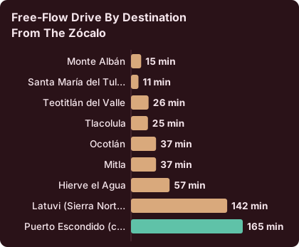
Mazunte and Zipolite are coastal villages on the Pacific side of Oaxaca state. Oaxaca City lies inland in the Valles Centrales, and the drive to the coast runs about 165 minutes to Puerto Escondido on the new highway before continuing along the coast road, so the villages work as an overnight extension rather than a day trip.
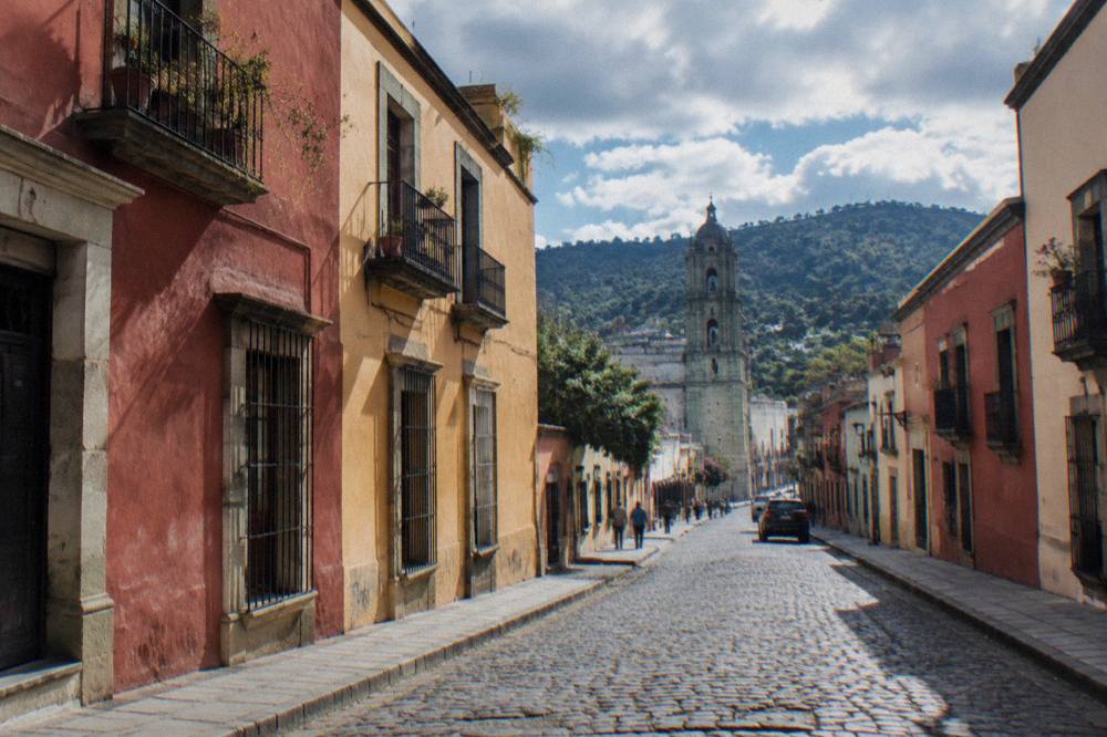
Oaxaca City is the capital of the state of Oaxaca in Mexico, an inland highland city in the Valles Centrales at about 1,550 m, and Mazunte and Zipolite are villages on the state's Pacific coast, roughly on the far side of the mountains that separate the valleys from the sea. That geography shapes everything about this route: the city has no beach, no port and no seafront, and the coast is a genuine extension of an Oaxaca trip, reached by a long road journey or a short flight, not a quick hop from the Zócalo.
Where Are Mazunte And Zipolite Relative To Oaxaca City?
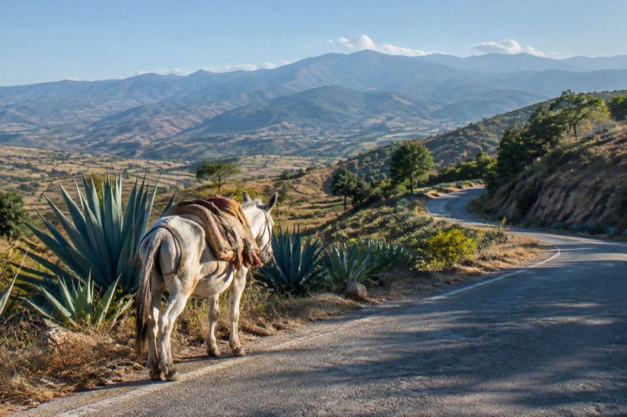
Mazunte and Zipolite lie on the Pacific coast of Oaxaca state, while Oaxaca City sits inland in the Valles Centrales at an altitude of about 1,550 m, so the two are separated by the mountain range that divides the highland valleys from the sea. The city itself has no coastline, and the villages belong to a different landscape entirely, reached only after a sustained descent from the highlands toward the Pacific.
The distinction matters because casual searches often blur the city and the state. Oaxaca de Juárez, the municipality, recorded 270,955 inhabitants at the 2020 census, and the state as a whole 4,132,148. The beaches people photograph when they talk about "Oaxaca" are hours away by road from the colonial centre, the Zócalo, the markets and Monte Albán. Treating Mazunte and Zipolite as if they were suburbs of the city produces broken itineraries; treating them as the coastal half of a two-part trip produces good ones.
Mazunte and Zipolite sit beyond Puerto Escondido along the coast, so the total journey from the city is longer than that figure, and mountain roads and real traffic add time beyond any free-flow estimate. For planning, the honest frame is this: the coast is a destination in its own right, and the drive is a committed piece of travel, not a spur of the moment excursion.
How Do You Get From Oaxaca City To Mazunte And Zipolite?
The route from Oaxaca City to the coast runs by road or by air: the drive covers about 190.1 km to Puerto Escondido in about 165 minutes of free-flow travel on the new highway before the final coast-road leg, and flights from the city's Xoxocotlán airport connect to coastal airports, with bus services also running from the city's ADO terminal.
Xoxocotlán International Airport (OAX) is operated by ASUR, and the ADO bus network serves the city, with its official site at ado.com.mx. Specific fares, timetables and terminal addresses shift constantly, so the practical advice is to book the flight or the bus ticket through the operator's own channels and treat anything quoted second-hand as stale. What stays stable is the shape of the decision: flying saves most of a day each way, the bus is the slower but atmospheric option, and a rental car or a private transfer gives the freedom to break the mountain descent with stops.
The 165 minute figure is a free-flow computation on OpenStreetMap roads, not an official schedule, so round up, expect slower going in rain, and do not plan a same-day connection that depends on the fast end of the range. Road blockades by teachers' unions are also a standing, sporadic risk in Oaxaca that can disrupt both road and airport access without much notice, so a buffer day around the coast leg is simply good hygiene.
The days before departure belong to the city itself. The historic centre walk is the standard orientation move, and the craft-and-ruins loop that this site features pairs Monte Albán with the alebrije and barro negro workshops in a single day; it works well as the anchor of a final city day before the coast. The pairing session with a certified sommelier is a popular evening choice, and the mezcal-mole combination is a distinctly Oaxacan one.
Can You Visit Mazunte And Zipolite As A Day Trip From Oaxaca City?
No, in any practical sense: Mazunte and Zipolite are a coast extension, not a day trip. The drive to Puerto Escondido alone is about 165 minutes of free-flow road time each way on the new highway, the villages lie beyond it, and the return leg the same day would consume the entire schedule in driving, leaving nothing for the beaches themselves.
The numbers settle it. A day trip budget from the city runs to roughly eight to twelve usable hours. Two coast legs at about three hours each, before the extra distance to Mazunte, before meals, checkpoints and the slow final stretch, leave a fragment of daylight at the destination. Compare that with the genuine day trips in the city's orbit: Monte Albán about 15 minutes from the Zócalo, Tule about 11, Teotitlán del Valle about 26, Mitla about 37, Hierve el Agua about 57. Those are day trips. The coast is not.
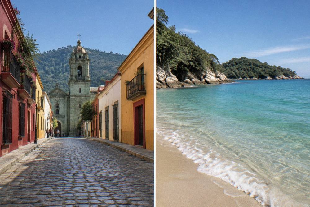
The right structure is two nights minimum on the coast, ideally three. That converts the drive from a burden into a journey: leave the city early, descend through the mountains, and arrive with a full beach day in hand rather than a racing clock. Travellers who insist on a single overnight can do it, but they will spend both transition days partly on the road, and the Oaxaca to Puerto Escondido route guide covers that larger coastal hub in detail if the priority is the biggest transport choice rather than the small villages.
For the city days around the coast leg, the featured craft-and-ruins day is worth locking in early, since it covers Monte Albán plus workshops in one move and frees the remaining days for food and neighbourhoods. The operator's booking page carries the current price and free-cancellation terms, and Check availability shows the live dates before you commit.
What Should You Do In Oaxaca City Before Or After The Coast Leg?
The strongest pre-coast city plan pairs one archaeology day with one valley day and one city day: Monte Albán lies about 15 minutes from the Zócalo and charges 105 MXN for Mexican nationals and 210 MXN for foreign visitors, the Tlacolula Valley sites sit within about an hour, and the historic centre, markets and Jardín Etnobotánico fill the rest without a vehicle.
The INAH fee structure is flat and knowable in advance. Monte Albán, Mitla and Yagul are Category I sites at 105 MXN for nationals and 210 MXN for foreigners; Dainzú, Lambityeco and Zaachila are Category III at 80 and 145 MXN. All of the major zones open at 08:00 and close at 17:00, with last access between 16:00 and 16:30, except Zaachila, which opens Thursday to Sunday only, 10:00 to 16:00. Planning around those windows is the difference between seeing two sites in a day and seeing one.
| INAH site | Category | Nationals MXN | Foreigners MXN | Hours | Last access |
|---|---|---|---|---|---|
| Monte Albán | I | 105 | 210 | Mon-Sun 08:00-17:00 | 16:00 |
| Mitla | I | 105 | 210 | Mon-Sun 08:00-17:00 | 16:30 |
| Yagul | I | 105 | 210 | Mon-Sun 08:00-17:00 | 16:00 |
| Dainzú | III | 80 | 145 | Mon-Sun 08:00-17:00 | 16:30 |
| Lambityeco | III | 80 | 145 | Mon-Sun 08:00-17:00 | 16:30 |
| Zaachila | III | 80 | 145 | Thu-Sun 10:00-16:00 | 16:00 |
| Atzompa | n/a | not on page | not on page | Mon-Sun 08:00-16:00 | 15:00 |
The Jardín Etnobotánico, beside Santo Domingo de Guzmán, runs free guided tours Monday to Friday at 10:30, 11:00, 11:30, 12:00 and 17:00, and Saturday from 10:30 to 12:00, with large groups asked to book two weeks ahead. The Museo de las Culturas de Oaxaca in the same complex opens Tuesday to Saturday only, 10:00 to 16:00, at the 105/210 MXN rates. A first-time visitor with three city days can therefore do Monte Albán, one valley loop such as the Hierve el Agua day trip or the Mitla and Tlacolula day trip, and a walking day through the centre, before the coach to the coast.
Solo travellers and families have dedicated angles covered elsewhere on this site, and the things to do in Oaxaca roundup holds the full menu. The point for this page is sequencing: heavy valley days before the coast, gentle city days after the return, because the mountain road back deserves a recovery morning.
What Is The Weather Like Along The Oaxaca City To Mazunte Route?
The highland half of the route follows the Oaxaca City climate pattern: dry season from November to April, rainy season from May to October with its peak from June to September, June averaging 188.3 mm of rain against January's 2.4 mm, and April posting the highest mean daily high at 34.9 C while December and January bring the coolest nights, about 11.0 and 10.3 C.
Those figures are the SMN station normals for Oaxaca, 1991 to 2020, measured at the city station in the Valles Centrales. Everything else covered here is indexed on Oaxaca Travel Guide.
| Month | Mean high C | Mean low C | Rain mm | Days with rain |
|---|---|---|---|---|
| Jan | 28.9 | 10.3 | 2.4 | 1.4 |
| Feb | 31.1 | 11.6 | 4.6 | 1.1 |
| Mar | 33.3 | 13.6 | 17.6 | 4.1 |
| Apr | 34.9 | 15.8 | 47.3 | 7.6 |
| May | 33.8 | 16.7 | 97.9 | 13.7 |
| Jun | 30.9 | 16.7 | 188.3 | 19.9 |
| Jul | 30.1 | 15.9 | 118.6 | 20.4 |
| Aug | 30.0 | 15.9 | 131.8 | 20.5 |
| Sep | 29.1 | 16.1 | 163.6 | 21.4 |
| Oct | 29.3 | 14.5 | 63.1 | 12.0 |
| Nov | 29.0 | 12.3 | 9.1 | 3.5 |
| Dec | 28.9 | 11.0 | 9.0 | 2.4 |
The practical reading is straightforward. From November to April the city side of the route sits under low rain counts, 9.1 mm or less per month, and the drive is at its most predictable. From June to September, rain days cluster around twenty per month in the valleys, and mountain driving in heavy rain is slower and less pleasant than the free-flow figures suggest. None of this is a ranking of months, simply the table speaking: if a coast trip lands in the wet half of the year, add buffer time to every road leg and expect afternoon rain rather than all-day rain.
How Does A Coast Extension Compare With The Valley Day Trips?
The valley day trips from Oaxaca City all sit within about an hour of the Zócalo, Monte Albán at about 15 minutes, Hierve el Agua about 57, Mitla about 37, while the coast starts at about 165 minutes of driving to Puerto Escondido before the final leg to Mazunte and Zipolite, which places the villages in a different planning category from every valley option.
The comparison table makes the gap concrete. Every valley destination is a same-day return with evening back in the city; the coast is not. That is not an argument against Mazunte and Zipolite, it is an argument for sequencing: do the valley days from a city base, then move base to the coast, rather than commuting outward in every direction from one hotel.
| Destination from the Zócalo | Distance km | Free-flow drive | Type |
|---|---|---|---|
| Monte Albán | 8.7 | about 15 min | Valley half day |
| Santa María del Tule | 10.2 | about 11 min | Valley half day |
| Teotitlán del Valle | 29.2 | about 26 min | Valley day trip |
| Tlacolula | 31.2 | about 25 min | Valley day trip |
| Ocotlán | 32.5 | about 37 min | Valley day trip |
| Mitla | 44.6 | about 37 min | Valley day trip |
| Hierve el Agua | 67.1 | about 57 min | Valley day trip |
| Latuvi (Sierra Norte) | 110.4 | about 142 min | Mountain extension |
| Puerto Escondido (coast) | 190.1 | about 165 min | Coast extension |
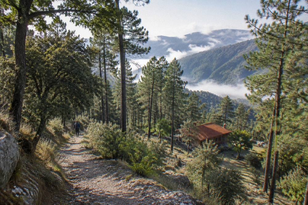
One middle option deserves a mention: the Sierra Norte. Latuvi, in the Pueblos Mancomunados, is about 142 minutes from the Zócalo, closer than the coast and a completely different proposition, pine mountains and village trails rather than beaches. The Sierra Norte and Pueblos Mancomunados guide covers it.
Is The Oaxaca City To Coast Route Safe?
The standing advisories name Oaxaca favourably overall: the US State Department lists Oaxaca state at Level 2, exercise increased caution, with no travel restrictions for its employees to Oaxaca City, Monte Albán, Puerto Escondido or Huatulco, while the UK FCDO does not name Oaxaca among the parts of Mexico it advises against, and Canada advises a high degree of caution in Mexico generally with regional advisories.
The restrictions that do exist for US government employees apply to the Isthmus region, away from both the city and the coastal beach corridor. Beyond advisories, the standing local risk is sporadic road blockades by teachers' unions, which have closed highway exits and airport access for hours at a time; they are unpredictable, they do not target travellers, and the standard response is patience and a flexible schedule rather than rerouting.
The road itself demands more respect than the distances suggest. The new highway is a genuine improvement, but the full route to the coast involves sustained mountain driving, and the final stretches to the villages are slower roads.
How Many Days Should An Oaxaca City And Mazunte Trip Take?
A balanced combined trip runs seven to ten days: three or four in Oaxaca City covering Monte Albán, one valley loop and the historic centre, two or three on the coast at Mazunte and Zipolite, and one flexible day on each end of the transfer to absorb the drive and any delay. Tighter plans down to five days work only by flying one direction.
Three city nights is the floor for Monte Albán plus one valley day plus a walking day; four is comfortable. On the coast, two nights gives one full beach day, three gives two. The transfer days are lost days by design: leave early, arrive mid afternoon, and keep the evening light.
Season and festival calendar bend the plan. Guelaguetza fills the city across two Mondays in July at the Auditorio Guelaguetza on the Cerro del Fortín, and the 2026 edition priced Palco A at 1,632 MXN and Palco B at 1,321 MXN with free sections C and D, figures that serve only as a reference for what a July visit involves. Late October and early November bring Día de Muertos, whose traditional core dates are 31 October to 2 November; the 2026 programme had not been announced, so plan around the pattern rather than a published schedule. A July or early November trip should book the city nights first and treat the coast as the pressure valve.
What Should You Pack For Highlands Plus Coast?
Pack for two climates in one bag: highland days in Oaxaca City range from about 10.3 C mean overnight lows in January to 34.9 C mean daily highs in April, while the coast calls for swimwear, sun protection and light layers, plus a rain shell if the trip falls between May and October, when monthly rain in the valleys runs from 63.1 mm in October up to 188.3 mm in June.
The highland swing is the part visitors underestimate. A January evening in the city at around 10 C after a 29 C afternoon means the same day needs sun protection and a warm layer, and the coast leg three hours away rewards the opposite emphasis. Footwear should handle cobbled city streets, dusty valley archaeological zones and sand. The what to pack for Oaxaca guide carries the full checklist.
Money matters less than visitors fear but more than in bigger cities: local costs are in pesos, INAH tickets are 80 to 210 MXN depending on site and nationality, and the state lodging tax is 3 percent on hotel-type stays, 5 percent where an intermediary platform collects it.
Common Questions About Oaxaca To Mazunte And Zipolite
How Far Is Mazunte From Oaxaca City?
Mazunte lies beyond Puerto Escondido along the coast road, so the full journey is longer, and real traffic and mountain sections add time to any estimate.
Can You Do Mazunte As A Day Trip From Oaxaca City?
No. The drive to the coast alone is about three hours each way in free-flow conditions, before the final leg to the village, so a same-day return would leave almost no time on the beach. Plan at least two nights on the coast and treat it as an extension.
Is It Better To Fly Or Drive From Oaxaca City To The Coast?
Flying from Xoxocotlán airport saves most of a day in each direction and suits short trips. Driving or taking the bus from the ADO terminal suits travellers with time who want the mountain scenery or want to break the journey. Both options are covered by the Oaxaca to Puerto Escondido guide.
When Is The Rainy Season On The Oaxaca City To Coast Route?
The highland half follows the Oaxaca station normals: rainy season May to October with a June to September peak, June averaging 188.3 mm of rain. The dry season runs November to April, with January down to 2.4 mm. Mountain roads are slower in the wet months, so add buffer time to transfers then.
Is The Road From Oaxaca City To Mazunte Safe?
The US State Department lists Oaxaca state at Level 2, exercise increased caution, with no restrictions for its employees on the Oaxaca City to Puerto Escondido corridor; the UK and Canadian advisories do not single out Oaxaca. The standing local risk is sporadic road blockades by teachers' unions, which can close highway sections and airport access for hours.
How Many Days Do You Need For Oaxaca City And Mazunte Together?
Seven to ten days is the comfortable frame: three or four in the city for Monte Albán, a valley loop and the centre, two or three on the coast, and a flexible day around each transfer. Five days is possible by flying at least one direction.
The route from Oaxaca City to Mazunte and Zipolite is really two trips stitched together, a highland capital at about 1,550 m with ruins, markets and mezcal, and a pair of small Pacific villages reached after about 165 minutes of driving to Puerto Escondido and a final coast-road leg. Keep the transfer days loose, and the combination becomes the fullest version of what the state of Oaxaca offers.